Help - Search - Members - Calendar
Full Version: Exploring Mt Sharp north of the dunes - Part 1: Beyond Pahrump Hills
Unmanned Spaceflight.com > Mars & Missions > MSL
Pages: 1, 2, 3, 4, 5, 6, 7, 8, 9, 10, 11, 12, 13, 14, 15, 16, 17, 18, 19, 20
nogal
QUOTE (atomoid @ Sep 18 2015, 12:49 AM) *
How far up we get ...

GE gives an altitude difference of about 430 m between the base of the foothill and Curiosity's current location. And the distance (based on the sketch of the new planned route) is over 7Km.
Fernando

Click to view attachment
PaulH51
QUOTE (nogal @ Sep 19 2015, 05:19 AM) *
....the distance (based on the sketch of the new planned route) is over 7Km....

That's cool... Any plans to include that 'planned' route in your next KMZ? smile.gif
jvandriel
The last images are down and here is the complete Navcam L view taken on Sol 1107.

Jan van Driel

Click to view attachment
PaulH51
I know they are no plans to climb the mountain, but I can live in hope that further discoveries lead them to the summit and beyond... smile.gif

Original (1995 x 1835) LINK
Phil Stooke
I've been too busy to do much these last few days - so it's time to catch up. Here are three circular views made from Jan's panoramas (for which I am always very thankful). You can see Curiosity making its way through the rugged outcrops step by step.

Phil

sol 1106: Click to view attachment

sol 1107: Click to view attachment

sol 1108: Click to view attachment
PaulH51
Laser Target Practice, sol 1108

Original (2603 x 1278) LINK

"Cody" (DRT and APXS target) identified in sol 1108 mosaic

Original (4119 x 2642) LINK
PaulH51
QUOTE (Phil Stooke @ Sep 19 2015, 10:57 PM) *
Here are three circular views made from Jan's panoramas...

Nice work Phil... Can we just make out 'Cut Bank Valley' to the west? smile.gif
algorithm
Now this is what I call 'Contact Science' !!! laugh.gif


Click to view attachment
brellis
An example of Mars' crumbling infrastructure laugh.gif
PaulH51
Midnight Planets is reporting a drive of 15.1 meters link during sol 1110. The plan was for a drive of ~50 meters link MP is showing just 2 end-of-drive thumbnail images so far, so it could be the drive was interrupted and it could resume, or it was terminated early by the navigation software.
PaulH51
Quick & Dirty Sol 1110 End-of-Drive L-NavCam Pano, just to tide you over until Jan can post his proper version smile.gif

Original (8192 x 1765) LINK
jvandriel
and here is my version of the Sol 1110 Navcam Panoramic view.

Jan van Driel

Click to view attachment
Phil Stooke
A circular version of Jan's panorama shows that we only just got off the outcrop, probably stopped by excessive tilt on the way out.

Phil

Click to view attachment
Herobrine
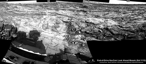
The NAVCAM travel animation for Sol 1110 is 1921 frames and does seem to suggest a significant increase in tilt toward the end.
Here's a small preview of the left NAVCAM's view: Click to view attachment
And here is the full-size (512x256) stereo-pair animation for Parallel and Cross-Eye viewing. File sizes are 3.2 MiB each.

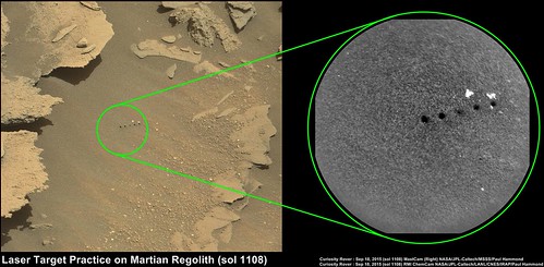
Edit: And the Sol 1108 NAVCAM travel animation is 13 frames.
Here's a small preview of the left NAVCAM's view: Click to view attachment
And here is the full-size (512x256) stereo-pair animation for Parallel and Cross-Eye viewing. File sizes are 2 MiB each.

Edit: Added two missing frames from the Sol 1110 animation and changed links to point to corrected versions.

Edit: And the Sol 1107 NAVCAM travel animation is 27 frames.
Here's a small preview of the left NAVCAM's view: Click to view attachment
And here is the full-size (512x256) stereo-pair animation for Parallel and Cross-Eye viewing. File sizes are 4.2 MiB each.

Edit: And, since the viewpoint at the end of Sol 1107 is the same as the beginning of Sol 1108, I put together a combined Sol 1107-8 NAVCAM travel animation, 40 frames in length.
Here's a small preview of the left NAVCAM's view: Click to view attachment
And here is the full-size (512x256) stereo-pair animation for Parallel and Cross-Eye viewing. File sizes are 6.2 MiB each.
PaulH51
Curiosity Mission Update from Ryan Anderson - Sol 1112-1113: Rough Driving LINK
QUOTE
The drive on Sol 1111 stopped early after just over 15 meters because we were driving over rough terrain and part of the rover’s suspension exceeded the allowed amount of tilt (this is not a physical limit, just a threshold in the software that tells the rover to stop and check with Earth to be safe). The rover is fine and we plan to drive again in the Sol 1112 plan. Meanwhile we are trying to decide where in the area we want to drill to maximize the science return. There are a lot of options because we’re surrounded by interesting geology!
Before we drive, we have some ChemCam observations of targets “Dakota”, “Conrad”, and “Firemoon”, plus two Mastcam mosaics of a potential drill target. I was on duty as ChemCam sPUL today, so two of the three targets are ones that I chose, which is always fun. I didn’t choose the names (someone else was quicker with the naming list than I was), but I especially like the name “Firemoon”.
After the drive, we have our standard post-drive imaging to allow us to choose targets on Wednesday. On sol 1113 we won’t have the sol 1112 data back yet, so we have some untargeted observations, including some ChemCam passive calibration measurements, DAN passive observation, and a Navcam 8-frame movie looking to the north.

EDIT
Sol 1110 :5 Frame L-MastCam 'Drive Direction' mosaic

Original (5745 x 1487) LINK
atomoid
any guesses as to how long have such like these sol1110 breached slope topcrust been almost but not quite just yet ready to slip? curious what process congeals the topcrust to hold it together? seems that covering is held together enough that loose sand leaks from out under.. here are a couple of crosseyes fwiw
Click to view attachmentClick to view attachment
serpens
That looks like build up of dust in the turbulence in the lee of the rock ledge. When the build up exceeds the angle of repose then you get a surface slip. Considering Emily's blog that pointed out that we are in the vicinity of a Bachan dune that shows some movement this is an indication that the wind velocity is not insignificant, so such slips would be an ongoing event. The extreme temperature variations could also play a part in triggering slips.
elakdawalla
I didn't wind up using this image in my post, so I'll throw it in here. It's a comparison of the horizon from the sol 1100 Mastcam panorama (stretched vertically by a factor of 2) to an "unwrapped" orbital view. After spending too long staring at it I decided that we can't see the Murray Buttes yet, just the ridge of washboard terrain that splits the barchan dunes that Curiosity will be exploring next. I hadn't realized until making this how much of a ridge the hematite ridge actually is. The light blue dots mark a rough outline of Curiosity's future path.

(Click to enlarge)

PaulH51
QUOTE (elakdawalla @ Sep 23 2015, 07:35 AM) *
....The light blue dots mark a rough outline of Curiosity's future path.
That is extremely useful... smile.gif

We are now another 9 meters closer to the mountain, after another drive on sol 1112.

Rough n Ready L-NavCam 'look ahead' and shows plenty of rugged terrain still to be traversed...

Original (3869 x 1689) LINK
MahFL
QUOTE (PaulH51 @ Sep 19 2015, 11:30 AM) *
I know they are no plans to climb the mountain,


I am pretty sure someone from the team said the long term goal ( 10 years + ) was to climb to the top of the mountain, if it's possible and the rover survives long enough.
Phil Stooke
Somebody might have said they would like to, but it's not a firm objective. The upper part of the mountain is probably fairly uniform and less interesting than the extremely varied materials in the lower part. There is a desire to reach the bottom of the upper portion in order to sample it, but after that there are other areas in the lower levels with different structure and composition which are more compelling targets. Curiosity could spend its remaining years moving slowly east and southeast around the mountain, never running out of things to do.

Phil

djellison
QUOTE (MahFL @ Sep 23 2015, 05:30 AM) *
I am pretty sure someone from the team said the long term goal ( 10 years + ) was to climb to the top of the mountain, if it's possible and the rover survives long enough.


I've not heard that. Would it be 'cool'. Yes. Is it scientifically meritorious? No. Far better to transect the lower strata at multiple locations.

nogal
QUOTE (PaulH51 @ Sep 19 2015, 03:15 AM) *
That's cool... Any plans to include that 'planned' route in your next KMZ? smile.gif


Hi Paul. Sorry for the belated reply. I am working on something ... and will post a proper reply on the route thread(not necessarily tomorrow smile.gif )
Fernando
Arizona Dave
QUOTE (atomoid @ Sep 22 2015, 02:59 PM) *
any guesses as to how long have such like these sol1110 breached slope topcrust been almost but not quite just yet ready to slip? curious what process congeals the topcrust to hold it together? seems that covering is held together enough that loose sand leaks from out under.. here are a couple of crosseyes fwiw


Ive been noticing these same "slide" areas also. I think one theory of the top crust is the possibility of either frost or dew forming in just the right conditions which is absorbed by the soil, and then allows the caking, either by leaching or dissolving of salts/minerals in the soil, this frost/dew sublimates to the atmosphere over and over again leaving the leached minerals behind - The gravity being much lower would require a lot less caking "glue" to hold the very topcrust together than here on earth.

Any other opins on this?
dvandorn
Just that as early as Viking 1 the surface was recognized, in places, to have a "duricrust" that was much more cemented than the granular fines just beneath.
atomoid
thanks, i hadn't read up much on whether duricrust was seen as mostly mechanical lock, molecular adhesion, cementations by dissolved minerals, or something else entirely. I'd suspect Mars dust has very rough texture to maximize mechanical lock aspect, but im holding out hope for enough water, though we haven't spotted frost in the Sharp environs as far as i know. The dust crust here may perhaps be just mechanical/van der Waals since these are suspected to be relatively fresh deposits.

Rock remnants and Pareidolia from sol1112 Navcam excerpts presented in parellel. Seems we finally get a good view of the dark sea of dunes ahead.
Click to view attachment Click to view attachment
serpens
QUOTE (dvandorn @ Sep 23 2015, 05:59 PM) *
Just that as early as Viking 1 the surface was recognized, in places, to have a "duricrust" that was much more cemented than the granular fines just beneath.

I'm not sure that "duricrust" is the right description of the very lightly armoured and weakly cemented millimetre or so of (in Arizona Dave's term) caked dust seen at all landing sites. Mars is essentially a static environment and such minimal induration would have taken place over hundreds of thousands or millions of years. However, Gale seems to enjoy a trifle more aeolian activity which would reduce the potential for surface induration. There was minor armouring of the Rocknest drift similar to Spirit's snake dune but Atomoid's post #866 examples look more like a slip of loose material than a fracturing of an indurated surface.
PaulH51
The 'rough and ready' end of drive L-NavCam pano from sol 1112 quickly assembled in MS ICE

Original (8192 x 1925) LINK
EDIT
Curiosity Mission Update from Ken Herkenhoff - Sols 1114-1115: Contact science on Big Sky LINK
QUOTE
The 14-meter Sol 1112 drive completed as planned, and the rover is in a good position for contact science. There are flat areas in front of the rover that are suitable for drilling, so the Sol 1114 plan includes DRT brushing, MAHLI imaging, and APXS measurements of a target named "Big Sky." Before the arm is deployed, ChemCam and Mastcam will observe Big Sky and "Big Rock." I'm MAHLI/MARDI uplink lead today, so I was busy planning MAHLI images of Big Sky before and after brushing, making sure that the post-brush images will be well illuminated by the sun. This required working closely with the rover planners as they modeled the illumination of the target with the MAHLI placed close to it. After the imaging of the brushed spot is completed, the arm will be pushed against the potential drill targets to confirm that they can be drilled, and low-resolution MAHLI images will be taken to look at the imprints of the drill prongs. The APXS will briefly measure the chemistry of an area offset a few centimeters from the center of the brush spot, then will be placed on the center of the spot for an overnight integration.

Planning is restricted again, so we planned 2 sols of activities today. On Sol 1115, Navcam will search for dust devils, ChemCam and Mastcam will observe targets named "Heath," "Leigh," and the distant slopes of Mt. Sharp. Mastcam will also acquire mosaics of "Amanda" and the "Bagnold Dunes" toward the southwest.
jvandriel
The Navcam L panoramic view on Sol 1112.

Jan van Driel

Click to view attachment
Herobrine
NAVCAM travel animation for Sol 1112 is 26 frames.
Here's a small preview of the right NAVCAM's view: Click to view attachment
And here's the full-size (512x256) stereo pair animation for Parallel and Cross-Eye viewing. File sizes are each 4 MiB.
One left frame was half missing, so I used the thumbnail to fill it in. It's not very noticeable when viewing in 3D.
Arizona Dave
QUOTE (atomoid @ Sep 23 2015, 02:16 PM) *
thanks, i hadn't read up much on whether duricrust was seen as mostly mechanical lock, molecular adhesion, cementations by dissolved minerals, or something else entirely. I'd suspect Mars dust has very rough texture to maximize mechanical lock aspect, but im holding out hope for enough water, though we haven't spotted frost in the Sharp environs as far as i know. The dust crust here may perhaps be just mechanical/van der Waals since these are suspected to be relatively fresh deposits.

Rock remnants and Pareidolia from sol1112 Navcam excerpts presented in parellel. Seems we finally get a good view of the dark sea of dunes ahead.


I seem to remember earlier on in Curiosity mission they detected either dew or condensation/frost on a few occasions. This link is to one a few years ago: http://www.sciencetimes.com/articles/5633/...ian-surface.htm about the salts and perchlorates, as well as saying the water vap condenses...but for some reason I want to say they had taken images of what appears to be small dew drops on parts of the lander.

Now I need to go do some research...and edit this post if I need :-)

If this process indeed happens, then it would have strong implications on erosion processes as well, freeze-thaw cycles being the most obvious...but chemical alterations, oxidation also...plus what happens when the sands and rocks absorb excess moisture? It might be enough to push some of the duracrust over the edge like icy snow, and form small slide areas.

I also started thinking the other day about the effect and impact of unabated UV light raining down on the rocks and soil for millions/billions of years...look at what the sun does to terrestrial materials here on Earth...UV light could be part of the erosional process as well, and might even interact with surface moisture/salts....cool stuff.
B Bernatchez
QUOTE (Arizona Dave @ Sep 24 2015, 12:58 PM) *
I seem to remember earlier on in Curiosity mission they detected either dew or condensation/frost on a few occasions. This link is to one a few years ago: http://www.sciencetimes.com/articles/5633/...ian-surface.htm about the salts and perchlorates, as well as saying the water vap condenses...but for some reason I want to say they had taken images of what appears to be small dew drops on parts of the lander.

I think that it was the Phoenix lander which photographed what appeared to be water droplets on the landing legs.
fredk
And Oppy saw frost many years ago.
PaulH51
Contact science at 'Big Sky' (pre-drill load test) captured by the L-HazCam during sol 1114 (4 frame animation)
Click to view attachment
Original (616 x 616) LINK
elakdawalla
Just some thread housekeeping: We're overdue for a thread split. I should have split it after the last drill site but didn't think of it until it was too late and would've created confusion. It looks like we're going to drill here at Big Sky, so let's start a new thread, maybe "Approaching Bagnold Dunes," on the occasion of the first multi-meter drive onward from this site.
PaulH51
Curiosity Mission Update from Ryan Anderson - Sols 1116-1118: Small drill, Big Sky LINK
QUOTE
It’s time to drill again! After much deliberation, we have decided to try drilling the target “Big Sky” at our current location, in hopes of getting a good sample of relatively unaltered bedrock to compare with some of the altered rocks we have seen nearby.....
PaulH51
Curiosity has been busy using its RMI-ChemCam in telescopic mode during sol 1115, gathering 4 overlapping images of the lower slopes of Mt Sharp. Here is a very rough 'cut & paste' mosaic of the images and a L-MastCam for context. I'm hoping that one of the accomplished contributors to this forum will create a better stitch and maybe even colorize it so we can all enjoy it properly (hint - hint) smile.gif

Original (3704 x 1196) LINK
neo56
A series of pictures was taken by the RMI telescope, part of ChemCam instrument, on sol 1104. I stitched together these pictures and colorized them using the MC100 picture taken the same day.


QUOTE (PaulH51 @ Sep 26 2015, 06:04 AM) *
[...] I'm hoping that one of the accomplished contributors to this forum will create a better stitch and maybe even colorize it so we can all enjoy it properly (hint - hint) smile.gif


I'm working on it Paul ! wink.gif
Phil Stooke
I'm sorry to come back to this. Paul's image two posts above is on Flickr and downloads just fine. Thomas's image one post above is on Flickr, but it requires me to join Flickr to get it. What is the difference? Is it the way the image is defined on Flickr?

Phil
MarsInMyLifetime
QUOTE (Phil Stooke @ Sep 27 2015, 08:32 AM) *
I'm sorry to come back to this. Paul's image two posts above is on Flickr and downloads just fine. Thomas's image one post above is on Flickr, but it requires me to join Flickr to get it. What is the difference? Is it the way the image is defined on Flickr?

Phil

If you add 'sizes/l/' to the end of Thomas's URL (in its unshortened form, at least), you get the same interface as Paul's link (full set of sizes offered). I am able to get into Thomas's link just fine, though, so perhaps Flickr is seeing a cookie on my browser that is not set on yours. Adding the 'sizes/l/' parm to the link is probably less distressing to most readers than relying on cookie settings in their browsers.
Phil Stooke
Many thanks for that very useful tip!

Phil
neo56
I was not aware of this annoyance. To prevent FlickR from asking to join it, I'll put the URL heading to full set of sizes from now on.
PaulH51
QUOTE (neo56 @ Sep 28 2015, 03:56 AM) *
I was not aware of this annoyance. To prevent FlickR from asking to join it, I'll put the URL heading to full set of sizes from now on.

Flickr may still be in a transition phase with the prompt for 'log in' coming and going. So it's good to hear that certain links still work smile.gif
PaulH51
Mission Update from Ryan Anderson - Sol 1119-1120: "Go" for full drill at Big Sky!

http://astrogeology.usgs.gov/news/astrogeo...ill-at-big-sky-

QUOTE
....GO for drilling “Big Sky” on sol 1119! The hope is that this location will provide a good sample of the “typical” rock in the area to compare with some of the interesting alteration we’ve been seeing. Along with the drilling, there will be a bunch of MAHLI documentation images of the hole from varying distances and angles....
PaulH51
Catching up.... R-MastCam 14x2 mosaic from sol 1115 (prior to mini test drill)

Original (8237 x 2605) LINK
IMGUR link (just in case)
Edit: Incorrect target name on the image, description amended on Flickr
Herobrine
Can anyone tell me what the bright patches in this MASTCAM image from Sol 1112 are/indicate?
Here's a crop with exaggerated color contrast.
Click to view attachment
fredk
That kind of bright mark and disturbed soil is a pretty clear sign of wheel tracks. You can confirm that easily by checking the wider fov navcams pointing in that direction. (A full set of navcams is always taken after a drive - in this case, the drive on sol 1110 took us to that 1112 position.) You can see that area on the left of the navcam frame, right under the wheel tracks:
http://mars.jpl.nasa.gov/msl-raw-images/pr...NCAM00350M_.JPG
jccwrt
Interesting outcrop of Murray formation imaged on Sol 1117. I believe this is looking towards Cut Bank Valley. At first it looked like it was turned on end, but I think that it's just some darker alteration of the rock running along a vertical joint rather than being a bedding feature.


Sol 1117 MastCam by Justin Cowart, on Flickr

Imgur link in case of Flickr problems
fredk
In anaglyph stereo:
Click to view attachment
And cross-eyed:
Click to view attachment
Edit: did you do some manual artifact cleanup after deBayering, Justin?
jccwrt
Yeah, I use Photoshop's "Replace Color" function to edit the green bayer artifacts. I usually have to work on the picture in areas of similar colors, or else the replacement colors that match in one area of the photo clash in another. Takes about 20 minutes for a small picture like this.

When I'm using that, I'll pick the green artifacts and usually get a close enough color match to the surrounding terrain by dropping the green channel brightness by about 10-15 levels, and then by increasing the overall brightness of the resulting color by 5-10. Gets rid of the worst artifacts, at least.
This is a "lo-fi" version of our main content. To view the full version with more information, formatting and images, please click here.
Invision Power Board © 2001-2024 Invision Power Services, Inc.