I assumed that with solar conjunction starting today that we were stuck with what was down already by late last night, but I guess that Curiosity got a few more images down before disappearing behind the Sun! EDIT: Full panorama is now stitched together.
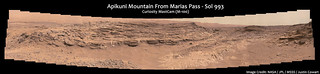
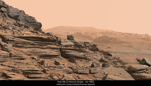
Full size
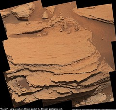
hereDebayered in gmic, assembled and stitched in Photoshop. I adjusted the color channels a bit, reducing the brightness of green by 5, and increasing the brightness of red by 5 and blue by 2. This seems to match the color of official releases pretty closely, at least on my home monitor (which should be properly calibrated), but doesn't seem to be reproducing well on other monitors. Once the green was darkened a bit, I used the "replace color" tool in Photoshop. I selected a couple of different green patches with a fuzziness of 35, then replaced it with a similar color with the red color values boosted by 20. This was entirely subjective, but it looked like it matched the surrounding rock hues pretty well.
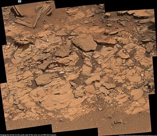
Also a bit more evidence that the Washboard was fluvially deposited. Load casts!
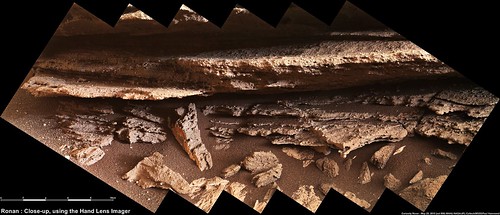
Click to view attachmentThese look like they're resting directly on Murray formation, so they could be remnants of the very basal layer of the Washboard. I think they'd have to be resting on mud for that to happen, since dry clay would be too hard to deform plastically like that.
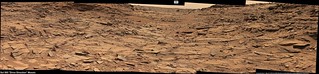
Also here's a comparison shot between some fluvially-deposited sandstone here in Illinois and one of the sandstone beds in the Washboard. Admittedly, my knowledge of eolian cross-bedding isn't very good, I've only seen it in person a couple of times, but it seems to me like the scale of the cross-bedding is a lot bigger. What we're seeing on Mars seems more in line with a fluvial setting.

Full size
herePerhaps the Washboard is a subaerially-exposed alluvial fan?


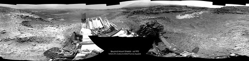


 I really appreciate when my work is used for teaching and outreach purpose. Your young students imagined being on Mars for a morning