Help - Search - Members - Calendar
Full Version: Jezero Delta Campaign, Sols 414-1000
Unmanned Spaceflight.com > Mars & Missions > Perseverance- Mars 2020 Rover
Pages: 1, 2, 3, 4, 5, 6, 7, 8, 9, 10, 11, 12, 13, 14, 15, 16, 17, 18, 19, 20, 21, 22, 23
scalbers
Now I see the funny looking feature in the gap appears to be much closer than I previously thought.

QUOTE (neville thompson @ Jul 28 2022, 04:46 PM) *
Gigapan - PERSEVERANCE 492
© NASA/JPL-Caltech/MSSS/ASU/NeV-T
neville thompson

Gigapan - PERSEVERANCE 502-503
© NASA/JPL-Caltech/MSSS/ASU/NeV-T
tau
Sol 510 SuperCam Remote Micro-Imager mosaic with Mastcam-Z context and sol 509 Navcam context

Click to view attachment Click to view attachment Click to view attachment
tau
Sol 512 SuperCam Remote Micro-Imager
with Mastcam-Z context,
Mastcam-Z left eye multispectral filters 1 to 6 principal components,
and sol 509 Navcam context

Click to view attachment Click to view attachment Click to view attachment Click to view attachment
Floyd
Anyone wish to speculate on the 510 and 512 light tone rock/mineral in the SuperCam images? Seems different from the gypsum seams we have seen elsewhere. In the 512 third image, there is a blue surface patch on the rock on the top right. Was this rock blue area where it was in contact with the blue type rock?
serpens
The veins are almost certainly enriched in calcium and sulphur but I've not seen anything on the hydration states of past examples (gypsum, bassanite, anhydrite) or enrichments. Extensive analysis of such veins by Curiosity has identified colour changes in veins due to varied fluid flow enrichments of silicon, iron, copper, manganese, chlorine, zinc, magnesium etc. Basically all we can do is exclaim 'oh look, a vein' and wait for the analytical papers to appear.
Bill Harris
Hard to say about that Sol 510-512 light material/ apparent fracture fill. I do think I see some laser spectrometer zaaps, so we'll soon have spectro data on that material.

--Bill
neville thompson

Gigapan - PERSEVERANCE 507
© NASA/JPL-Caltech/MSSS/ASU/NeV-T
neville thompson

Gigapan - PERSEVERANCE 501
© NASA/JPL-Caltech/MSSS/ASU/NeV-T
tau
1. Sol 510 Mastcam-Z left eye filter 0 raw image (black frame omitted)
2. Sol 510 Mastcam-Z left eye multispectral filters 1 to 6 principal components
3. Sol 502 Navcam context

Click to view attachmentClick to view attachmentClick to view attachment
PaulH51
Sol 516 Rock core number 12, located between 'Hazeltop' and the abraded patch on 'Wildcat Ridge' outcrop.
Processed R-NavCam
Click to view attachment
tau
Sol 520 SuperCam Remote Micro-Imager mosaic with sol 518 Mastcam-Z context.
Four or five of the ten laser holes hit a coating that is presumably hematite (bluish-gray color in this inmage).
The crack to the right of the coating is filled with a light-colored material, probably a gypsum vein.
A multispectral context is the upper right corner of this image in post #304.

Click to view attachmentClick to view attachment
tau
Sol 513 Mastcam-Z mosaic of left eye multispectral filters 1 to 6 principal components
and two corresponding left eye filter 0 raw images (black frames omitted)

Click to view attachmentClick to view attachmentClick to view attachment
tdemko
QUOTE (tau @ Aug 8 2022, 10:55 AM) *
Sol 513 Mastcam-Z mosaic of left eye multispectral filters 1 to 6 principal components
and two corresponding left eye filter 0 raw images (black frames omitted)


These are looking like some of the finest-grained sediments yet seen. Important, because organic matter, if present, that was carried by the sediment gravity flows building the delta would be higher in concentration in the deepest, most distal parts of the depositional system. This because of relative lower density, allowing them to remain in suspension for a longer period of time until they are in a part of the lake with lower turbulence, and adsorption and adherence to clay minerals which also remain in suspension longer. Dilute sediment gravity flows, like turbidity currents and hyperpycnal flows, move downslope because of the fine-grained (mud) material in suspension, which creates a density difference with the surrounding ambient water. As this material falls out of suspension and is deposited, the flows slow, and eventually stop. While they are flowing, they can move coarser material (sand and gravel) as bedload and create bedforms (ripples, dunes, antidunes, cyclic steps, and chutes and pools), as well as erode previously deposited material. In modern sublacustrine and submarine fans, turbidity currents can transport fine-grained material and organic material far from its source in deltas and fluvial systems (in the modern Congo/Zaire system >750 km of transport).
Bill Harris
"Hyperpycnal", now there is a concept that I've not thought of in years, Tim. And you are absolutely correct, this is where organics, and organics adhering to clays, will end up. Organics, and reactions and interactions with the organics.

--Bill
Phil Stooke
The newest sample has a name: Bearwallow.

Click to view attachment

Phil
tau
Sol 522 SuperCam Remote Micro-Imager mosaic.
The outcrops remind me of glacial till with erratic blocks.

Click to view attachment
tau
The sol 522 SuperCam Remote Micro-Imager mosaic in a Mastcam-Z context image with "marsonaut" for scale.

Click to view attachment (edited image)


Edit: The first upload was with a wrong size of the "marsonaut". I enlarged the Mastcam-Z image by a factor of 2 and forgot to do the same with the scale.
Here is now (hopefully) the correct size.
Bill Harris
QUOTE (tau @ Aug 10 2022, 12:04 PM) *
Sol 522 SuperCam Remote Micro-Imager mosaic.
The outcrops remind me of glacial till with erratic blocks.

Click to view attachment


Yes, or talus with float. I'm looking upslope and wondering how resistant that white fine-grained unit is.

--Bill
tau
A broader context for the sol 522 SuperCam RMI mosaic (with "marsonaut") in a sol 502 Navcam image.

Click to view attachment
tdemko
QUOTE (Bill Harris @ Aug 10 2022, 01:35 PM) *
Yes, or talus with float. I'm looking upslope and wondering how resistant that white fine-grained unit is.

--Bill


In my previous reply, I purposely used the term "dilute" sediment gravity flow. The proportion of sediment to water in a subaqueous sediment gravity flow determines the rheology and fluid mechanics of the flow. In a dilute flow (in terrestrial settings that is ≤ around 15% sediment), the flow is turbulent, and the sediment concentration is greater at the base of the flow (dense basal layer), and decreases upward, with a mixing zone at the top where ambient water gets mixed into the flow. The flow largely behaves as a Newtonian fluid. Mixing of ambient water and deposition of the suspended sediment decreases the concentration of the flow, which can eventually remove the potential energy of the density difference, and the flow stops. The flow may also spread out once it exits a channel, and the slope angle usually also decreases downflow, also contributing to lower velocity, turbulence, and therefore sediment carrying capacity. This is the typical evolution of turbidity currents in submarine and sublacustrine fans. The deposits of lower concentration sediment gravity flows reflect these conditions, and often produce a characteristic fining-upward texture (graded), and a fabric of predictable sedimentary structures (including the famous Bouma sequence), called turbidites.

The rheology and fluid mechanics of higher concentration flows (> 15-20% sediment) gets interesting. They may act as non-Newtonian fluids, plastics, or even plug-like flows with increasing concentration. In general, in higher-concentration subaqueous sediment gravity flows, turbulence is suppressed, and they can act as laminar flows (like a fluid mud), or even slide and/or hydroplane on a thin later of ambient water trapped beneath the flow as it moves downslope. The deposits of higher-concentration subaqueous sediment gravity flows (sometimes called debrites) are often characterized by very poor sorting (little or no grading), floating outsized clasts, rafted blocks of disparate materials, deformed internal fabrics, or can be structureless and massive.

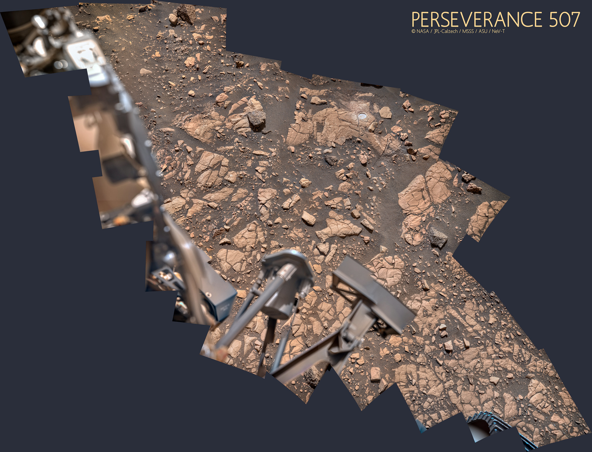
I think these outcrops reflect an initial episode of high concentration sediment gravity flow deposition (the structureless, poorly sorted units in the foreground) followed by lower concentration sediment gravity flow deposition (the bedded units in the background). Both could have been in the lake, or the initial deposits could have been part of a subaerial debris flow during a lake-level lowstand, followed by a lake level rise and progradation of the delta. It is interesting that the poorly-sorted unit contains a lot of rounded clasts...it apparently was sourced by fluvial deposits somewhere in the drainage basin, maybe from a catastrophic flash flood.
Bill Harris
Good description of that sequence. I dismissed it simplistically as blocks of outcrop that had detached and are moving downhill with the loose talus. And the light-toned boulders are simply rounded by wind erosion.
Your post is teaching this old dog new tricks: thanks!

--Bill
tau
Sol 524 SuperCam Remote Micro-Imager mosaic (in two parts because of unclear upload limitations)

Click to view attachment Click to view attachment
tau
The sol 524 SuperCam RMI mosaic in a sol 484 Mastcam-Z context image with "marsonaut" for scale

Click to view attachment
serpens
QUOTE (tdemko @ Aug 10 2022, 11:58 PM) *
..... It is interesting that the poorly-sorted unit contains a lot of rounded clasts...it apparently was sourced by fluvial deposits somewhere in the drainage basin, maybe from a catastrophic flash flood.


From the context image the flow here was from left to right. The rounded clast rich unit does not seem to extend far laterally and sits below the topsets. My initial thought was that this was channel fill.
tdemko
QUOTE (serpens @ Aug 11 2022, 05:54 PM) *
From the context image the flow here was from left to right. The rounded clast rich unit does not seem to extend far laterally and sits below the topsets. My initial thought was that this was channel fill.


The story gets even more interesting...the latest image show that the inclined units below the topset truncation surface are much more poorly sorted than the overlying topsets. If the two sets of units are related ala Walther's Law, this is counterintuitive: deltaic and other sediment gravity flow deposits are relentlessly better sorted as one goes downflow. Flow stripping of the finest-grained material in from that in suspension, and deposition of the coarsest material from bedload, drives the sorting of the deposits to some better-sorted mean (or stated differently, losing the coarse and fine tails of the grain size distribution). So, one would expect that the topsets, deposited in a more up flow proximal position, would be more poorly sorted than the more distal foresets, again, if they are related in a Waltherian sense. I would say, in this case, they are not. The foresets were deposited by progradation of poorly sorted, debris-rich flows, while the apparent topsets were deposited by better sorted sandy flows. We may be looking at the vertical juxtaposition of parts of two different delta lobes with very different sediment sources, from a grain size and sorting sense.

The other view of the cobble/debris rich unit looked massive and structureless, the debris-rich inclined foresets here look bedded. Some interesting stratal architecture and geometries, as we process stratigraphers would say, are not yet well known...
serpens
No possibility that this is an erosional hiatus?
tau
Sol 526 SuperCam Remote Micro Imager mosaic

Click to view attachment

tau
The sol 526 SuperCam RMI mosaic in a sol 507 Mastcam-Z context image

Click to view attachment
Bill Harris
QUOTE (tau @ Aug 13 2022, 02:43 PM) *
Sol 526 SuperCam Remote Micro Imager mosaic

Click to view attachment

Like Serpens, I'm tending towards a channel fill with this feature.

--Bill
serpens
That's the scour fill discussed back in posts #295 and #297.
Bill Harris
I don't think this is the case here, but I've seen boulders dropped by glaciers/floating sea ice into underlying sediment.
One complicating factor is that we have multiple erosional/depositional events happening over millions of years. Mars never disappoints.

--Bill


tdemko
QUOTE (Bill Harris @ Aug 14 2022, 04:19 PM) *
I don't think this is the case here, but I've seen boulders dropped by glaciers/floating sea ice into underlying sediment.
One complicating factor is that we have multiple erosional/depositional events happening over millions of years. Mars never disappoints.


I'm sticking with my previous interpretation in reply #297: these interesting stratal geometries are the result of scour and current shadows around an outsized intraclast, which now looks like a big armored mudball, studded with imbedded interclasts. The closer view also shows smaller scour and fill structures associated with partial, and then complete, burial of the clast. It even looks like some coarser bedload material was trapped behind the clast. As I mentioned before, I've seen big clasts like this far out on submarine fan lobes, with similar sedimentary structures around them.
serpens
The recent images with more detail confirm your interpretation Tim. If this was 'normal', part eroded scour fill it should reflect the nature of the deposits above the scour, but this 'lump' is anomalous. For a clast ridden mudball to survive the flow forces necessary to transport it would seem to require a reasonable degree of lithification of the matrix. This has implications for assessments of the longevity of the lake and depositional/erosional cycles and a minimum depth of water/flow necessary to provide the buoyancy/impetus to move this 'lump' along a pretty much horizontal bed.
tau
Here are some more details on the discussed "lump".
1. The central part of the sol 526 SuperCam RMI mosaic with added scale.
2. Sol 526 Mastcam-Z wiggle-stereo image
3. Sol 526 Mastcam-Z anaglyph
As can be seen in the two stereo images, the left side of the "lump" protrudes.
Behind it is a cavity with a depth of roughly 20 to 30 cm.
The background of the cavity consists of sandstone and/or sand with a grain size of about 0.7 to 1 mm.
The "lump" appears to continue into the rock in a northeasterly direction (to the right in the images).
The distance from the camera to the outcrop was about 24 m.

Click to view attachment Click to view attachment Click to view attachment
tdemko
QUOTE (tau @ Aug 15 2022, 10:08 AM) *
Here are some more details on the discussed "lump".
1. The central part of the sol 526 SuperCam RMI mosaic with added scale.
2. Sol 526 Mastcam-Z wiggle-stereo image
3. Sol 526 Mastcam-Z anaglyph
As can be seen in the two stereo images, the left side of the "lump" protrudes.
Behind it is a cavity with a depth of roughly 20 to 30 cm.
The background of the cavity consists of sandstone and/or sand with a grain size of about 0.7 to 1 mm.
The "lump" appears to continue into the rock in a northeasterly direction (to the right in the images).
The distance from the camera to the outcrop was about 24 m.


These are great! I think the cavity is a wind tafoni feature: some of the clast, which was likely friable and loosely bound once dried out, has weathered and fallen away, creating a little pocket to catch even more wind action. The clast was probably a fairly equidimensional, but now only a remnant remains. The coarser sediment in the back of the cavity was behind the clast.
Bill Harris
Another example of the coarse clast is to the upper left of the discussed clast in this cropped image of Tau's from Sol 507 on post 329.
serpens
Thanks Tau, great images.
tau
Sol 532 SuperCam Remote Micro-Imager mosaic with sol 525 Mastcam-Z context

Click to view attachment Click to view attachment
tau
Sol 532 SuperCam Remote Micro-Imager mosaic no. 2 with sol 532 Mastcam-Z context

Click to view attachmentClick to view attachment
neville thompson

Gigapan - PERSEVERANCE 530
© NASA/JPL-Caltech/MSSS/ASU/NeV-T
tau
Sol 533 SuperCam Remote Micro-Imager mosaic with Mastcam-Z context

Click to view attachmentClick to view attachment
Bill Harris
Thanks, Tau!

Sol 533 is likely an example of the coarse clast we observed in 526.
532 are the wonderful textures of sandblasted sedimentary structure. The first Remote micro-imager mosaic seems to be an example.of fracture-fill, with the texture brought out by the aeolian weathering.
tau
Sol 534 SuperCam Remote Micro-Imager
This is a second SuperCam laser investigation of this target with four deeper laser holes, two in the coating, two in the rock without coating.
The laser analysis of the uncoated rock allows to eliminate the rock background and to refine the analysis of the coating.
The first investigation with ten laser holes on a line was performed on sol 520, see post #312.
An interesting video about the coating and its comparison to desert varnish is Mars Guy's Episode 72.

Click to view attachment
Phil Stooke
Sol 535 was a driving day, moving east. I assume we are going south after this and back to Enchanted Lake, according to the blog. Paul provided the images for this view.

Phil


Click to view attachment

Bill Harris
Are we near a named spot on the Route Map above? I've lost track of our driving location!

--Bill
Phil Stooke
Remember that you can always use the mission map to keep track of location between our updates.

https://mars.nasa.gov/mars2020/mission/where-is-the-rover/

Phil
PaulH51
Drive on 536: A selection of roughly assembled and processed 4-tile L-NavCam's

Click to view attachment Click to view attachment Click to view attachment
Phil Stooke
I used the full set of Paul's images (except the upper tier, I was too busy today to spend the extra time it takes to add them) for this circular view. Still moving east, and old tracks are visible on the slope below.

Phil

Click to view attachment
StargazeInWonder
Four papers published in Science today discuss the discoveries made so far by Perseverance.

Overview:
https://mars.nasa.gov/news/9252/nasas-perse...-jezero-crater/
This is a "lo-fi" version of our main content. To view the full version with more information, formatting and images, please click here.
Invision Power Board © 2001-2024 Invision Power Services, Inc.