Help - Search - Members - Calendar
Full Version: South from the landing site, sols 72-237
Unmanned Spaceflight.com > Mars & Missions > Perseverance- Mars 2020 Rover
Pages: 1, 2, 3, 4, 5, 6, 7, 8, 9, 10, 11, 12, 13, 14, 15
PaulH51
I must admit I was a little concerned when I first saw this image on the server.
Then I found the answer in a pay-walled paper.
It's the 'Flight Abrading Bit'. It's not designed/fitted with tabs that would allow it to be placed into the bit carousel.
It is supposed to be discarded soon after landing (phew)
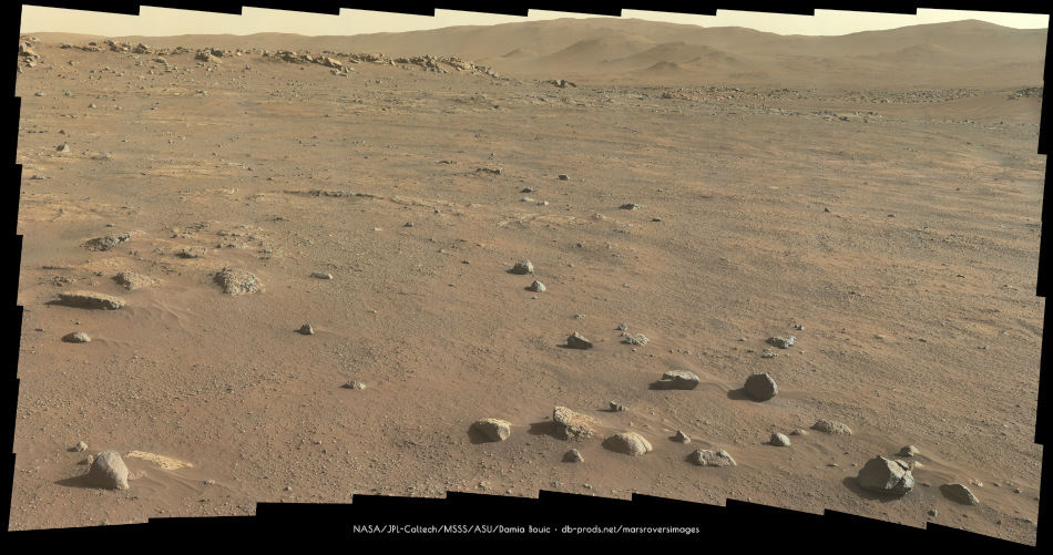
 smile.gif
Hazcam from sol 148
Click to view attachment

EDIT

I forget to add...

Here is the link to the paper https://link.springer.com/article/10.1007/s11214-020-00783-7

Title: The Sampling and Caching Subsystem (SCS) for the Scientific Exploration of Jezero Crater by the Mars 2020 Perseverance Rover
(Moeller et all, published: 21 December 2020)
charborob
Sol 145 LMastcam-Z panorama:
Click to view attachment
tau
SuperCam RMI spotted some layered outcrops on sol 147, presumably anywhere northeast to southeast of Airfield F.

Click to view attachment Click to view attachment Click to view attachment
MichaelJWP
QUOTE (PaulH51 @ Jul 21 2021, 03:44 PM) *
I forget to add...

Here is the link to the paper https://link.springer.com/article/10.1007/s11214-020-00783-7

Title: The Sampling and Caching Subsystem (SCS) for the Scientific Exploration of Jezero Crater by the Mars 2020 Perseverance Rover
(Moeller et all, published: 21 December 2020)

That paper looks really interesting, presumably as NASA is a public funded body this paper as a PDF should be available without a paywall, anyone have the link?
Bill Harris
Space Science Journal, the publisher of this paper, is not publicly funded.
tau
Sol 149 SuperCam RMI with context

Click to view attachment Click to view attachment Click to view attachment
mcaplinger
QUOTE (MichaelJWP @ Jul 22 2021, 03:05 AM) *
presumably as NASA is a public funded body this paper as a PDF should be available without a paywall

I suspect this is more complex than you think. Current NASA policy is described at https://sti.nasa.gov/submit-to-pubspace/ but this is still evolving and there's a 12-month lag. Many NASA center and JPL documents eventually show up on https://ntrs.nasa.gov/

Authors who wrote papers that are open-access at the journal paid that journal for the service out of their own funding streams, it's not required.
fredk
You can always ask one of the authors for a copy, or visit a university library if one is close.
MichaelJWP
QUOTE (fredk @ Jul 22 2021, 04:25 PM) *
You can always ask one of the authors for a copy, or visit a university library if one is close.

I actually live near Imperial College in London which has a great library - unfortunately still closed due to the pandemic sad.gif
MahFL
Is this a sample tube in the ground ?

Click to view attachment
PDP8E
MahFL, see post #351 from PaulH51 (above) wink.gif
MahFL
QUOTE (PDP8E @ Jul 23 2021, 02:27 AM) *
MahFL, see post #351 from PaulH51 (above) wink.gif


Sadly for me the article costs $ to read.
PaulH51
QUOTE (MahFL @ Jul 23 2021, 10:23 AM) *
Is this a sample tube in the ground ?

I believe that this is the launch abrading bit, is it slightly shorter than the other two abrading bits that are stored inside the bit carousel. This bit does not have 'Bit Exchange Tangs' so it can not be placed inside the bit carousel, as it is designed to simply be dropped on the surface early in the mission and replaced with one of the other bits. See Figs 13 & 19. The bit in your post is missing the bit exchange tangs identified in Fig 19.

This bit was fitted before launch to seal the chuck of the corer, the document states it could be used early in the mission but would be dropped onto the ground and another bit fitted. I suspect this could be associated with potential contamination prior to launch, whereas the bits in the bit exchange carousel were enclosed and they and the ACA were fed a supply of clean air on the launch tower.

DM me your email address.

Click to view attachment Click to view attachment


PaulH51
Here are 2 annotated Navcam frames with timestamps from sol 150.
The left image shows the coring drill with an empty chuck. The right image was snapped later and shows the chuck mounted with an abrading bit, note it is a little longer than the bit we saw previously that was discarded onto the ground after testing. Note also that this abrading bit has the 'Bit Exchange Tangs' that the flight abrading bit did not have (see previous post with a sketch of the bits and a brief explanation)

Click to view attachment

typo fixed
tau
Sol 150 SuperCam RMI with context from Mastcam-Z and Navcam

Click to view attachment Click to view attachment Click to view attachment
tau
Sol 146 SuperCam RMI with context (sol 146 Mastcam-Z and sol 143 Navcam).
The rock looks rather unspectacular, but there is a faintly visible color zoning (layering?) in it, see the color enhanced Mastcam-Z image.
It would be interesting to know if this is caused by mineralogical or chemical variations in the rock.

Click to view attachment Click to view attachment Click to view attachment Click to view attachment

By the way, in the press conference three days ago, Perseverance project scientist Ken Farley said that the team is not yet sure whether the "Crater floor fractured rough" unit is volcanic or sedimentary.
Is it better not to call it "basalt" until this question is resolved? Or did I miss something?
serpens
The cracked and vesicular rocks that have been discussed herein are basalt tau, seemingly the remnants of an effusive lava deposit. The rocks discussed in the briefing that the team call paving stones lie under these remnants and may well be sedimentary and this was raised on page 21 of this thread. Very early on in the mission, Maaz rock, a paving stone was investigated and shown to have a basaltic composition and was surrounded by vesicular rocks. But that result could also reflect a sedimentary rock formed from fine grains of igneous rock. When approaching the current position Perseverence descended into what may be a more heavily eroded area, hopefully down into the old lake bed.
tau
Thank you for your explanation, serpens.
After looking at photos like the one below from sol 139 I thought that the vesicular material is just the upper part (the proverbial "tip of the iceberg") of the "paving stones".
But if I understand it correctly, the vesicular rocks are erosion remnants of a layer on top of the Crater floor fractured rough unit.

Click to view attachment
Bill Harris
That is how this basalt could be described.
I am looking for a close view of the contact between the underlying "paving stone" and the basalt. As well.as determining the mythology of that lower unit.

--Bill
tau
Sol 152 SuperCam RMI with Sherloc Watson camera context.
The very different illumination made it quite a challenge to find a reasonable match (with rotation).

Click to view attachment Click to view attachment
PaulH51
A drive on sol 153 takes the rover to site 5/2296 as seen in this left-Navcam.
Click to view attachment
tau
An anaglyph with enhanced colors from Sherloc Watson camera images of the sol 152 SuperCam laser target.
Some small laser holes are visible. Dust around them was blown away by the laser explosions.

Click to view attachment
Bill Harris
Interesting. The Sol 152 Supercam tends to show vitreous wind-polished faces, but the Watson cam Context suggests a matte surface.
And the SuperCam shows many well-rounded clasts, which suggests abrasion by moving water (ie, streams). I don't think they are Oppy-like Blueberries.
I wonder if it is possible for us to determine an image scale on those photos? That will take knowing a precise distance to the subject.
tau
The vitreous-versus-matte appearance is probably an effect of the lighting geometry. Both cameras looked down on the target from above.
The SuperCam took the images at nearly noon (12:28 to 12:59 local mean solar time), with the sun shining from above. Therefore, there are some specular reflections sun - target - camera, and almost no shadows.
The Watson camera photos were taken in the evening (around 17:20) with the sun low above the horizon, so they show long shadows and nearly no specular reflection into the camera.
Nevertheless, the difference in appearance is somewhat surprising because the composite SuperCam image shows the dusty surface before the laser activity,
while the Watson camera photographed the same surface after some dust was removed by the laser explosions.

Edit
A simple experiment to show this effect
Turn off your slightly dusty computer monitor.
Shine a bright light perpendicularly on it - you will see a specular reflection, but no dust.
Shine a bright light (or the Sun) on it at a low angle from the side - you will see the dust, but no specular reflection.
Phil Stooke
Here is a circular view of the sol 153 location on another patch of these 'paver rocks'. Dust devil at 9 o'clock!

Phil

Click to view attachment
tau
Geological panorama with layered outcrops of various kind on sol 153.
Mastcam-Z left eye filter 0, principal components of RGB

Click to view attachment
Bill Harris
QUOTE (Phil Stooke @ Jul 26 2021, 01:35 PM) *
Here is a circular view of the sol 153 location on another patch of these 'paver rocks'. Dust devil at 9 o'clock!

So to West (left), in the direction of the Dust Devil, lies the Raised Ridges and the landing point of Ingenuity's Flight 10.

--Bill
tau
A mountain panorama from sol 153
Mastcam-Z left eye filter 0, principal components of RGB
(with unavoidable compression artifacts of the raw images)

Click to view attachment
tau
An artifact in the crater floor - the launch abrading bit on sol 151.
Can this be used as a scale for grain size estimation at least in this image?

Click to view attachment Click to view attachment
Bill Harris
The cuttings don't look like the rock is a basalt. A pile of cuttings may not tell us much, but I'd like to see a microphoto of this.

--Bill
PDP8E
(throwback) SOL 73 -- 6:09 PM local -- Clouds late in the afternoon
(Stochastic equalization)
GIF
Click to view attachment

serpens
I'm not sure what the pixel number required for Mastcam grain size resolution is, but these particles would seem too fine for assessment. If these paving stones are sedimentary then the sediment from which they formed would have been subject to significant fluvial/lacustrine alteration during transport and after deposition.
tau
I do not assume that the grain size of the abraded powder can be determined from this photo.
If we do not know the distance between the camera and the object, something of known size in the picture may help to estimate the size of other objects, in this case very coarse sand grains and larger.
The diameter of the abrading bit is my rough estimate based on drawings and other available (but not official) information. Then one pixel would correspond to about 0.2 mm in lateral direction.

In addition, here are two multispectral principal components images, Mastcam-Z left eye and right eye filters 0 to 6.

Click to view attachment Click to view attachment Click to view attachment
tau
Sol 150 Mastcam-Z
1) Left eye filter 0 (RGB) raw image
2) Left eye filters 0 to 6 multispectral principal components
3) Right eye filters 0 to 6 multispectral principal components
4) Anaglyph

1 Click to view attachment . . 2 Click to view attachment . . 3 Click to view attachment . . 4 Click to view attachment
tau
Another sol 150 Mastcam-Z multispectral series
1) Left eye filter 0 (RGB) raw image
2) Left eye filters 0 to 6 principal components
3) Right eye filters 0 to 6 principal components
4) Anaglyph

In 3) there is a false-color dark red pebble (arrow) with a low reflectance in visible light and higher reflectance in the infrared.
According to Fig. 3 in a publication on Mastcam-Z by J.F. Bell III et al. it might be hematite.

1Click to view attachment . . 2Click to view attachment . . 3Click to view attachment . . 4Click to view attachment
tdemko
QUOTE (Bill Harris @ Jul 27 2021, 01:53 PM) *
The cuttings don't look like the rock is a basalt. A pile of cuttings may not tell us much, but I'd like to see a microphoto of this.

--Bill


I agree, Bill. Almost looks like some kind of intraclast pebble conglomerate. Could be mudstone clasts, but could also be one of those Silurian/Mars flaxseed/peloid ironstones.
tau
Sol 155 SuperCam RMI (here only the right part, because the left part is out of focus and blurred) with context.

Click to view attachment Click to view attachment Click to view attachment
tau
We get closer to layered outcrops.
Sol 155 Mastcam-Z panorama with enhanced colors.

Click to view attachment
Sean
Here is an 8 minute video in 8k from Sol 153 Mastcam Panorama. Click to view on Youtube.

Ant103
Sol 156 MastcamZ at 110mm panoramic.

Phil Stooke
The sol 155 panorama in circular form.

Phil

Click to view attachment
Phil Stooke
This is the panorama used to create that circular view.

Phil

Click to view attachment
charborob
Sol 156 partial LMastcam-Z panorama:
Click to view attachment
Phil Stooke
https://twitter.com/NASAPersevere/status/1420794290930782210


Sampling coming up!

Phil
Bill Harris
Sampling station is at the Sol 155 location, about 0.3km East of the Raised Ridges.
Presumably this is the sedimentary unit just below the basalt flows. A good place to start measuring the Section as it represents the lacustrine deposits of Lake (or Bay) Jezero before the start of volcanism or uplift of the Syrtis region and the subsequent emplacement of the Jezero delta complex.

Or so it might seem.

--Bill
serpens
Given the extent of the step back of the delta through erosion before the volcanic capping unit was emplaced wouldn't this likely be a delta bottomset deposit?
PaulH51
deleted
Phil Stooke
The original interpretation of this location was that it was the Crater Floor Fractured Rough unit, interpreted as a mafic unit. Usually it is called basalt but it could be or include ash deposits. I don't know if the team has now decided this is really part of the Seitah unit thought to be deposited in the lake.

Phil
Phil Stooke
A circular view for sol 157. The tracks show the small move to the southeast. Dust devil at 8 o'clock!

Phil

Click to view attachment
tau
Sol 158 Mastcam-Z panorama with enhanced colors in two parts, here is the left part
(uploading the whole panorama at once fails, although its file size is only 2,4 MB)

Click to view attachment
This is a "lo-fi" version of our main content. To view the full version with more information, formatting and images, please click here.
Invision Power Board © 2001-2024 Invision Power Services, Inc.