Reports of my distress have been greatly exaggerated. -- Ingenuity
Thanks to Tom for the links earlier.
Full Version: Ingenuity- Mars 2020 Helicopter
So this is a loss of LOS telemetry with the Rover. At least the autonomous flight functions remained functional.
--Bill
--Bill
Yeah, just a line of site thing because the rover wasn't where the flight plan had originally assumed it would be.
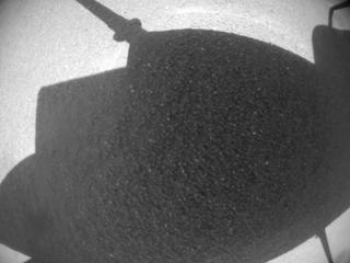
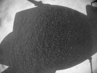
(full_res: https://mars.nasa.gov/mars2020-raw-images/p...1_01_295J01.png)
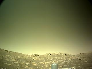
Mars Perseverance Sol 282: Left Navigation Camera (Navcam)
This image was acquired on Dec. 5, 2021 (Sol 282) at the local mean solar time of 13:40:26
mastAz: "179.973",
mastEl: "25.1973",
Azimuth: "60 deg"
1. Am I right that this is the Bras hillock behind which Ingenuity has just hidden ~hour before?
2. Last Phil's map shows that the azimuth from the landing site to Perseverance on the flight sol (282) was almost the same as on sol 281 and the move on sol 282 could not cause the serious aggravation in LOS.
QUOTE (tau @ Dec 15 2021, 06:48 PM) 
Bras hill is marked with B in the image below.
Thank you, Tau.
Maybe I misunderstand this statement
QUOTE
When we originally planned Flight 17, we believed that the rover was going to be parked in a specific location and oriented in a certain direction. However, Perseverances plans change day to day to maximize overall science return.
https://mars.nasa.gov/technology/helicopter/status/350
https://mars.nasa.gov/technology/helicopter/status/350
but given these elevations, where nothing changed significantly from sol 281 to sol 282, neither the elevation, not the azimuth to the planned landing site.
280 -2572,029541
281 -2574,433838
282 (flight date)
283 -2574,299316
it comes out that the Ingenuity team beleived that Perseverance still stands where it stood on sol 280, or 2 days before the planned departure date?
I'm sorry again if I misunderstood something in the complaint that 'Perseverances plans change day to day'
"When we originally planned Flight 17, we believed that the rover was going to be parked in a specific location and oriented in a certain direction. "
The rover turned in place, so the location and elevation did not change, but the new orientation was not so suitable for communication with the helicopter.
Phil
The rover turned in place, so the location and elevation did not change, but the new orientation was not so suitable for communication with the helicopter.
Phil
Extract from this press release : https://www.jpl.nasa.gov/news/nasas-ingenui...0-minutes-aloft
QUOTE
Flight 18 is scheduled to take place no earlier than today, Dec. 15, with Ingenuity covering another 754 feet (230 meters) at a speed of 5.6 mph (2.5 meters per second) over 125 seconds. The new airfield, close to the northern boundary of Séítah, will be the rotorcrafts 10th on Mars. Data from the flight is expected to be received at JPL no earlier than in the late afternoon today.
As with the previous effort, Flight 18 will push the limits of Ingenuitys radio range and performance. To provide it with the best chance of maintaining a link throughout landing, the Mars Helicopter team has modified the flight sequence to communicate in a low-data-rate mode, which will provide an additional signal-strength boost to the radio link.
If we do lose radio link on landing, it may be several days or weeks until the line-of-sight between Ingenuity and Perseverance improves enough to attempt a communication session, said Tzanetos. While delaying our post-flight data analysis is an inconvenience, it is not unexpected and becoming the new normal as we continue to operate in challenging terrain in the weeks ahead.
Looks like flight 18 completed successfully, here's one of 5 Navcam's that show the last moments of the flight, the JSON data has not been issued yet, but I believe the point to point distance was ~230 meters (as planned) but it appears to have landed inside a trough of a sand ripple inside North Seitah. The landing site was captured during flight 9 by one of the RTE images. James Sorenson created this animation that identifies the landing site link
Click to view attachment
Click to view attachment
QUOTE (PaulH51 @ Dec 16 2021, 10:18 AM)
James Sorenson created this animation that identifies the landing site link
Nice, but too short
 .
.I had a use of compiling the animations for almost all the flights: they are kept in this catalogue at the Wikimedia Commons storage. However my principle was not to rush with the assembly until the whole 180/190 frame set appears at NASA's storage. Rotation ground tests were the only exclusion. However, no additional frames (to 5 existing) appeared after flight 17, and I still wait for the missing frames, doing nothing.
Although manual display time setting for each of 200 frames is a time consuming process, I wrote a simple code to extract seconds and millis from file names thereby bringing the scrolling of frames closer to a real-time documentary film. Today I fear I shall not have the occasion for this enhancement, because 5 frames is too short time.
New year, new flight planned for Friday. https://mars.nasa.gov/technology/helicopter...same-ingenuity/
This caught my eye:
Trying to parse this; are they leaving Perseverance behind already!?
This caught my eye:
QUOTE
The final act of the flight is to turn nearly 180 degrees to flip the RTE camera to a forward-facing orientation for future flights toward the river delta.
Trying to parse this; are they leaving Perseverance behind already!?
QUOTE (Explorer1 @ Jan 5 2022, 09:46 AM)
New year, new flight planned for Friday. https://mars.nasa.gov/technology/helicopter...same-ingenuity/
This caught my eye:
Trying to parse this; are they leaving Perseverance behind already!?
This caught my eye:
Trying to parse this; are they leaving Perseverance behind already!?
Nope. They want to have Ingenuity available when Perseverance arrives at the Delta. But Ingenuity might be able go directly over some terrain that Perseverance will have to take the long way around.
How will they communicate at such a distance though? We saw the problems even a little bit of topography between Ingenuity and Perseverance can cause.
The maximum communication range is 1,000 metres, with maximum range for a flight probably half that given the extra power required to fly in the current, declining atmospheric density. I would assume that the flight profiles will be designed to ensure that Ingenuity is always in data contact with Perseverance and hence Earth based taskers. The performance of what was a concept demonstrator has been surprising.
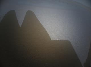
Before flight 19 (hopefully) starts today, I ask the permission to put forward a series of questions I accumulated upon the photos that trace the ground activities of Ingenuity after flight 18.
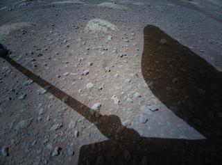
Sol 292, December 15. Flight 18 landing.
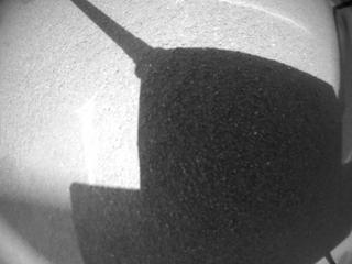
(left) 12:04:35 before touch-down; (right) 12:04:36 touch-down
Question. Presuming the helicopter always lands vertically, may the visible difference of space between the legs and the ground surface be used in calculations of the slope angle? (In this case helicopters' body is expected to have the backwards tilt after the final touch-down)
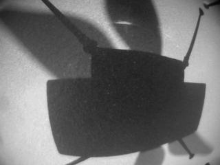
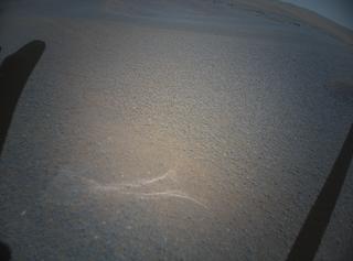
Sol 297, December 20. Three from the series of 4 NAV photos

DTG, left to right 11:10:44, 11:12:27, [skipped], 11:16:47
Skipped photo is timestamped 11:14:37, URL is here
Note the light arcuate streak on the ground, going parallel to the upper (front) edge of the helicopter's body shadow. On January 9-10 it shall 'disappear' from the NAV photos.
Question. A slow-speed rotation test on sol 297, isn't it?
Sol 292, December 15. Flight 18 landing.
(left) 12:04:35 before touch-down; (right) 12:04:36 touch-down
Question. Presuming the helicopter always lands vertically, may the visible difference of space between the legs and the ground surface be used in calculations of the slope angle? (In this case helicopters' body is expected to have the backwards tilt after the final touch-down)
Sol 297, December 20. Three from the series of 4 NAV photos
DTG, left to right 11:10:44, 11:12:27, [skipped], 11:16:47
Skipped photo is timestamped 11:14:37, URL is here
Note the light arcuate streak on the ground, going parallel to the upper (front) edge of the helicopter's body shadow. On January 9-10 it shall 'disappear' from the NAV photos.
Question. A slow-speed rotation test on sol 297, isn't it?
Sol 302, December 26, 12:37:28. Color photo from RTE.
Left: Sol 302, December 26, 12:37:28; Right: Sol 045, April 6, 13:58:38 (Wright Brothers' Field)
URL of the heavy full-size 27 Mb image is here
Comment (am I right?): a piece of sky confirms my hypothesis about the backwards tilt; the absence of sky in the left corner adds that the left pair of Ingenuity's legs stands topographically lower thus providing a CCW inclination.
The airborne RTE photos (not shown here) always display the inner edges of the 'hoofs' for both Ingenuity's legs.
Instead of 'hoofs', available ground photos (here the one for sol 45 is shown for comparison purposes) display the middle part of only one front leg (or its shadow) instead of both. The reason for that may be the gravity which spreads the legs wider under the weight of the helicopter.
Taking the Wright Brothers' Field as a close-to-ideal flat surface étalon we may draw the conclusion that the surface of Airfield L for today's (Jan. 23) start has the backward and 'left' inclination.
Possibility: panorama gurus may calculate the azimuth for this photo.
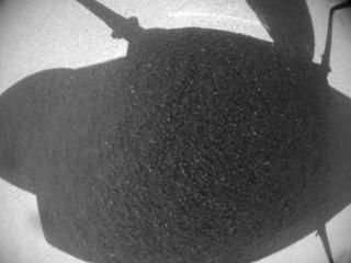
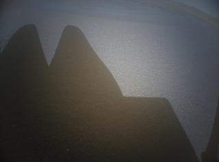
Sols 316 and 317, January 9 and 10, LMST 11:01:22 and 11:00:49 respectively.
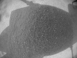

Comment (am I right?): the paleness of NAV images shot 2-3 sols after the cancelled flight on January 7 may be caused by worsening tau.
Remember the light arcuate streak on the ground we saw on December 20? Now it 'disappears' either because of sandy mist or being covered with the dust brought by the wind. Instead, we see a group of new blobs in the top left corner. They repeat on photo(s) taken on January 13. Are they the new ground features brought/uncovered with the wind, or they reside on the NAV optics shall be clear after flight 19.
Question. To what extent may the decrease of visibility (tau) affect the capabilities of the NAV-based inertial navigation?
Left: Sol 302, December 26, 12:37:28; Right: Sol 045, April 6, 13:58:38 (Wright Brothers' Field)
URL of the heavy full-size 27 Mb image is here
Comment (am I right?): a piece of sky confirms my hypothesis about the backwards tilt; the absence of sky in the left corner adds that the left pair of Ingenuity's legs stands topographically lower thus providing a CCW inclination.
The airborne RTE photos (not shown here) always display the inner edges of the 'hoofs' for both Ingenuity's legs.
Instead of 'hoofs', available ground photos (here the one for sol 45 is shown for comparison purposes) display the middle part of only one front leg (or its shadow) instead of both. The reason for that may be the gravity which spreads the legs wider under the weight of the helicopter.
Taking the Wright Brothers' Field as a close-to-ideal flat surface étalon we may draw the conclusion that the surface of Airfield L for today's (Jan. 23) start has the backward and 'left' inclination.
Possibility: panorama gurus may calculate the azimuth for this photo.
Sols 316 and 317, January 9 and 10, LMST 11:01:22 and 11:00:49 respectively.
Comment (am I right?): the paleness of NAV images shot 2-3 sols after the cancelled flight on January 7 may be caused by worsening tau.
Remember the light arcuate streak on the ground we saw on December 20? Now it 'disappears' either because of sandy mist or being covered with the dust brought by the wind. Instead, we see a group of new blobs in the top left corner. They repeat on photo(s) taken on January 13. Are they the new ground features brought/uncovered with the wind, or they reside on the NAV optics shall be clear after flight 19.
Question. To what extent may the decrease of visibility (tau) affect the capabilities of the NAV-based inertial navigation?
Sol 320, January 13.
i) Camera NAV, timestamp 11:01:17 LMST.

Apparently a duplicate stored under different file names. Note that the difference involves only the 4-digit group corresponding to the sol number while the DTG group (seconds_milliseconds) is exactly the same.
HNM_0320_0695342787_991ECM_N0180001HELI00141_0000A0J01
HNM_0302_0695342787_991ECM_N0180001HELI00141_0000A0J01
Question. Lost time stamp, manual database record editing, ...?
Position of blades is the same, as on sols 316-317.
ii) Camera RTE, timestamp 11:01:38 LMST.
Unlike the previous pair of NAV images, this pair from RTE are actually different, taken in the 16 ms interval within the same second. However there's the same mess with the filenames
HSF_0302_0695342810_000ECM_N0180001HELI00000_000085J
HSF_0320_0695342810_016ECM_N0180001HELI00000_000085J
File names were already different 000 (milliseconds) for the earliest versus 016 (milliseconds) for the latest, so what could be the reason for changing the sol group from 320 to 302?
Question. The blades are in the 'rabbit's ears' position now. Another blade rotation test between 11:01:17 and 11:01:38?
i) Camera NAV, timestamp 11:01:17 LMST.
Apparently a duplicate stored under different file names. Note that the difference involves only the 4-digit group corresponding to the sol number while the DTG group (seconds_milliseconds) is exactly the same.
HNM_0320_0695342787_991ECM_N0180001HELI00141_0000A0J01
HNM_0302_0695342787_991ECM_N0180001HELI00141_0000A0J01
Question. Lost time stamp, manual database record editing, ...?
Position of blades is the same, as on sols 316-317.
ii) Camera RTE, timestamp 11:01:38 LMST.
Unlike the previous pair of NAV images, this pair from RTE are actually different, taken in the 16 ms interval within the same second. However there's the same mess with the filenames
HSF_0302_0695342810_000ECM_N0180001HELI00000_000085J
HSF_0320_0695342810_016ECM_N0180001HELI00000_000085J
File names were already different 000 (milliseconds) for the earliest versus 016 (milliseconds) for the latest, so what could be the reason for changing the sol group from 320 to 302?
Question. The blades are in the 'rabbit's ears' position now. Another blade rotation test between 11:01:17 and 11:01:38?
QUOTE (Cherurbino @ Jan 22 2022, 08:29 PM)
Before flight 19 (hopefully) starts today, I ask the permission to put forward a series of questions...
Question. Presuming the helicopter always lands vertically, may the visible difference of space between the legs and the ground surface be used in calculations of the slope angle? (In this case helicopters' body is expected to have the backwards tilt after the final touch-down)
(original Post snipped)
I don't know the details off the flight software of Ingenuity, but since it shares a common lineage with current radio control UAV helicopters, we could presume this: when landing on an unlevel surface, the copter's landing legs will conform to that surface. It is not uncommon for the deck of the copter to be unlevel. When the copter powers up the rotors for flight, the gyroscopes of the flight control will first level the deck of the copter before it lifts off. I see no reason why Ingenuity should operate differently.
--Bill
QUOTE (Bill Harris @ Jan 23 2022, 11:17 PM)
when landing on an unlevel surface, the copter's landing legs will conform to that surface. It is not uncommon for the deck of the copter to be unlevel. When the copter powers up the rotors for flight, the gyroscopes of the flight control will first level the deck of the copter before it lifts off.
Thank you, Bill. I shall take your explanation as a ruling guideline until Gripp or Tzanetos shall publish extended memoirs upon 'how it really worked' in some far future when Ingenuity's mission shall finally end.
-- Cherurbino
Accidentally clicked  on the first page and found the paper I did not read before:
Paper name: Mars Helicopter Telecom, IEEE Buena Ventura, Microwave Theory and Techniques Chapter Meeting, July 19, 2018
Attached are pages 50 (Antenna Location, Mast Bundle) and 51 (Helicopter Side Antenna) from this paper
Question: am I right supposing that these are the parts that were not chosen for the 'final release' of Ingenuity?
= Thank you
on the first page and found the paper I did not read before:QUOTE (mcaplinger @ Mar 7 2021, 11:33 PM)
Some interesting info in https://trs.jpl.nasa.gov/bitstream/handle/2...L%2318-3381.pdf -- stuff in JPL TRS is circa 2018 so might be out of date though.
Paper name: Mars Helicopter Telecom, IEEE Buena Ventura, Microwave Theory and Techniques Chapter Meeting, July 19, 2018
Attached are pages 50 (Antenna Location, Mast Bundle) and 51 (Helicopter Side Antenna) from this paper
Question: am I right supposing that these are the parts that were not chosen for the 'final release' of Ingenuity?
= Thank you
Ingenuity landed near rover tracks after its 19th flight on sol 345.
Individual rocks in the b/w images from the helicopter's navigation camera can be seen in a color photo taken during the 9th flight on Sol 133.
The blue dots mark the successive positions of the shadow in five navigation camera images. The large dot is the most probable landing position.
Click to view attachment
Most proceedings of MEPAG 14th meeting (Febuary 2-3, 2022) are already uploaded to the site https://mepag.jpl.nasa.gov/meetings.cfm
My question relates to the slide set of Jaakko Karras (https://mepag.jpl.nasa.gov/meeting/2022-01/07_Karras_Tzanetos_MEPAG_20220202_Ingenuity.pdf).
Can anybody comment, what issue is illustrated on page/slide 13? What does the mask shape represent?
To whom this is of interest: slide 10 says that in early-mid March the helicopter may return to the normal 2536 RPM mode with 170 s flights
Speculating (I was not there): There is debris on the optics around the edges since the January dust storm. The mask tells the software not to treat that as Martian surface features during navigation.
Deimos is correct. The Ingenuity presentation took place on Day 1 of the MEPAG meeting, starting at about the 3 hour mark. A video of the session is on this page: https://mepag.jpl.nasa.gov/meetings.cfm
This image is discussed at about 3:12. Karass said that, as a result of a recent dust storm Ingenuity picked up some additional debris on the navigation camera window, visible around the periphery of the left image. The new navigation camera image mask tells the vision navigation software to ignore the periphery, because they don't want to track the debris.
This image is discussed at about 3:12. Karass said that, as a result of a recent dust storm Ingenuity picked up some additional debris on the navigation camera window, visible around the periphery of the left image. The new navigation camera image mask tells the vision navigation software to ignore the periphery, because they don't want to track the debris.
QUOTE (Tom Tamlyn @ Feb 18 2022, 05:38 AM)
Deimos is correct. The Ingenuity presentation took place on Day 1 of the MEPAG meeting, starting at about the 3 hour mark. A video of the session is on this page: https://mepag.jpl.nasa.gov/meetings.cfm
This image is discussed at about 3:12. Karass said that, as a result of a recent dust storm Ingenuity picked up some additional debris on the navigation camera window, visible around the periphery of the left image. The new navigation camera image mask tells the vision navigation software to ignore the periphery, because they don't want to track the debris.
This image is discussed at about 3:12. Karass said that, as a result of a recent dust storm Ingenuity picked up some additional debris on the navigation camera window, visible around the periphery of the left image. The new navigation camera image mask tells the vision navigation software to ignore the periphery, because they don't want to track the debris.
Thank you, Deimos and Tom. I have not uploaded the video yet, only pdf's.
So Percy was able to contact Ginny and she was able to fly to LOS spot.
Good show.
--Bill
Good show.
--Bill
Positions of Ingenuitys shadow on its 20th flight on sol 362 in images of its high-resolution color camera,
estimated by comparing features in the orbital photo and the helicopter photos.
At 10:03:43, the shadow crosses a track at the sol 111 rover position.
The flight velocity was about 16 km/h.
The images of the helicopter color camera are now even more noisy (dust on the lens?).
Click to view attachment
Ingenuity successfully completed its 21st flight on the Red Planet. The small rotorcraft travelled 370 meters at a speed of 3.85 meters per second and stayed aloft for 129.2 seconds. (twitter)
This is the landing site for flight 21, using the last few navigation frames.
Phil
Click to view attachment
Phil
Click to view attachment
Independently, I got almost the same result for Ingenuity's new position on sol 375, just a few meters further south.
My estimation of the new coordinates: 77.4422°E, 18.4451°N (within a few meters).
At first I was surprised when I saw Ingenuity aiming for the elevated obstacle in the middle of Séítah.
Presumably, the helicopter will take a closer look at this elevation, which is inaccessible to the rover.
Click to view attachment
PUBLISHED AS A MATTER OF DISCUSSION
Yes, the topographic heights of this hill on the northern way from the current airfield reach -2553/-2554 m which is ~5m higher than the elevation mark at which Ingenuity resides now (-2558.66). Climbing +10 m was not a problem even in recent flights with their unsufficient pressure. My personal understanding that the most tricky thing here is navigating over the rapidly changing relative flight level above the ground beneath. Possible solution could be the right zigzag in the shape of the '>' bracket with landing near the burnt descent stage.
All these hypothesis stem from the general route description as 'heading NW from WBF to the point at the bottom of the delta scarps' - as I got from one recent official status report. It was not written there straightly but logically supposes the pause of communications for an interval of time necessary for Perseverance to perform a CCW detour hook to La Orotava and then back.
The need for such a maneuver is conditioned by the exit of both vehicles beyond the reach of their radio communications. Even if the LOS is clear and free from physical obstacles, we are facing the 'nameplate' limit of 1000 m. Im my drawing of the 'deaf / blind zone' I conservatively took 600 m (the maximum reached in actual communications on Mars). Yellow dashed lines converging at an acute angle are the projections of Pereseverance's routes, shifted 600 m down from the top (upper line) or up from the bottom (lower line).
The conservativeness of my communications' range estimates may be too rigid. At this point I prefer to be mistaken, keeping in my mind a secret wish for the vehicles to perform data relay at 1000 m. In these optimistic assumptions the spot at which Ingenuity lands before entering the communications' pause is the one at which the 'blue balloon' points, while the star for the burnt remains of the descent stage marks the pessimistic outcome.
--
All abovewritten is a personal hypothesis being put forward here for the purpose of discussion
-- Cherurbino
UPD: P.S.
The new map carefully updated by kymani76 (clickable also with this thumbnail):

may contain an alternate clue. The present landing point (field N) lies within a narrow gap providing LOS between the vehicles. Moving northwards from this latitude locks the communications with the high (-2565/-2566) shaft of sand and stones which 'frames' the Seitah 'coast' in this location.
For the same reason, next communications' session may require rover to advance 300 meters NE to the next rupture of the coastline (azimuth passing through a belly pan / debries shield).
QUOTE (tau @ Mar 15 2022, 01:53 AM)
At first I was surprised when I saw Ingenuity aiming for the elevated obstacle in the middle of Séítah.
Yes, the topographic heights of this hill on the northern way from the current airfield reach -2553/-2554 m which is ~5m higher than the elevation mark at which Ingenuity resides now (-2558.66). Climbing +10 m was not a problem even in recent flights with their unsufficient pressure. My personal understanding that the most tricky thing here is navigating over the rapidly changing relative flight level above the ground beneath. Possible solution could be the right zigzag in the shape of the '>' bracket with landing near the burnt descent stage.
All these hypothesis stem from the general route description as 'heading NW from WBF to the point at the bottom of the delta scarps' - as I got from one recent official status report. It was not written there straightly but logically supposes the pause of communications for an interval of time necessary for Perseverance to perform a CCW detour hook to La Orotava and then back.
The need for such a maneuver is conditioned by the exit of both vehicles beyond the reach of their radio communications. Even if the LOS is clear and free from physical obstacles, we are facing the 'nameplate' limit of 1000 m. Im my drawing of the 'deaf / blind zone' I conservatively took 600 m (the maximum reached in actual communications on Mars). Yellow dashed lines converging at an acute angle are the projections of Pereseverance's routes, shifted 600 m down from the top (upper line) or up from the bottom (lower line).
The conservativeness of my communications' range estimates may be too rigid. At this point I prefer to be mistaken, keeping in my mind a secret wish for the vehicles to perform data relay at 1000 m. In these optimistic assumptions the spot at which Ingenuity lands before entering the communications' pause is the one at which the 'blue balloon' points, while the star for the burnt remains of the descent stage marks the pessimistic outcome.
--
All abovewritten is a personal hypothesis being put forward here for the purpose of discussion
-- Cherurbino
UPD: P.S.
QUOTE (tau @ Mar 15 2022, 01:53 AM)
At first I was surprised when I saw Ingenuity aiming for the elevated obstacle in the middle of Séítah.
Presumably, the helicopter will take a closer look at this elevation, which is inaccessible to the rover.
Presumably, the helicopter will take a closer look at this elevation, which is inaccessible to the rover.
The new map carefully updated by kymani76 (clickable also with this thumbnail):

may contain an alternate clue. The present landing point (field N) lies within a narrow gap providing LOS between the vehicles. Moving northwards from this latitude locks the communications with the high (-2565/-2566) shaft of sand and stones which 'frames' the Seitah 'coast' in this location.
For the same reason, next communications' session may require rover to advance 300 meters NE to the next rupture of the coastline (azimuth passing through a belly pan / debries shield).
Thank you, sir.
Here is an analysis of telecommunication possibility between the helicopter at its sol 375 position (blue dot)
and the planned rover traverse (yellow line), based on following assumptions:
1. communication is only possible up to a distance of 1000 meters between the two,
2. there should be no obstacles in the line of sight between the highest points of the helicopter (0.49 m) and the rover (2.2 m).
With these limitations, communication is not possible in the dull-colored areas on the map.
Conclusion: The helicopter must change its position before the rover leaves the 1000 m circle.
If the rover moves fast, the next flight can be expected soon (within a few days).
After the next flight, the analysis has to be be updated.
Click to view attachment
QUOTE (tau @ Mar 16 2022, 01:21 PM)
Here is an analysis of telecommunication possibility between the helicopter at its sol 375 position (blue dot)
Thank you, tau; NASA has just published their plan in this article (attached)
Extract from their comments to the drawing:
QUOTE
The first flight in this series (indicated by the number 1 in blue) occurred on March 10, 2022. After the next flight which includes a sharp bend in the course to avoid a large hill the helicopter team will consider which of two routes to take. The first option requires two flights to reach the base of the delta. The second option is more direct, necessitating only one final flight to reach the same location.
QUOTE (tau @ Mar 16 2022, 05:21 PM)
Snip.... 2. there should be no obstacles in the line of sight between the highest points of the helicopter (0.49 m) and the rover (2.2 m)....
The Helicopter base-station antenna on the rover is located at the right side of the rover, about the same level and close to the SuperCam calibration targets, so it's closer to 1.5 m, for those LOS communication calculations. EDIT https://link.springer.com/article/10.1007/s...815-w/figures/2
The next flight (#22) will be no sooner than March 19, after we establish where it lands it should be possible to calculate which areas of terrain come into play for effective communications.
QUOTE (Cherurbino @ Mar 16 2022, 01:19 PM)
Thank you, tau; NASA has just published their plan in this article (attached)
Extract from their comments to the drawing:
Extract from their comments to the drawing:
How nice ! Ingenuity will be able to see the SkyCrane remnants and the parachute and its backshell from above : impressive views to come indeed !
Click to view attachment
(Link to SkyCrane and parachute locations : https://mars.nasa.gov/system/downloadable_i...3-annotated.png )
Yes, the lack of need to avoid contamination of scientific instruments means it can get a better look at that 'Martian hazmat zone' than the rover itself would ever be allowed. I'm not sure if the field of view will be quite enough to accommodate if not flying directly over the Skycrane site, but they did catch the rover itself on some early flights last year on the edge of the image.
This may not be in their flight plan, but a possibility exists that Ginny could fly an overlapping "search pattern grid" over the Skycrane impact site and map the debris field. This could be done as a demonstration of that capability. And incidentally produce an iconic "Oh Wow" image.
With my coaxial model of Ingenuity I have flown and recorded video of a gravel pit.
--Bill
With my coaxial model of Ingenuity I have flown and recorded video of a gravel pit.
--Bill
QUOTE (Bill Harris @ Mar 16 2022, 01:38 AM)
Thank you, sir.
Bill, it's me who has to thank you, Paul, Phil, tau, kymani and many others who gave me here knowledge and materials enough to 'predict' some details of flgihts! Thank you all including not mentioned above.
-- Cherubino
QUESTION
At the begining of September 2021 the mass media including world known AFP news agency brought good news that
However a short time later, „ExtremeTech” (the Ziff Davis news blog) withdrew this statement saying
If not to mention one obituary-styled article „NASA’s eventual farewell to tiny Mars helicopter could be emotional” published in December, for half a year nobody reminded about the possibility of a soon helicopter project shutdown.
In these controversial circumstances I doubt how to treat the last official statement
Thank you,
-- Cherurbino
At the begining of September 2021 the mass media including world known AFP news agency brought good news that
QUOTE
Given its stunning and unexpected success, the US space agency has extended Ingenuity's mission indefinitely.
(Lucy Auburg)
(Lucy Auburg)
However a short time later, „ExtremeTech” (the Ziff Davis news blog) withdrew this statement saying
QUOTE
widespread reports that Ingenuity’s mission has been extended “indefinitely” are incorrect. ExtremeTech reached out to NASA, which provided us with the following response:
— No. NASA redefined Ingenuity’s mission, and is granting month-to-month extensions to continue its scouting role for Perseverance.
(Jessica Hall)
— No. NASA redefined Ingenuity’s mission, and is granting month-to-month extensions to continue its scouting role for Perseverance.
(Jessica Hall)
If not to mention one obituary-styled article „NASA’s eventual farewell to tiny Mars helicopter could be emotional” published in December, for half a year nobody reminded about the possibility of a soon helicopter project shutdown.
In these controversial circumstances I doubt how to treat the last official statement
QUOTE
NASA has extended flight operations of the Ingenuity Mars Helicopter through September.
(NASA news #9146 (15 March))
:(NASA news #9146 (15 March))
- optimistically, in the sense that NASA changed its funding pattern for the Ingenuity project from monthly to the quarterly basis, or
- pessimistically, in the sense that September 2022 is a final deadline supposing that no other fruitful usage of the helicopter is foreseen after Perserverance shall begin to climb up along the chosen delta canal?
Thank you,
-- Cherurbino
It's very unlikely that NASA would set an absolute drop-dead date in this fashion, so I think you should view this as funding until at least September.
It's not productive over-analyzing random media reports IMHO.
It's not productive over-analyzing random media reports IMHO.
QUOTE (mcaplinger @ Mar 17 2022, 10:06 PM)
It's very unlikely that NASA would set an absolute drop-dead date in this fashion, so I think you should view this as funding until at least September.
I also tend to hold the optimistic view. Moreover, my previous experience in finance and budgeting says that from the POV of the organizational unit (like Ingenuity's command) a quarter/trimester pattern of funding is much better than a bureaucracy of month-by-month applications for funds.
QUOTE (mcaplinger @ Mar 17 2022, 10:06 PM)
It's not productive over-analyzing random media reports IMHO.
I also agree with you at this point. I would send most of them to the trash, because 95% of their contents is a mere repost of the official NASA figures.
However the official position in the English section of Wikipedia is opposite. If you open the article about Ingenuity in the edit mode you shall be shocked with the volume and count of unnecessary footnotes to 101 newspapers, news agencies and blogs: the official position of Wikipedia is that they are preferable against the so-called 'primary sources'. Last year I suspended my support of the English page after smbd. 'DonFB' rose against my phrase 'Ingenuity flew parallel to Artuby' because the name Artuby was written on one map and the track was shown on another! He told me (and I may find a prooflink to it) that it is an "original research" of mine which is strictly prohibited.
At the same time quotations from the press are highly welcome in Wikipedia whether the "research" of journalists are original or simply *** (let me wipe out the necessary word). My 'over-analyzing' is the result of necessity to work in the specific 'information environment'.
I used to edit Wikipedia myself a long long time ago, that post brings back some memories Cherurbrino.... (not all pleasant!)
Still astonishing that the helicopter is working so well; something so seemingly fragile being so durable. I can hardly imagine the sort of flights they will be attempting by September (right onto the delta would certainly solve the recent line of sight problems!)
Still astonishing that the helicopter is working so well; something so seemingly fragile being so durable. I can hardly imagine the sort of flights they will be attempting by September (right onto the delta would certainly solve the recent line of sight problems!)
QUOTE (tau @ Mar 16 2022, 01:21 PM)
2. there should be no obstacles in the line of sight between the highest points of the helicopter (0.49 m) and the rover (2.2 m).
QUOTE (PaulH51 @ Mar 16 2022, 05:33 PM)
The Helicopter base-station antenna on the rover is located at the right side of the rover, about the same level and close to the SuperCam calibration targets, so it's closer to 1.5 m
I was wrong with 0.5 m for each antenna.
Exact figures for heights from antenna propagations analysis and coverage drawings are 0.48 m for helicopter and 1.23 m for rover antennae, if I correctly treat the attached chart
QUOTE (Explorer1 @ Mar 18 2022, 05:53 AM)
I used to edit Wikipedia myself a long long time ago, that post brings back some memories Cherurbrino.... (not all pleasant!)
I'm glad you know the inner structure of Wiki, so you may find my epic discussions with DonFB about Artuby map and 'original research' in the archives of the Talk page.
To finish this offtop: Wikipedia also brought me many friends at en-wiki, especially from USA. One of them, a lawyer, also abandoned en-wiki after many years under admin flag (!) and now does his best at commons. He is not only a guru in copyright issues but also has unique skills in finding PDF sources.
Let's return to the subject.
QUOTE (Explorer1 @ Mar 18 2022, 05:53 AM)
I can hardly imagine the sort of flights they will be attempting by September (right onto the delta would certainly solve the recent line of sight problems!)
Available sources say Ingenuity shall scout for the best among the canals which form the fork. I know that the search strategy including the traverse routes up to the crater rim has already been formed some years before mission launch, in the sequence of workgroups' meetings. These are scientists who decide in which direction to move, not the JPL helicopter pilots. This scheme of October 2018 was drawn upon the high-res orbital photos and scans, so I don't expect that helicopter photos may find the reasons to switch to an alternative canal
Canal is canal (sorry for the tautology). If helicopter finds a 'nice pebble' in 300-400 meters, it is not its own scientific discovery in the broad sence, because sooner or later the rover shall see this pebble with its own
The riverbed is meandering. It makes turns, leaving behind which the helicopter can disappear from LOS. Short drives hold back and slow down the rover movement. One of the ways to continue effectively using the helicopter after September may be (this is only my proposal!) to 'prefetch' their own trajectory above the riverbed, on the 'commanding heights' along the river bank. Flying above the riverbed may help with recharging batteries when high river banks shadow the solar panel.
I had lunch at the IEEE meeting last week with Bob Balaram, Havard Grip and Teddy Tzanetos. One interesting item Bob mentioned was that during assembly of Ingenuity, there was some wiring harness to the RTE (color) camera that had some packaging difficulty (I think susceptible to flexing by vibration) so they had to rotate the camera round to secure it/fit it in the available space. Thus, although Bob's 2018 paper shows it in portrait orientation, it's actually landscape. This is also why in general the RTE images do not show the horizon. The ones that do require Havard to pitch up slightly for the shot. One of many tidbits of info going into my AIAA book of Dragonfly and Ingenuity coming out this summer....
QUOTE (rlorenz @ Mar 18 2022, 04:45 AM)
I had lunch at the IEEE meeting last week with Bob Balaram, Havard Grip and Teddy Tzanetos. One interesting item Bob mentioned was that during assembly of Ingenuity, there was some wiring harness to the RTE (color) camera that had some packaging difficulty (I think susceptible to flexing by vibration) so they had to rotate the camera round to secure it/fit it in the available space. Thus, although Bob's 2018 paper shows it in portrait orientation, it's actually landscape. This is also why in general the RTE images do not show the horizon. The ones that do require Havard to pitch up slightly for the shot. One of many tidbits of info going into my AIAA book of Dragonfly and Ingenuity coming out this summer....
Ralph, looking forward to the new book. I hope you'll announce it here (I think there's a thread for announcing one's own new publications.)
I also eagerly await Ralph's book on Ingenuity and Dragonfly. The "rotary-wing exploration" of off-worlds has been waiting in the wings for years and becsme a proven concept with Ingenuity.
--Bill
--Bill
Thank you, PaulH51. According to the picture of the rover, I set the tip of the communication antenna to 1.4 m above the ground.
Thank you, Cherurbino, for the flight plan and antenna characteristics. The 1 km radius in the figures confirms the distance limit I used.
In the meantime, I did a visibility analysis of the radio antennas around the three planned helicopter waypoints in Séítah.
The current (sol 381) rover position (red dot) already is an optimal location with respect to waypoints 1 and 2 and to the current (sol 375) helicopter position (see also this post).
Therefore, I expect the flights over Séítah to occur before the rover's next longer drive.
A flight from waypoint 1 to the optional waypoint 2 would go over the crashed descent stage (black dot).
A radio link between waypoint 3 on the west side and the rover on the east side of Séítah seems unlikely,
so we will probably have to wait until the rover has circumnavigated Séítah to listen again from the helicopter from there.
Click to view attachment
The areas that allow radio communication may not be as narrow in reality as shown on my maps. Two examples:
According to a NASA status report, radio communication was lost during landing on sol 282 when the helicopter was still 3 m above the ground.
Considering the local topography, the apex of the Bras elevation was already about 3.7 m above the straight line between the two antennas at that time.
And on sol 362, the edge of the small crater where Ingenuity landed without losing radio communication was about 2.6 m above the straight line.
But in those cases, the distances between rover and helicopter were smaller: 320 and 220 meters, respectively.
Now we have distances of 720, 630, 820 and 1330 meters.
This is a "lo-fi" version of our main content. To view the full version with more information, formatting and images, please click here.