So much to look at !
I came across this close-up from sol 66 which caught my attention because of the relation between pebbles, sand ripples and pediment:
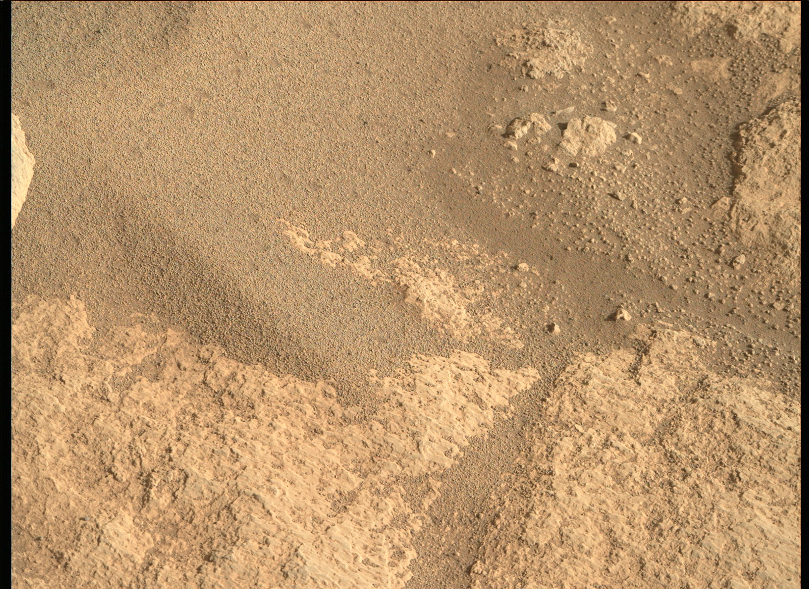
Finer pebbles are covering the wind formed ripple, probably due to subtraction of finer grain sections by wind erosion. But at some point the pebbles appear to have been transported by stronger winds as well to help form the ripple. Another, very speculative explanation may be that the fine pebbles formed in situ, by an accretion, condensation like process, from dust, but without water it is hard to conceive of such a process (tiny forces from frictional electrostatics ?).
In addition there are these darker dimples we have seen previously. They appear on both sides of the ripple but are harder to see on the shaded sight due to lighting. I think this site is still too close to the landing area to exclude blasting or fine debris during descent as explanations.
Then there are coarser pebbly fragments which seem to weather out of the pediment, or perhaps just have collected in the small depression together with fine dust. There is not a clear link between fine pebbles and coarser pebbles since they appear pretty strictly separated from each other. The small pebbles also tend to collect and be preserved in small, wind protected depression and pockets.
Do we know what kind of grain size and particle mass can be wind transported ? Since rather massive dunes have been observed to migrate, pebbles of this size do not seem out of the question with a heavier storm.
I guess I was most intrigued by the pebble covered ripple.