Help - Search - Members - Calendar
Full Version: Perseverance - Early Drives
Unmanned Spaceflight.com > Mars & Missions > Perseverance- Mars 2020 Rover
Pages: 1, 2, 3, 4, 5, 6, 7
climber
QUOTE (ElkGroveDan @ Apr 8 2021, 04:52 PM) *

Oooooooo, Dan’s still around dd.gif wheel.gif
Sean
'tis me

QUOTE (ElkGroveDan @ Apr 8 2021, 03:52 PM) *

neo56
Saying goodbye to Ingenuity, on the way to Van Zyl Overlook.


Phil Stooke
A circular projection of the sol 47 Navcam panorama.
Phil
Click to view attachment
PaulH51
QUOTE (nogal @ Apr 8 2021, 06:28 PM) *
Nice closeup!
Dust is already accumulating on the solar panel. Hopefully the flight will shake it off. Another experiment...
Fernando

If you look closely at the dust in the GIF, we can see that some of the dust moves between frames, so I think you are right and much of that dust will likely be ejected when they run the blades at 2400 RPM smile.gif
Andreas Plesch
https://bit.ly/PercyMAP was updated to include the latest drives and a little help feature to show mouse navigation options.
Phil Stooke
This is the sol 48 panorama in circular form.
Phil
Click to view attachment
charborob
Sol 48 Mascam-Z left:
Click to view attachment
Phil Stooke
This is the sol 48 panorama which I reprojected into my circular view. I have not been posting these because mine are not very good (seams are fudged, and resolution is reduced by my procedure which is an ad hoc Photoshop job). I keep hoping someone else will produce better panoramas from the post-drive Navcams. I modified the color of the circular view because I didn't like the yellow appearance of the earlier ones. I cut the rover out of overlap areas to maximize surface coverage so your favorite bit might be missing.
Phil
Click to view attachment
James Sorenson
Here is the Sol-47 and Sol-48 Panorama's that I've made, Phil. I have a good workflow for these Navcam panorama's now I think.

Sol-47


Sol-47 Polar


Sol-48


Sol-48 Polar


vikingmars
QUOTE (James Sorenson @ Apr 10 2021, 07:23 AM) *
Here is the Sol-47 and Sol-48 Panorama's that I've made, Phil. I have a good workflow for these Navcam panorama's now I think.

Congratulations, James for this nice work of yours smile.gif
Phil Stooke
Excellent!
Meanwhile, sol 49 - we just have a few frames down but the hazcams are enough to give a reliable location. Here is an ad hoc circular projection of them.

Phil
Click to view attachment
Phil Stooke
And a circular projection of a full Navcam panorama for sol 49.
Phil
Click to view attachment
Andreas Plesch
Updated links from the recent waypoints on https://bit.ly/PercyMAP but

https://mars.nasa.gov/mmgis-maps/M20/Layers...0_traverse.json

is currently not showing the correct fromRMC and toRMC properties which causes the rover to drive somewhat erratically on the page. The json had changes in its structure before. So I am going to wait a few days before I make changes to the page logic hoping that the json gets fixed. I could use the waypoints json to determine to traverse segment order but it would complicate the logic.
eliBonora
The panorama of sol 48 standard version


and anaglyph
James Sorenson
The Sol-49 Navcam panorama.


Polar
charborob
QUOTE (eliBonora @ Apr 11 2021, 09:25 AM) *
The panorama of sol 48 standard version

and anaglyph


Your anaglyph looks really strange.
Here is my try:
Click to view attachment
Greenish
Sol 49 Navcam Right Panorama. Not quite as clean as James's, especially in near field, but perhaps useful in some way. [I kept reported Az/El unchanged and image is 3600 px for 360 deg, with 0 deg centered].
Click to view attachment
(edited: image v2, minor correction)
Phil Stooke
Thanks, James and Greenish, for your nice panoramas. I couldn't resist making circular versions of a couple of James's, for sols 48 and 49.
Phil
48: Click to view attachment
49: Click to view attachment
kymani76
Click to view attachment
Here is my version of sol 49's left navcam. Turns out images stitch pretty well, but colors come out really wonky.
I will try to improve my pipeline in the future.

Click to view attachment
Circular version.
fredk
QUOTE (charborob @ Apr 12 2021, 12:56 AM) *
Your anaglyph looks really strange.

It's been "flattened", ie the images have been sheared so that the bottom of the mosaic looks about as far away as the top. Individual rocks and ridges, though, appear in front of their immediate background.
Ant103
My take on those delicate pictures. Sol 49.

PaulH51
Sol 52 'Arm Workspace' 6 overlapping L-MastCam-Z at 34mm, assembled in MS-ICE, cropped the black margins ton improve the stitching, no additional processing.
They seem to be mimicking the MSL workspace style smile.gif
Would I be correct in assuming the scale would be similar to MSL L-Mastcam when using the camera 34mm?

Click to view attachment
kenny
Lovely image, PaulH51.

When I blow it right up to highest magnfication, I see hundreds of little spherules at lower left.

They remind me of what Opportunity discovered in 2004, and were dubbed "blueberries" -- actually spherical hematite inclusions formed in water.
7B8
QUOTE (PaulH51 @ Apr 13 2021, 10:27 AM) *
Sol 52 'Arm Workspace' 6 overlapping L-MastCam-Z at 34mm, assembled in MS-ICE, cropped the black margins ton improve the stitching, no additional processing.
They seem to be mimicking the MSL workspace style smile.gif
Would I be correct in assuming the scale would be similar to MSL L-Mastcam when using the camera 34mm?

Click to view attachment


Anybody knows what the process for those darker spots are? They are all over the lighter-toned sand. They look like indentations or drop marks.

Click to view attachment
kenny
Fascinating tear drop shapes. Depending upon aligment, might they be made by ejecta from the landing rockets scouring?
MahFL
Is that a dust devil ?

fredk
QUOTE (PaulH51 @ Apr 13 2021, 10:27 AM) *
Would I be correct in assuming the scale would be similar to MSL L-Mastcam when using the camera 34mm?

The MC and MCZ sensor sizes are the same, so the angular scales would be the same at 34mm. So if the distances to the subject are the same the physical size of features will be the same too.
John Moore
Just a query: do certain faces on the various featured rocks (highlighted in orange) suggest erosional/impact processes?

John

djellison
QUOTE (7B8 @ Apr 13 2021, 04:03 AM) *
They look like indentations or drop marks.


Small pebbles/gravel/sand from the blast of the skycrane engines. The landing site is to the 'right' of this image so the teardrop shapes would strongly infer they came from that direction
erwan
QUOTE (djellison @ Apr 13 2021, 05:58 PM) *
Small pebbles/gravel/sand from the blast of the skycrane engines. The landing site is to the 'right' of this image so the teardrop shapes would strongly infer they came from that direction


I share your opinion Doug. Other examples of blasting pebbles are seen in sol 32 and 34 navcam images, as these ones :

https://mars.nasa.gov/mars2020-raw-images/p...2_07_195J02.png

https://mars.nasa.gov/mars2020-raw-images/p...4_13_195J01.png
erwan
QUOTE (MahFL @ Apr 13 2021, 12:28 PM) *
Is that a dust devil ?

Thanks MahFL, a very beautiful one IMHO, clearly evidenced without any image enhancement !
kymani76
Click to view attachment
Sol 52 Navcam Left partial panorama, dust devil visible.
Ryan Kinnett
QUOTE (MahFL @ Apr 13 2021, 03:28 AM) *
Is that a dust devil ?


Nice find.

Here's another (EDIT: or same?) (less well-defined) one, behind Ingenuity, but safely far away. Sol 52.
Click to view attachment
PaulH51
QUOTE (Ryan Kinnett @ Apr 14 2021, 09:53 AM) *
Nice find.
Here's another (EDIT: or same?) (less well-defined) one, behind Ingenuity, but safely far away. Sol 52.


timestamps:-

Your GIF: 13:13:31
MahFL's : 14:35:33

So either a long lived DD or the conditions were good for DD generation smile.gif
neo56
Nice dust devil spotted by kymani76, with vignetting and levels corrected and sky extended.

James Sorenson
This is the binned 2x2 Navcam tile mosaic that was taken on Sol-52 that includes the dust devil in the distance. Okay...This took abit of time. smile.gif


Link to Full resolution
https://www.flickr.com/photos/43581439@N08/...070591/sizes/o/
eliBonora
QUOTE (7B8 @ Apr 13 2021, 01:03 PM) *
Anybody knows what the process for those darker spots are? They are all over the lighter-toned sand. They look like indentations or drop marks.

Click to view attachment


Hi, I wondered too. They seem to be due to little pebbles splashing on the sand, almost certainly. I don't know if they could still be the effects of the landing.
Here one of our de-bayer

MarkL
[quote name='James Sorenson' date='Apr 14 2021, 10:31 AM' post='251611']
This is the binned 2x2 Navcam tile mosaic that was taken on Sol-52 that includes the dust devil in the distance. Okay...This took abit of time. smile.gif

Gorgeous. Thanks!
Phil Stooke
This is James's panorama for sol 52 with the missing bit (only available at lower resolution) added by me and made into a circular projection.
Phil
Click to view attachment
John Moore
Looking at a close-up of the structural properties of these rocks, there is a very sharp edge between most of them. This might suggest that the process of
fracturing (?) was very violent, if not recent (in geological terms); where we're looking at both the outer surface rock (red outlines) showing a more eroded,
smooth surface, and the rock's innards (blue outlines) showing multiple fracture-type effects.

I wouldn't know about the landing distance from this rock, but I assume that the above violent process resulting in the above fragments wasn't due to
Percy's engine blasts, but more due to temperature variation effects on rocks on Mars's surface over time.

John
PS. PaulH51's original image, below, has obviously been highly edited, so I know he won't mind in the interest of science (thanks Paul).

abalone
The sharp edges are probably an artefact as a result of wind erosion rather than fracturing. The clue is that they all have a similar orientation
Sean
Jezero Delta Sol 54 Mastcam Z with simulated Percy

eliBonora
Looking at the ground …

atomoid
Another good example sol55 of the ventifacts previously mentioned with the sharp terminator and revealing the predominant wind direction, much like terrestrial examples.

I'm holding out hope we'll eventually come across more of the larger variety surreal ones since you'd think the process with billions of years practically uninterrupted would produce some crazy formations over that timescale, but the most extreme we've seen i recall are relatively small as seen by Curiosity at various points along the trek to Mt Sharp, or the eroded rocks imaged by Spirit at bottom of Husband Hill on the way to Home Plate. Wish i had links to those..

There is an example of a tiny one in eliBonora's image above if you zoom in just to the left of center.
charborob
Sol 57 LMastcam-Z panorama:
Click to view attachment
Andreas Plesch
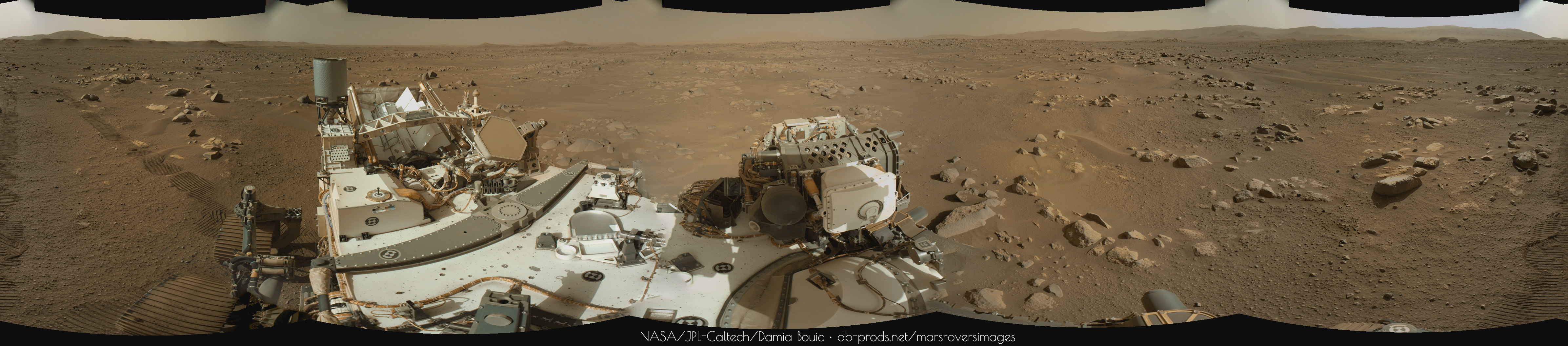
sol57 animated gif of wide angle navcam left series, 100ms per frame, vs. ca. 14s per frame in reality.


crop of dd on top of delta (was there another one in a similar location earlier?):


short workflow:

use roverpics to filter for navcam selection, download list of urls, use wget -i urlFile to download images

use gimp to load all pngs in one step as layers (filenames with timestamps will lead to correct sorting).

optionally crop

use filters - animation - optimize for gif

use image - mode - indexed - 255 colors, dither

export as gif - as animation

[todo: figure out how to batch process all layers for contrast stretch]

The gmic plugin can apply filters to all layers. With gmic auto balance, 150ms per frame (100 x speed up):


with gmic color balance stretch

Phil Stooke
There's something happening at the right edge as well... I can't see well enough in the GIF to tell if there are in fact several dust devils, but that's my impression.

Phil

Sean
Sol 57 MZL

Ryan Kinnett
QUOTE (Andreas Plesch @ Apr 18 2021, 05:46 PM) *
crop of dd on top of delta


These wide-field horizon time lapses appear to be a standard change-detection sequence, signified by ncam005**, starting on sol 50 and repeated on 52, 56, and 57. Remarkably, there appears to be at least one dust devil in each sequence! I wrote a little thread about this, with some average-subtraction gifs to make some easier to spot. None of the dust devils are too spectacular on their own, but it's interesting that they're so prolific. Maybe not all that surprising given the abundance of DD tracks seen from orbit, many very large (estimated 50m wide) and very distinct. This place seems to breathe dust devils.
This is a "lo-fi" version of our main content. To view the full version with more information, formatting and images, please click here.
Invision Power Board © 2001-2024 Invision Power Services, Inc.