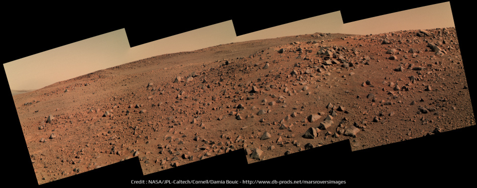
Sol 3600 right navcam pan:
Click to view attachment
---
Apr 24, 2014. This thread is dedicated to the rover activities after the winter campaign at / around Cook Haven. Moved several pages from that thread here.
Tesheiner (Moderator)
Full Version: Exploring Murray Ridge
The Sol 3600 Left Navcam view.
Click to view attachment
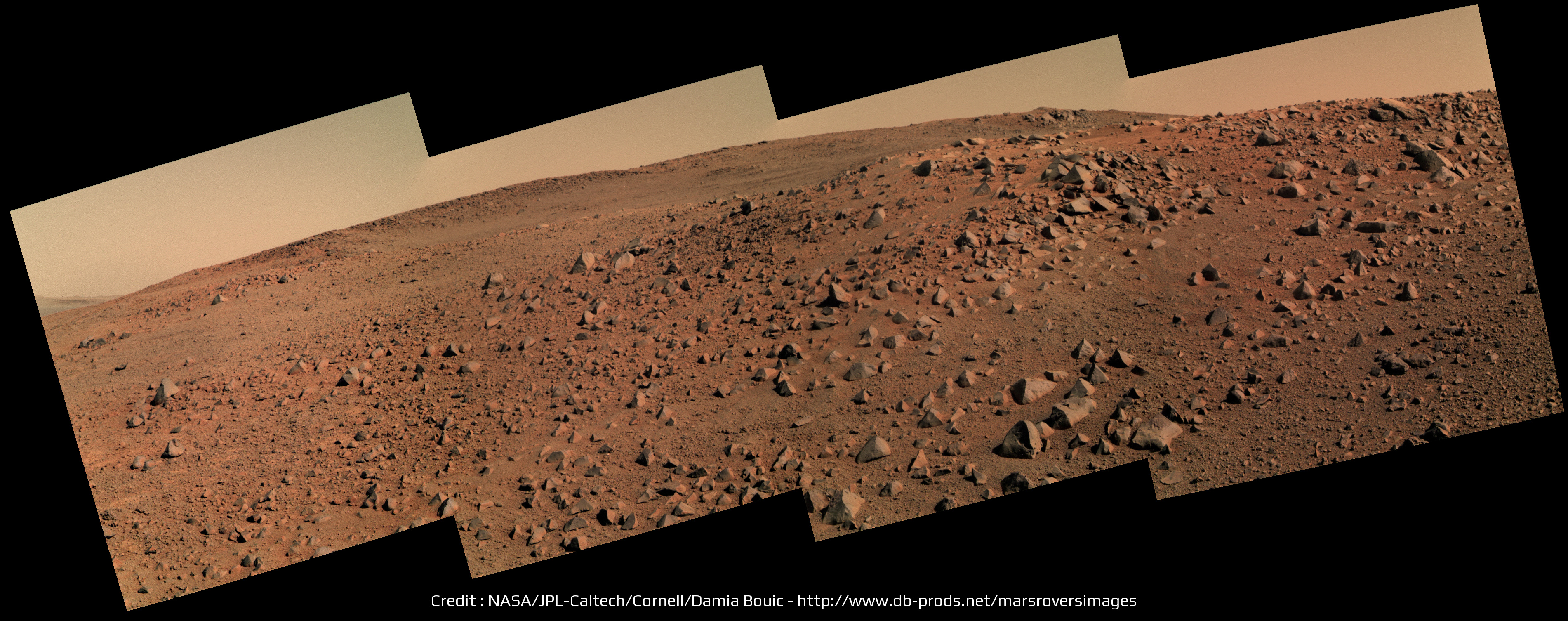
and the Sol 3601 Left Navcam view.
Click to view attachment
Jan van Driel
Click to view attachment
and the Sol 3601 Left Navcam view.
Click to view attachment
Jan van Driel
the surreal negative shading effect of filter 2 on the dusty little campfire ring rock garden from SOL3601
Click to view attachment
..seemed a good candidate for gif illusion (epileptics probably should NOT open)
Click to view attachment
Click to view attachment
..seemed a good candidate for gif illusion (epileptics probably should NOT open)
Click to view attachment
These rocks look like ventifacts.
Curiosity might be getting all the attention but for me Opportunity remains the doyen of Mars rovers. Yet another change of scenery in the rock garden at McClure Beverlin West. Lithic breccia clasts eroding out of a sandy matrix?
Hey, when'd we drive to Gusev so fast? No one told me! 
sol3609: its nice to finally get a peek over the top
Click to view attachment
look! up in the sky, is it a cross-eyed cloud? is it schmutz? sort of, its just an amateur job at filling missing sky pixels.
Click to view attachment
look! up in the sky, is it a cross-eyed cloud? is it schmutz? sort of, its just an amateur job at filling missing sky pixels.
The Navcam Lo view on sol 3608
Click to view attachment
and on Sol 3609
Click to view attachment
Jan van Driel
Click to view attachment
and on Sol 3609
Click to view attachment
Jan van Driel
I'm not sure exactly where we are, but I think this new view is just over a small ridge on Solander, and we can't yet see to the highest part of Solander, or beyond to Tribulation.
But we did see some real clouds tosol:
http://qt.exploratorium.edu/mars/opportuni...0M1.JPG?sol3610
But we did see some real clouds tosol:
http://qt.exploratorium.edu/mars/opportuni...0M1.JPG?sol3610
For the complete view I have added the images from Sol 3607
to the panorama taken on Sol 3608.
Jan van Driel
Click to view attachment
to the panorama taken on Sol 3608.
Jan van Driel
Click to view attachment
Actuallly I'm willing to guess where we are - this is not based on data at all, I just stared at navcams and the orbital view for a bit:
Click to view attachment
It makes sense as we head south to stay close to the plains-side of Solander - smoother driving and longer line-of-sight views for planning.
Click to view attachment
It makes sense as we head south to stay close to the plains-side of Solander - smoother driving and longer line-of-sight views for planning.
Sol 3609 pancam pan (similar to jvandriel's pan but with one more image on the left side):
Click to view attachment
Click to view attachment
QUOTE (fredk @ Mar 21 2014, 04:32 PM) 
Actuallly I'm willing to guess where we are - this is not based on data at all, I just stared at navcams and the orbital view for a bit:
I just extracted the latest info from the pancam website and this is the result. I did no manual corrections at all for the time being but most probably will have to. Your guess based on the navcams should be more accurate.
Click to view attachment
Right... that whole track needs to be shifted to the left about one diameter of that crater at the top left edge of the image.
Do we have enough images for a 360 pan from the recent stop at Augustine?
Phil
Do we have enough images for a 360 pan from the recent stop at Augustine?
Phil
Here is the complete panoramic view from images taken on Sol 3607 and Sol 3608
with the L0 Navcam.
Jan van Driel
Click to view attachment
with the L0 Navcam.
Jan van Driel
Click to view attachment
Fantastic - thanks. And with a little bit of geometric magic, it becomes a circular version of the area.
Phil
Click to view attachment
Phil
Click to view attachment
Power levels up to 574 Whrs - that was a good level at the best part of this past summer!
Sparkly clean.
Sol 3613 pancam pan:
Click to view attachment
Click to view attachment
I don't totally forget Opportunity, and I found myself processing this color panorama of Sol 3609 
Spectacular! What a great place. That picture just makes me think I could walk right up to that ridge and peek over it. It seems that we have still not seen the layers under the impact ejecta that we saw at Cape York (Whitewater etc.) - obviously we were very lucky to find that exposure. But there's lots more crater rim to explore.
Phil
Phil
They identified those layers as the pre impact surface / sub surface, only a few metres above the Burns formation level, so I don't think we could reasonably expect to see it high on Solander. The interesting thing is that Larry Crumpler's LPSC paper identifies that the unconformity between impactites and the pre-impact surface had a dip of some 11 +/- 2 degrees towards the crater centre. This correlates quite nicely to Parker and Bills paper hypothesising that the bench does in fact reflect a previously level coastal geomorphology and there was subsequent tilting towards the crater. Circumstantial, but worthy of thought.
Sol 3613 Pancam panoramic Is that some crater we have behind the crest ?

Is that some crater we have behind the crest ?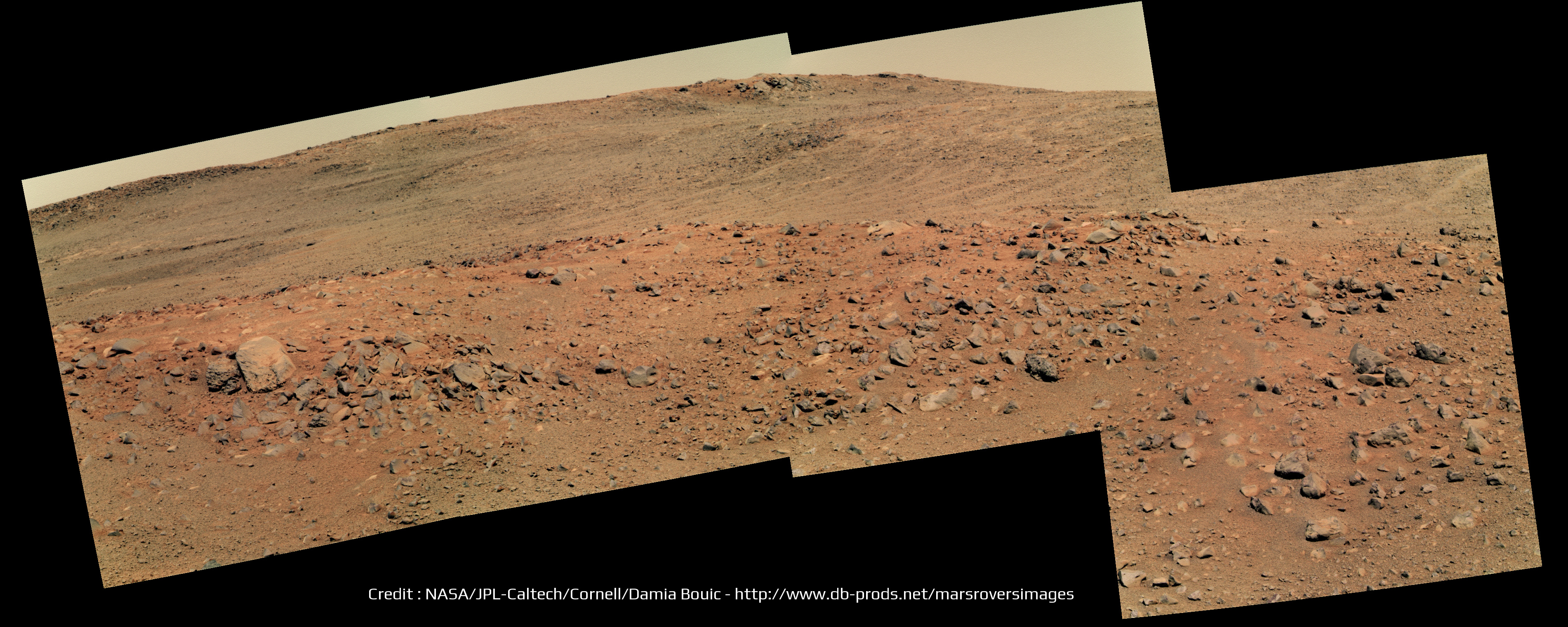
Very nice mosaic Damia! Oppy is really doing mountain hiking
There is indeed what looks like a crater on the left part of your panorama. But I can't figure out where it is located on fredk map.
There is indeed what looks like a crater on the left part of your panorama. But I can't figure out where it is located on fredk map.
QUOTE (Ant103 @ Mar 25 2014, 04:33 PM)
Sol 3613 Pancam panoramic Is that some crater we have behind the crest ?
Is that some crater we have behind the crest ?Wow, beautiful! The best view from Oppy I've seen in a long time.
Nice view indeed. I think this is the crater in question over the near crest:
Click to view attachment
I don't think we've moved much since the 3610 location.
Click to view attachment
I don't think we've moved much since the 3610 location.
I agree with that crater location. And it was only a small move, 3 m or so.
Phil
Phil
concur-o-gram
Click to view attachment
Click to view attachment
sort of interesting detail of "Turnagain Arm" back on sol 3598 makes me forget im not looking at a HiRise of kimberly
Click to view attachment
Click to view attachment
Any idea of what we are seeing West on the horizon ?
http://www.midnightplanets.com/web/MERB/im...0P1777R0M1.html
Click to view attachment
http://www.midnightplanets.com/web/MERB/im...0P1777R0M1.html
Click to view attachment
Hi Bill,
Here is a Phil-O-Vision (10x stretch, vertical only) of that navcam 3618?
Click to view attachment
I don't know how to obtain azimuths from the pictures (some here do I think)
If I had a bearing we could consult a HiRise image for possibilities
First Guess:: it looks like a rock.
It is as dark if not darker that the surrounding 'horizon stuff', a more distant object could be lighter than the horizon material since there is more atmosphere and dust to see through.
cheers
I don't know if we can see out across the plains yet but if so there is a candidate small crater in that general direction that is quite prominent. I gave it the nickname Rockaway when we first saw it. It does look darker than its distance suggests.
Some crazy-looking "raked" or washboard terrain from pre-drive 3621:
http://qt.exploratorium.edu/mars/opportuni...5M1.JPG?sol3621
I assume we're just seeing lots of fine ripples perpendicular to the line of sight. The ripples are hardly visible in the corresponding navcam:
http://marsrovers.jpl.nasa.gov/gallery/all...00P0673R0M1.JPG
That's the same nameless 5-10 metre crater we've been eyeing for some time now.
And now we're almost at 90% dust factor! 
The cleanest panels since 2006!
From Crumpler's latest post.
The cleanest panels since 2006!
From Crumpler's latest post.
Very impressive!
As visible from following plots, in the last 5 years dust factor never went above 79.5% (record set on Sol 2313 or July 27, 2010):
Click to view attachment
As visible from following plots, in the last 5 years dust factor never went above 79.5% (record set on Sol 2313 or July 27, 2010):
Click to view attachment
QUOTE (fredk @ Apr 5 2014, 04:38 AM)
...
From Crumpler's latest post.
From Crumpler's latest post.
This anouncement in Crumpler's post is very interesting:
"After we take a look at the local outcrops up here on the ridge crest, and maybe drive to the local summit for a good view of the crater, we will start driving south along the west side of the rim."
Given the uneven terrain on the Western side of the rim this means for the next few Years Oppy will always be within a few 100m of a North facing slope, which I think is a good decision
QUOTE (PaulM @ Apr 5 2014, 07:43 AM)
...for the next few Years Oppy will always be within a few 100m of a North facing slope, which I think is a good decision
In fact, they shows 3 possible paths in this region, while "next long-term target is about 600 m south along the west side of the crater rim"; however, the 10-26 sol drive time seems optimistic to me (unless they refers only to full, long drive sols!)
But the path in question (path "A") stays away from the rough ridge of Solander and would probably be easy driving like out on the plains (and much easier than our climb up Solander so far). So that drive time sounds realistic, considering how fast we drove from Nobby's Head to Solander.
Of course in practice the limiting factor for the drive time will be the science stops.
Of course in practice the limiting factor for the drive time will be the science stops.
Sol 3625 pancam filter 2 pan:
Click to view attachment
Click to view attachment
QUOTE (charborob @ Apr 7 2014, 02:04 PM)
Sol 3625 pancam filter 2 pan:
Thanks a lot Charborob.
The view on the plains on the other side of the crater starts to be terrific ! I hope they will image it with the "L7" filter soon to gain more details far away. Thanks again
This is a "lo-fi" version of our main content. To view the full version with more information, formatting and images, please click here.