QUOTE (MarsIsImportant @ Sep 11 2009, 02:36 AM)

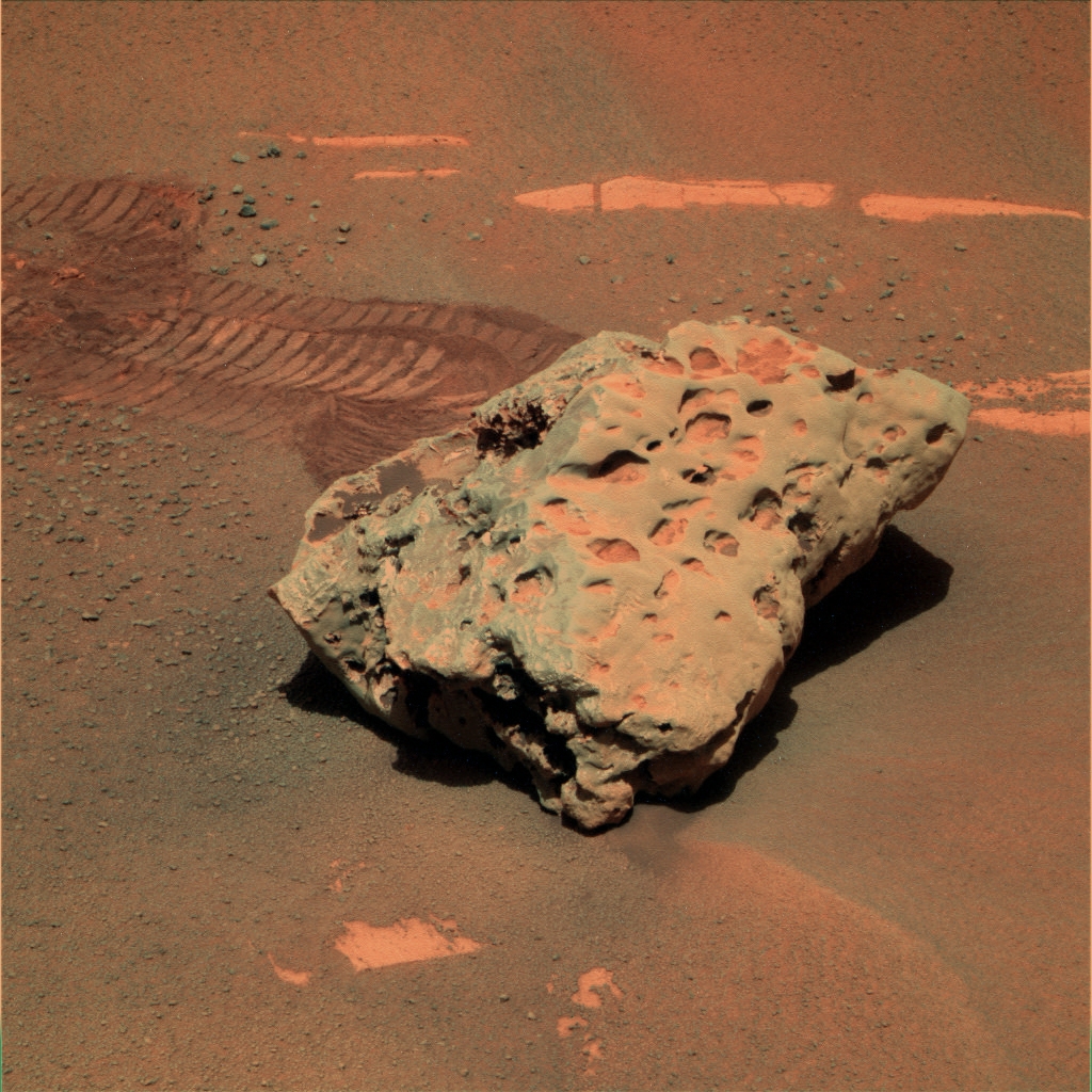
If there was surface excavation along with ablation through wind erosion, then the chances that these would all be on the surface would be next to zero. At least some of these big meteorites should be at least partially embedded into the ground.
This is probably giving us an idea of rate of "resistant" impacts vs. ablation erosion rate.
Imagine a surface dotted with craters of varying depth. Some containing resistant meteorites.
If the cratering rate (of resistant impactors) was really high, and the erosion rate really high: then we should see exposed meteorites all over the place. There would be a few still partially buried, but those would get completely exposed in the blink of an eye. (Once exposed, they remain exposed. The time it would take to exhume would be the time it took for the surrounding sediments to be removed along the Z coordinate of the embedded meteorite.)
If the cratering rate (of resistant impactors) was really low, and the erosion rate really high: then we should see a few exposed meteorites lying around completely exhumed, only a few would be buried (but not for long).
If the cratering rate was high, and the erosion rate really low: then we would see only a few popping out of the surface. Most would still be buried (and they'd stay that way for a while)
If the cratering rate was low and the erosion rate low, then the few resistant impactors would be buried.
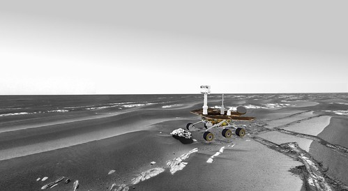
We've got an n=3 of exposed meteorites that we've seen in our journeys. Is this a "few" or "a lot" or "all over the place"?
The unknowns are still the resistant meteorite cratering rate and average emplacement depths (most of the meteorites are within a few orders of magnitude in size), the absolute time-averaged erosion rate, the absolute age of the current surface, and the absolute age of the highest layer in the historical stack.
At least we can safely say that the resistant-impactor cratering rate is significantly above "never".