Help - Search - Members - Calendar
Full Version: Beyond Lewis and Clark Gap
Unmanned Spaceflight.com > Mars & Missions > Past and Future > MER > Opportunity
Pages: 1, 2, 3, 4, 5, 6, 7, 8
James Sorenson
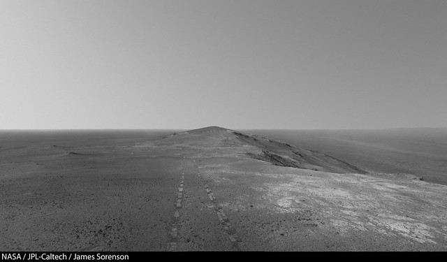
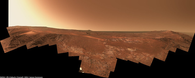
With a drive of just over a meter, that marked the end of acquiring frames for the "Rocheport" Panorama. pancam.gif


False Color version:

Ant103
This Rocheport panoramic is a mess, so I gave up on the stitching work. You did good James smile.gif

The last Navcam panoramic updated with some Navcam imagery of Sol 4653. And yes, I was wondering if this is a dust event we are seeing on the horizon on the right part of the pano.

fredk
From the new PS update:
QUOTE
In one of the Navcam panoramas we can actually see [the storm] in the distance,” said Callas. “This is the first time we've actually seen one of these dust storms from the ground.

I'm surprized by this comment - usually all we see is an increase in tau and I would have guessed that a storm edge would be gradual. I guess he must be referring to the large 4653 gust we talked about. I don't know how easy it is to define the edge of a local storm - maybe it would have various gusts forming and disipating. But it certainly was true that this was one huge gust.

Also from Nelson:
QUOTE
the dust factor... dropp[ed] from around 0.92 on Sol 4654 to 0.84 on Sol 4655 (February 26, 1017).
Needless to say 0.92 is pretty much pristine. Of course now as dust settles that will rise.
fredk
Nice to have a change of scenery! This is the first time we've seen Iazu in a while. Even with the high tau you can make it out on the left side of this frame:
http://merpublic.s3.amazonaws.com/oss/merb...D1P2364R2M_.JPG
Ant103
Very nice scenery there, with a two-Sols Navcam panoramic, on Sols 4660 & 4661 :

vikingmars
And here is a spectacular view of the rim in 3-D. Enjoy smile.gif
Click to view attachment
Explorer1
Marvellous.... that's why we all come to this forum after a decade....
Phil Stooke
Circular version of Damia's panorama.

Phil

Click to view attachment

(should really be rotated a bit counterclockwise to put north at the top)
James Sorenson
Wonderful guys! smile.gif

My jab at the vista.


Link to multiple resolutions:
https://www.flickr.com/photos/43581439@N08/...0418175/sizes/l
vikingmars
As a TPS Member, I hope that the rover team will make a quick stop at the highest peak nearby to have a spectacular 360° global view of the horizon to help our EPO activities on Earth rolleyes.gif
Click to view attachment
ngunn
I hope so too, although most or all of the horizon features more distant than Iazu are likely to be obscured by dust.
James Sorenson
I hope so to, but I find doing a full 360 color panorama is pretty slim to none given Oppy's flash situation and would take roughly a month to do in current RAM mode. That's a whole month of sitting still when she could be driving and a month closer to the gully. I do hope a smaller color pan is taken somewhere along the way, like at the point you suggested. smile.gif
vikingmars
QUOTE (James Sorenson @ Mar 7 2017, 01:58 PM) *
I hope so to, but I find doing a full 360 color panorama is pretty slim to none given Oppy's flash situation and would take roughly a month to do in current RAM mode. That's a whole month of sitting still when she could be driving and a month closer to the gully. I do hope a smaller color pan is taken somewhere along the way, like at the point you suggested. smile.gif

Thanks James : I was just thinking about a quick 360° NavCam pan,
like the one taken at Sol 3894 when the rover reached the summit of Cape Tribulation
http://mars.nasa.gov/mer/gallery/all/opportunity_n3894.html

plus (if possible) a L7 (blue) or L1 (clear) pan looking at the horizon only (like the ones taken at Sols 3902 and 4662)
http://mars.nasa.gov/mer/gallery/all/opportunity_p3902.html
http://mars.nasa.gov/mer/gallery/all/opportunity_p4662.html
not only for EPO, but also for documentation purposes (pics that maybe interesting to revisit for science and geological setting in the future)

smile.gif smile.gif smile.gif
atomoid
Brief update to Crumpler's page for sol4662 describing the path over the rim and those dusty gusts. I had to slap myself (yet again): "..14th year of operations..."
RoverDriver
Click to view attachment Click to view attachment

OMG (Oh My Gully!) One would think that by this time I had seen it all. One would think.

Paolo
fredk
Stunning view!

Here's my best guess as to what we're seeing. Matching colours match:
Click to view attachment
The white arrows in the pancam view are my best guess for Perseverence Valley. But my confindence isn't extremely high...

Edit: see corrected views below...

(Btw, great to see you here again, Paolo!)
atomoid
fwiw, a few stereo outtakes on the sol4665 perspective compared with simulated views generated using Sean's sketchfab model and another closer-up view from the sky to the left of fredk's blue circle
Click to view attachment Click to view attachment Click to view attachment Click to view attachment
marswiggle
I'm happy with fredk's yellow line, but beyond that, it seems we must use a bit grander scale to get features matched. From this several years old anaglyph (the respective view in reduced size), it looks like the peculiar ledge on the opposite Cape (is it called Cape Byron?) is akin to the white-headed feature in pancams. It is obvious that we should expect to see that Cape before being able to peek into the rather deep valley in between. The fresh dark crater is aligned with our destination gully along the lowest topography of the valley (thus being hidden by the local rim). Also the gully itself would appear rather subdued in relief until we practically drive on top of it. -Just my two cents as they say.
fredk
Yeah, the feature I'd circled green would appear far larger than that.

Here are my corrected identifications:
Click to view attachment

As we proceed we should see the redlined ridge extend towards the lower left, until the head of Perseverence Valley (white arrows) will appear as a dip.
jvandriel
The Navcam L view on Sol 4663-4664.

Jan van Driel

Click to view attachment
vikingmars
QUOTE (jvandriel @ Mar 10 2017, 01:03 PM) *
The Navcam L view on Sol 4663-4664.
Jan van Driel

Thank a lot Jan van Driel smile.gif
I hope that Opportunity will rove up the last few meters and take a quick and spectacular 360° pan from this nice vantage point !
http://www.unmannedspaceflight.com/index.p...st&id=40946
wheel.gif wheel.gif wheel.gif
fredk
QUOTE (fredk @ Mar 3 2017, 06:45 PM) *
I'm surprized by this comment - usually all we see is an increase in tau and I would have guessed that a storm edge would be gradual.

Well, from the new press image, I guess they were talking about the 4653 pancam sequence, not the navcam frame. The pancam sequence spans a couple of minutes, about 10 minutes before the massive gust was caught on navcam. Here's an animation:
Click to view attachment
You can pretty clearly see a huge (based on its distance) gust front moving in from the left (north), just below the horizon.

I guess it's possible this continued to approach and became the gust visible in navcam.
Phil Stooke
Sol 4665 looks pretty bad too.

http://www.midnightplanets.com/web/MERB/im...7P1987L0M1.html

Phil
jvandriel
The Pancam L2 view on Sol 4665.

Jan van Driel

Click to view attachment
Phil Stooke
Jan's last full panorama in circular form. It exaggerates the nearby summit to almost Everest-like proportions - sorry, Olivier, I don't think we'll be scrambling up that! Of course, if we do, it will just look like a little bump from the top.

Phil

Click to view attachment
jvandriel
The complete Navcam L0 view on Sol 4665-4667.

Jan van Driel

Click to view attachment
Phil Stooke
A circular view of Jan's panorama showing us passing Olivier's 'mound' (sorry about that, Olivier... maybe next time).

Phil

Click to view attachment
vikingmars
QUOTE (Phil Stooke @ Mar 13 2017, 11:47 PM) *
A circular view of Jan's panorama showing us passing Olivier's 'mound' (sorry about that, Olivier... maybe next time).
Phil

Thanks a lot Phil for your kind comment
'Sigh' for not having roved the 2nd summit...

Here is Opportunity's view on Mars from Sol 4668 along the rim of the big Endeavour crater...
Processed for you in real colors and in false colors, to enhance the local geological setting (with the hematite plains looking purple-gray). Enjoy smile.gif
Click to view attachment
polaris
As always a fantastic work, Olivier.
By the way, congratulations for your impressive work in the last release of "Ciel & Espace" !
vikingmars
QUOTE (polaris @ Mar 14 2017, 12:00 PM) *
As always a fantastic work, Olivier.
By the way, congratulations for your impressive work in the last release of "Ciel & Espace" !

Thank you very much Polaris : your kind comments are much appreciated smile.gif
jvandriel
The Pancam L2 view on Sol 4667.

Jan van Driel

Click to view attachment

jvandriel
The complete view stitched from images taken on Sol 4665 and Sol 4668.

Jan van Driel

Click to view attachment
RoverDriver
It took more than 13 years, but it finally happened, and it happened on my watch. Today I had the pleasure of sequencing a drive with Doug Ellison in the room. I wish all of you UMSF-ers could be part of it. Well, you are, but you know what I mean.

Paolo
climber
Congratulations Doug you make it!
As member 682, I'll have to wait quite a bit more 😀
I guess Oppy will still be around wheel.gif
RoverDriver
What do you mean "you guess"? ;-)

Paolo
nprev
I KNEW the drive felt particularly UMSF today. smile.gif Great job, Paolo!
Explorer1
Coming full circle; congrats Doug! wheel.gif
Is is safe to say that this is the first time a mission ever lasted long enough for enthusiasts to end up on the mission team? (Maybe Voyager?)
climber
QUOTE (RoverDriver @ Mar 16 2017, 02:04 AM) *
What do you mean "you guess"? ;-)

Paolo

Hahaha!
682x13= how many Sol ?
RoverDriver
QUOTE (climber @ Mar 16 2017, 05:42 AM) *
Hahaha!
682x13= how many Sol ?


That would be Sol 8865, Jan 1 2029. I think that the most difficult part is that for JPL is is a Holiday, so you will have to wait Jan 2nd.

Paolo
djellison
QUOTE (climber @ Mar 15 2017, 02:17 PM) *
I guess Oppy will still be around wheel.gif


It's possible the batteries could last 15,000 sols before really degrading.

Who knew it could go full circle. Even when I started working at JPL 7 years ago, the idea of working in surface ops didn't even enter my mind. It was only last summer when people like Paolo suggested it that it became a possibility. Certified as an ECAM Uplink Lead on MSL just before Christmas, and Wednesday was my first training shift on MER for the same role ( plus MI duty! ) . It'll be a month or two before I'm certified on MER as well - but I can't wait to start contributing meaningfully to a mission that in every possible way - absolutely changed my life.

Paolo, Keri, Mike, Kim, Hallie, Fred, Scott...... I just hope I can make you proud smile.gif
Explorer1
QUOTE (djellison @ Mar 17 2017, 08:44 PM) *
Paolo, Keri, Mike, Kim, Hallie, Fred, Scott...... I just hope I can make you proud smile.gif

Given what you did for public outreach since 2004, I'm sure you already have!
jvandriel
The Pancam L2 view on Sol 4672.

Jan van Driel

Click to view attachment
jvandriel
The Navcam L0 view on Sol 4672-4674.

Jan van Driel

Click to view attachment
hendric
Bah, I expect Martian colonists to watch Opportunity roll past their windows! smile.gif

wheel.gif

Congrats Doug, and thanks again for creating this awesome space.
ngunn
It seems the air is clearing enough for spying distant features once more. On the horizon just left of centre here is what I take to be part of Bopolu - please correct me if I'm wrong. http://qt.exploratorium.edu/mars/opportuni...00P0703L0M1.JPG
EDIT: On further examination I think it's too far south for Bopolu, so maybe it's the top of charborob's hill, first noted here - http://www.unmannedspaceflight.com/index.p...st&id=34597
Steve5304
are we are headed for that very interesting feature on the left?


Couple other forums saying some sort of mineral deposit. Don't think we have seen anything like that yet, looks like a solid slab of some sorts wonder what that is? Cant wait to get there. I was able to find it on HIRISE, it is notably different color.

http://qt.exploratorium.edu/mars/opportuni...00P2377R2M1.JPG
Phil Stooke
Here is Jan's most recent panorama in circular form, showing how we crossed the outcrop area.

Regarding that bright flat-topped hill... most places like that turn out to be just patches of bright dust. There was a small one immediately south of the exit point a couple of weeks back. They look intriguing but they are not really very significant. If it's a major mineral feature CRISM would probably have resolved it and we would know about it. It's not on the projected path so the science team don't regard it as significant.

Phil

Click to view attachment
RoverDriver
QUOTE (Steve5304 @ Mar 22 2017, 04:18 AM) *
are we are headed for that very interesting feature on the left?


Couple other forums saying some sort of mineral deposit. Don't think we have seen anything like that yet, looks like a solid slab of some sorts wonder what that is? Cant wait to get there. I was able to find it on HIRISE, it is notably different color.

http://qt.exploratorium.edu/mars/opportuni...00P2377R2M1.JPG


So far nobody asked us to do so but we will be driving in that vicinity to drive around the sandy terrain that we have South of the rover.

Paolo
fredk
We can now see the "fresh crater" that was originally on the planned route - the dark "splash" just past the near slope at right middle frame:
http://merpublic.s3.amazonaws.com/oss/merb...00P2377R2M_.JPG
jvandriel
The Navcam L0 view on Sol 4677-4678.

Jan van Driel

Click to view attachment
This is a "lo-fi" version of our main content. To view the full version with more information, formatting and images, please click here.
Invision Power Board © 2001-2024 Invision Power Services, Inc.