Astro0
May 13 2010, 05:37 AM
Nice credit for Emily in JPL article today covering that Moment In Time image.
http://www.jpl.nasa.gov/news/news.cfm?release=2010-152aEmily's suggestion for this image has continued to spread to a worldwide audience. That's outreach at its best!

Big thanks also go to Jim Bell and the MER Team for thinking it was a great idea and for making it possible.
And a pat on the back for JPL and the DSN for transmitting the commands and receiving the data of course (I could hardly leave them out now, could I!?)
Floyd
May 13 2010, 09:22 PM
So I originally thought Scott's Tweet indicated the drive would be delayed one day. We aren't parked until after winter solstice are we?? Anyone know Opportunity's mobility status?
elakdawalla
May 13 2010, 09:25 PM
Floyd, you know that the winter solstice is today, right?
Poolio
May 13 2010, 09:27 PM
The latest
official update says a drive was planned for sol 2240.
Floyd
May 13 2010, 09:52 PM
Thanks Poolio, I had missed today's update. Emily, I didn't know it was today, thought solstice was a week or so off

I keep looking for snow in the images to let me know it is the dead of winter--I'm from New England

briv1016
May 13 2010, 09:55 PM
According to the latest update they're using the "lily pad" driving technique used by Spirit in the past.
fredk
May 14 2010, 03:23 AM
A drive to celebrate the solstice, again parking on a bit of a northerly slope:
http://qt.exploratorium.edu/mars/opportuni...0M1.JPG?sol2240Another larger-than-average dark cobble up ahead. Could be regular Meridiani rock, way too early to tell:
http://qt.exploratorium.edu/mars/opportuni...2M1.JPG?sol2240
Stu
May 14 2010, 07:20 AM
Updated my "Road to Endeavour" blog with some new 3D images, and a close-up of that rather cute spiral-patterned dune slope up ahead...
http://roadtoendeavour.wordpress.com/2010/...rough-the-dunes
Tesheiner
May 14 2010, 08:28 AM
This last move was some 20m due south. Map update soon.
walfy
May 14 2010, 07:12 PM
QUOTE (Tesheiner @ May 14 2010, 01:28 AM)

This last move was some 20m due south. Map update soon.
And on the winter solstice!
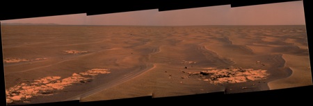
fredk
May 19 2010, 02:13 AM
We've hit the road again. And it looks like a cobble up ahead:
http://qt.exploratorium.edu/mars/opportuni...0M1.JPG?sol2245
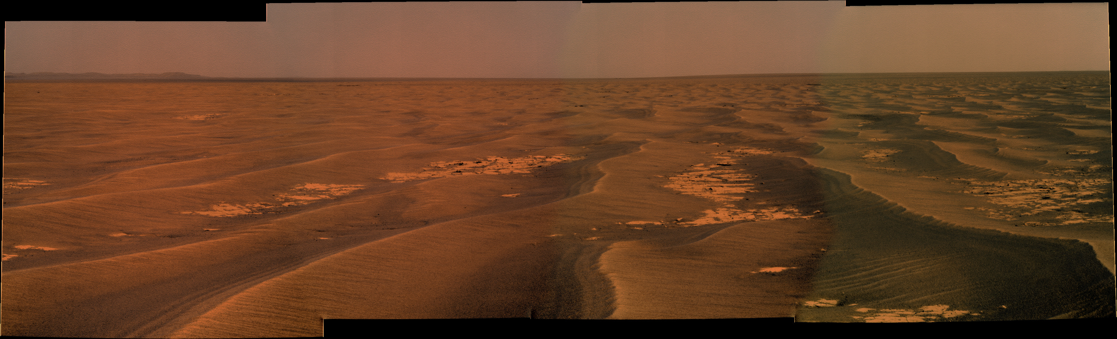
Astro0
May 19 2010, 04:17 AM
There's something I really like about this Navcam image
http://qt.exploratorium.edu/mars/opportuni...00P1607R0M1.JPGJust like rolling waves...beautiful.
nprev
May 19 2010, 04:43 AM
Sail on, Oppy, sail on...
Tesheiner
May 19 2010, 05:41 AM
This drive was not a "small" bump to a close northward facing ripple but more like a normal 50+ meters move. Actually, 55m SSE according to the rover's own mobility info.
akuo
May 19 2010, 10:37 AM
As far as I can see, Oppy has now claimed the top position in number of (confirmed) operational sols on the surface of Mars. Viking 1 functioned for 2245 sols. Spirit will in all likelihood take the top position again in a couple of months, but at the moment we cannot be sure that she is OK.
Another milestone claimed by the MER team, and one I definitely didn't think was going to be broken by the rovers.
NW71
May 19 2010, 11:27 AM
QUOTE (Tesheiner @ May 19 2010, 06:41 AM)
Actually, 55m SSE according to the rover's own mobility info.
Does this signify the start of the straight(ish) run towards Endeavour crater or is that a little premature?
Neil
Hungry4info
May 19 2010, 12:08 PM
I'd say a bit premature. It's not uncommon for Opportunity to head SSE over the past few weeks.
climber
May 19 2010, 12:49 PM
I'll say that Oppy will soon resume the 70m drive once Solstice will be behind her a bit more. Next issue will be Opposition that'll occur sometimes next January (correct me if I'm wrong).
There's no means to know whether she'll drove steadily till then since a one (or more) month stop at an interesting target could happen anytime but I wonder if planners already forecast any target of interest for a 3 weeks study without moving when this will occur.
NW71
May 19 2010, 10:08 PM
QUOTE (climber @ May 19 2010, 01:49 PM)
I wonder if planners already forecast any target of interest for a 3 weeks study without moving when this will occur.
I'm really tempted to give the glib answer and say there's a really large crater SE of Oppy which should keep it busy for 3 weeks or so!

Seriously though, I'm interested in the problems associated with Opposition next January. Does the new software on the Rovers negate this issue or will it still affect travel during this period?
Neil
fredk
May 20 2010, 02:08 AM
QUOTE (fredk @ May 19 2010, 03:13 AM)
it looks like a cobble up ahead:
It looks like just a slab of ordinary Meridiani bedrock:
http://qt.exploratorium.edu/mars/opportuni...1M1.JPG?sol2246Nothing here. Move along...
djellison
May 20 2010, 02:28 AM
QUOTE (NW71 @ May 19 2010, 02:08 PM)
I'm interested in the problems associated with Opposition next January. Does the new software on the Rovers negate this issue or will it still affect travel during this period?
New software is great - but a big fat radio source getting in the way of a spacecraft can't be avoided with a software feature. Typically, the rovers park up for about 10 days, and conduct a pre-programmed schedule of in-situ science and/or remote observations. To plan a drive, you need data. With the sun in the way, you can't get it reliably.
alan
May 20 2010, 04:05 AM
If I was driving this patch of pavement would be where I turned left to begin the eastward trek.
jamescanvin
May 20 2010, 07:20 AM
I thought exactly the same thing when I saw Tesh's map yesterday Alan. We must be very close to the turning point and this pavement looks ideal.

kenny
May 20 2010, 09:26 AM
Well, I was also thinking it's high time we turned east. We're 19 pages into this thread entitled "Eastward" and it's still inappropriately named, as we continue going south...
Bill Harris
May 20 2010, 12:10 PM
QUOTE
If I was driving this patch of pavement would be where I turned left to begin the eastward trek.
I've been thinking the same thing. This looks like the start of a Yellow Brick road.
And the near horizon continues to clear...
--Bill
Tesheiner
May 20 2010, 12:31 PM
Usually, the "post-drive" mosaics (both pancam and navcam) give a hint about the heading of the next move.
But in this case, although the navcam is centered at 162º indicating a potential east turn, the pancam mosaic is pointing (almost) due south. 50 / 50 chances.
BTW, I'm updating the thread title...done.
Phil Stooke
May 20 2010, 01:36 PM
http://marsrovers.jpl.nasa.gov/mission/tm-...B_Sol2243_1.jpgThis map by Tim Parker shows very clearly, in the upper right corner, the patch of large drifts that was the final obstacle to be avoided on this long trek. We have finally passed it, so a turn must be happening in the very near future. Then just watch that horizon change!
Phil
Ant103
May 21 2010, 04:48 PM
Sol 2246 drive direction pan
Tman
May 23 2010, 07:42 PM
Now we have the eastward track ahead on sol 2249's drive direction pics:
Click to view attachment Click to view attachment Click to view attachment
Tesheiner
May 24 2010, 05:33 AM
That's a good indication the eastward trek will start soon.
BrianL
May 24 2010, 03:40 PM
Scott just tweeted, "Good: driving Opportunity today".
Perhaps soon time for a new thread to mark the turn east?
fredk
May 26 2010, 02:34 PM
The latest drive (2252) looks like a substantial move east:
http://qt.exploratorium.edu/mars/opportuni...0M1.JPG?sol2252Maybe it's too early to be sure after just one drive east, but this may be the start of the next leg in our journey.
Tesheiner
May 26 2010, 04:44 PM
Around 55m ESE. We'll better wait for a few additional moves to confirm this trend but I think (or wish) they'll move east whenever possible from now on.
Bill Harris
May 26 2010, 04:54 PM
We're seeing interesting surfaces to the bedrock along with interesting erratics laying around. I suspect that we are seeing an old paleo-surface being exhumed, with the sand being eroded and making a thinner cover.
L257 Pancam from Sol 2247. Note the brownish color of the pebbles as well as the wind-tails.
--Bill
Oersted
May 27 2010, 07:53 AM
backseat drivers y'all
Astro0
May 27 2010, 09:10 AM
If this really the turn final east, could we call the waypoint 'Albuquerque'

As in "I knew I shoulda taken that left turn at..."
http://www.youtube.com/watch?v=e8TUwHTfOOU
Bill Harris
May 27 2010, 10:20 AM
Or "Niagara Falls"...
As in "Niagara Falls! Slowly I turned ... step by step ... inch by inch ..."
http://en.wikipedia.org/wiki/Slowly_I_Turnedhttp://www.youtube.com/watch?v=nr6VBg1SiYI--Bill
tacitus
May 27 2010, 05:00 PM
QUOTE (Tesheiner @ May 26 2010, 10:44 AM)
Around 55m ESE. We'll better wait for a few additional moves to confirm this trend but I think (or wish) they'll move east whenever possible from now on.
Seems to me that continuing on the same track is almost certain at this point. Directly to the south of the current track there is an area of sand where there is no exposed bedrock at all. It looks like there could be an old crater under there, and if the sand is a little deeper as a result, then there really is little option but to continue ESE for another 100m or more.
Stu
May 27 2010, 05:48 PM
Fascinating new leg of the journey coming up. I hope Exploratorium gets back up to speed soon; it's really been struggling the past few days.
Hungry4info
May 28 2010, 09:13 AM
From
the Exploratorium:
QUOTE
Folks,
The computer that we use for hosting the raw Mars Rover data had a serious meltdown recently. We will be rebuilding it and will hopefully have your beloved raw data flowing in a few days. Sorry for the inconvenience. Who knew that hard drives don't last forever (or that the Rovers would be such troopers!)
- Ron 2010-05-27
briv1016
May 28 2010, 11:44 AM
Somebodys going to have a long Memorial Day weekend.
Tesheiner
May 28 2010, 03:33 PM
Ok, since the images server is down we will have to live with the mobility data provided by the tracking web.
Last drive, which was yesterday during sol 2254, covered some 25m heading southeast.
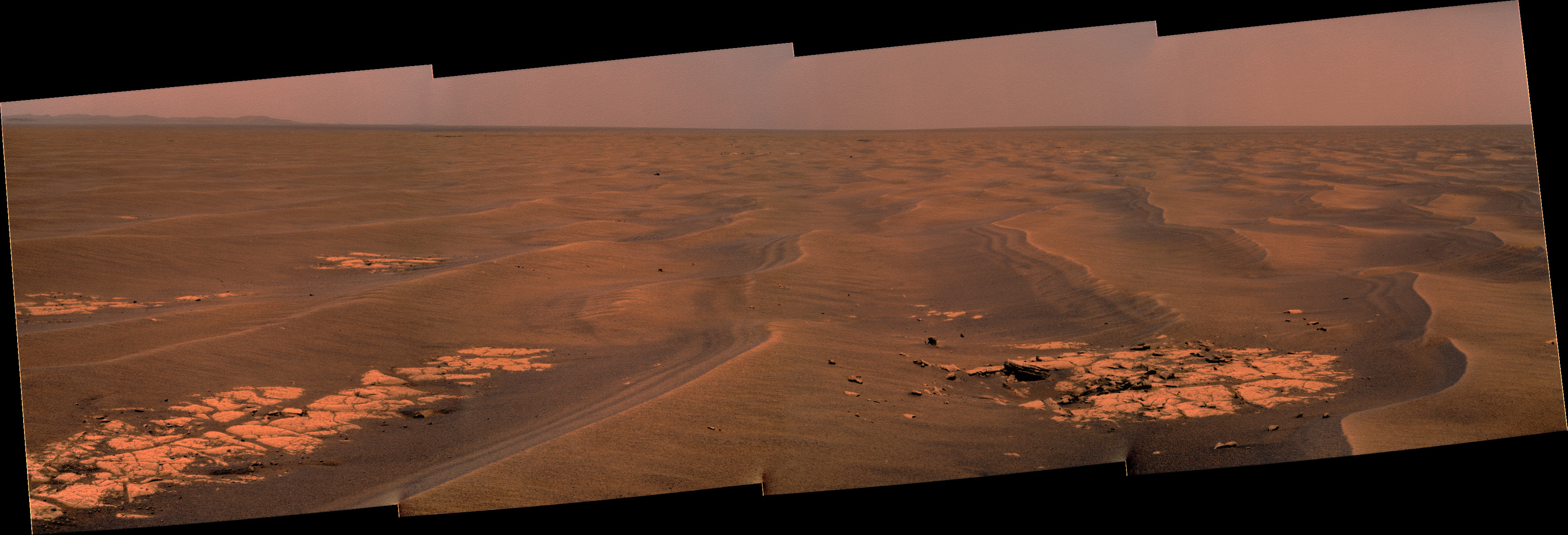
Ant103
May 28 2010, 09:05 PM
Sol 2251 color view :
NW71
May 28 2010, 09:32 PM
Thanks for that colour view Ant103.
When you look at the picture in detail the differing terrain between the left and right hand side of the image is really noticeable. I know a great deal of posts in this forum have discussed the future route but just to be clear, I would assume we will be taking the left hand route as it looks considerably smoother?
Neil
Phil Stooke
May 28 2010, 09:46 PM
We should be going to the left in that view, but most of the difference in texture in the image is caused by lighting angles. On the right you see lots of shadows, on the left the shadows are hidden behind the drifts. There isn't really much difference in texture between the two sides of the image.
Phil
JayB
May 29 2010, 12:55 AM
couple of tweets from Scott today
Energy levels not spectacular; drive truncated to 30min or so; will go 15-25m. Shooting for a spot where we'll recharge well over weekend.
On the plus side, we had a cleaning event this week, so energy levels are maybe 10% (or more) higher than they would be otherwise.
briv1016
May 29 2010, 01:54 AM
Exploratorium is back up.

Stu
May 29 2010, 05:49 AM

I still can't get on...
Stu
May 29 2010, 06:39 AM
Hmmm. I can get to the front page, but clicking on the individual camera links brings everything to a stop.
Sigh.
Tman
May 29 2010, 08:05 AM
This is a "lo-fi" version of our main content. To view the full version with more information, formatting and images, please
click here.