There are tons of Earth observing satellites producing gorgeous detailed images, but I'm trying to figure out if any of them is capable of producing full-globe images of Earth on some regularly updated basis. Does anyone here know of such a beast? Are there weather monitoring satellites that do this?
--Emily
Full Version: Whole Earth images
Well - there's Meteosat, the European geostationary effort - but that's just one side of said globe. The latest version of Meteosat is the second generation vehicle ( MSG ) which is producing good imagery at high res, every 6 hours. Of course that means basically one full colour image over 0 degrees per day ( the 0600 and 1800 images are, of course, half dark )
Proper website is www.eumetsat.de ( might have seen signposts for Eumetsat on the way into Darmstadt on the Bus - just opposite ESOC )
I'd recommend here - http://www.sat.dundee.ac.uk - (free reg required for good stuff) for regular full res MSG imagery as well as from other, not quite so high-res or full colour etc sats. (i.e. GOESE, GOESW, IODC, MTSAT). TECHNICALLY...one could take these multiple geostationary views, and fudge some sort of global view from them.
Also - Aqua and Terra each with my favorite polar orbiting instrument MODIS, do technically cover the entire glove at about 500m/pixel, in colour, at about 1200 and 1400 LOCAL time every day - but I don't believe they produce a daily global product, just the swathes in near real time and a lot of near realtime subset that are reprojected - http://rapidfire.sci.gsfc.nasa.gov/
I guess it depends on what you mean by global.
Doug
This will get you the "other" side of the globe. (click on the type of view and you'll get the full disk)
http://www.goes.noaa.gov/goesfull.html
And this will get you a full globe snapshot. (The rotating globe movie is waaaaaay cool-o!)
http://www.ssec.wisc.edu/data/composites.html
-Mike
http://www.goes.noaa.gov/goesfull.html
And this will get you a full globe snapshot. (The rotating globe movie is waaaaaay cool-o!)
http://www.ssec.wisc.edu/data/composites.html
-Mike
You'd have to be pretty far out there to fit the whole globe in one frame, no?
The NOAA whole-earth water vapor movies are fantastic... neat eddies.
The NOAA whole-earth water vapor movies are fantastic... neat eddies.
I think you could get full-globe images by combining pictures from multiple weather satellites, but obviously you get no more than a hemisphere from anything in GEO. Earth is (if I've done my sums right) 20 degrees across from GEO, so you need some sort of scanning platform to take your detector across Earth.
Ah, this is already done: http://www.ghcc.msfc.nasa.gov/GOES/globalwv.html has global images composed from GOES-EAST (over Peru), GOES-WEST (over the Pacific), and the two Meteosats over the Bight of Benin and Sri Lanka. I suspect there's a Japanese satellite filling the gap east of India.
These don't show the poles very well for geometric reasons, and are monochrome (OK, they're trichrome, but those are 10.8u infra-red, 2u infra-red and visible).
The polar Earth-observing satellites (say http://rapidfire.sci.gsfc.nasa.gov/) get any point on Earth every few days, but clouds move fast enough that the pictures will look pretty ugly and not line up.
Modis covers the entire earth every one to two days, depending on how the Aqua and Terra ground tracks fall. This page has some good stuff http://visibleearth.nasa.gov/view_rec.php?id=2429
Seawifs also gets nearly full coverage on a daily basis.
Seawifs also gets nearly full coverage on a daily basis.
Thought I would see just how hard it is to merge all the GEO MET IR imagery into one strip.....and the answer...with photoshop..is 'suprisingly hard'
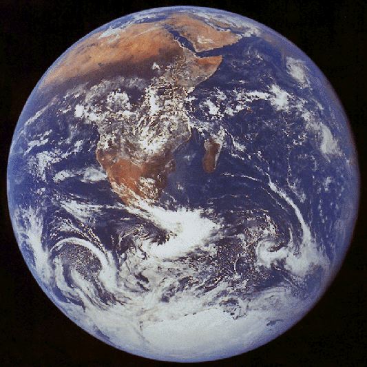
On second thought, Emily, you are breaking the law which states that the only global image of the earth is this one:

I'm asking this question on behalf of Lou, and I think what he really means by "global" is "looks like a globe" -- but then he probably wants to see the whole planet too. I'll have to find out what he really wants.
--Emily
Again...TEEEeeechnnically - one could take one of those global composites, reproject it as a texture in realtime and render out a globe-like sphere. But that's way beyond my talents (one offs, yeah, automated every few hours...pah)
Alternatively, who's got a few hundred million to launch Triana?
Doug
Alternatively, who's got a few hundred million to launch Triana?
Doug
I want to make a comment here, but I can't without being political, so I won't. But the link I gave in the post before my last one definitely has globe-like images.
QUOTE
... the only global image of the earth is this one:
Hey - I can see my old house in that.
QUOTE (djellison @ Mar 8 2007, 04:47 PM) 
Thought I would see just how hard it is to merge all the GEO MET IR imagery into one strip
That is just amazing, Doug. What a thing to think of doing!
QUOTE (stevesliva @ Mar 8 2007, 08:40 AM)
You'd have to be pretty far out there to fit the whole globe in one frame, no?
That reminds me, here's another one...


This is one of the more inspiring Earth image to me.
You can see city's lights on the dark side while others are still seeing the sun :
Click to view attachment
You can see city's lights on the dark side while others are still seeing the sun :
Click to view attachment
a shame it's not a real image. Would be nice to see the bottom of the oceans and no clouds at all in the entire world!
I wonder if one could see the shadow resulting from the March 19th eclipse in the visible image on the Meteosat or GOES web pages?
Pity they aren't "live" webcams!
Pity they aren't "live" webcams!
ISS sure had a good look: e.g.
http://www.nasa.gov/vision/universe/solars...rthday2006.html
edit - I'm sure I've seen an animation of the moon's shadow moving across the earth, but can't find it right now.
pretty:
http://sunearthday.nasa.gov/2006/multimedia/gal_011.php
http://www.nasa.gov/vision/universe/solars...rthday2006.html
edit - I'm sure I've seen an animation of the moon's shadow moving across the earth, but can't find it right now.
pretty:
http://sunearthday.nasa.gov/2006/multimedia/gal_011.php
Very cool! I hadn't seen that before. Thanks, remcook!
-Mike
-Mike
EUMESAT is a geo-stationary satellite with full disc imagery in lots of spectra: http://www.eumetsat.int/Home/Main/Image_Ga...mages/index.htm
but can also be found via the link djellison mentioned I think.
There are plenty of full disc images in the Apollo Archive http://www.apolloarchive.com/apollo_gallery.html but they're not exactly modern
but can also be found via the link djellison mentioned I think.
There are plenty of full disc images in the Apollo Archive http://www.apolloarchive.com/apollo_gallery.html but they're not exactly modern
For clouds this is one of the things I'm working on at NOAA in connection with the Science On a Sphere project. We do have a 30-min global IR animation (interpolated to 15-min) in real-time using a mosaic from the Aviation Weather Center that I am augmenting with Japan's MTSAT data. The actual time resolution does vary over the globe depending on which satellite(s) are covering the area.
My current goal within this effort is to produce an upgraded 15-min global animation by more directly using the various geosynchronous (and polar orbiting) satellites. This will work best with the Meteosat Second Generation data that I believe would have two satellites with the full 15-min resolution over their respective areas of coverage. Other satellites would be used with appropriate temporal interpolation.
The IR mosaics exist in up to 2048x4096 resolution, though for display we sometimes reduce this by half when we wrap the animation around the sphere.
The fundamental problem is that there are no spacecraft that can usefully image the "whole" earth beyond geostationary orbit. From 22 thousand miles out, they see to a horizon of something like 82 north and south (and the same east and west of the subspacecraft point) It's easy to imagine the view as a hemisphere, but a matched view to something from at or beyond the moon would show the difference.
Somebody should be able to match up geostationary global data to Messenger or the failed Japanese Mars orbiter or some such mission to get a quasi simultaneous match and maybe fake it using global mosaic data to show the geostationary view you'd have directly below the deep space mission.
Somebody should be able to match up geostationary global data to Messenger or the failed Japanese Mars orbiter or some such mission to get a quasi simultaneous match and maybe fake it using global mosaic data to show the geostationary view you'd have directly below the deep space mission.
I used to make Earth textures from weather sats using images gathered during equinoxes when the lighting would cover the most of the planet. The availability of the high res European and Asian satellite coverage dried up on the GOES page I used to frequent and I gave up. I did manage to make one nice instantaneous Earth image which I colorised (with night lights added), and a days noon lighting global composite. A good 4K texture was just possible from these sources. Below can be seen a sample rendering from this work. I used 'Morph', a nice Mac package from years ago, to warp the images to fit a simple cylindrical projection, adding the poles from other sources.
I later did the same thing to MGS global swaths to make my own Mars albedo maps.
Don Click to view attachment
I later did the same thing to MGS global swaths to make my own Mars albedo maps.
Don Click to view attachment
Greetings,
I can show a somewhat dated example of the animation I'm working on at this URL. The current animation has an improved blending and colorizing scheme.
http://sos.noaa.gov/datasets/Atmosphere/grayscaleIR.html
Edstrick - I think the geostationary satellites see up to about 72 degrees latitude. There are an increasing number of polar orbiting satellites that would image the poles with a reasonable frequency if you take them all together.
Steve that is stunning.
Will the newer version be made public?
Will the newer version be made public?
In a recent update to my Earth texture I added gas flares to the night lights, but data on where the flaring takes place seems elusive. National Geographic had some flare locations shown in their recent world map so I used a lot of those, and whatever Middle East, Nigeria, and Canada flare images I could find. Does anyone know of a world map showing current gas flaring?
Don
Don
Helvick - glad the animation played OK for you. It is a good question about whether this can be made public. You can see it at the dozen or so museums and such that have the SOS exhibit installed. In terms of having it online in real-time this is a bit different category compared with the single frame planetary maps I work on. There are various proprietary, bandwidth, or simply inertia and political issues that might stand in the way here unfortunately. One example is that EUMETSAT charges a significant amount for their high-resolution data. You're welcome to contact the "powers that be" to add your voice to this question. I suppose that the 5MB compressed animation that is on the SOS website could technically be updated in real-time.
By the way, the upper animation on the page looks to be the current colorization I'm using and the lower one is the older one we're phasing out. Although this is a little frustrating I am hoping to share with everyone what could be possible.
By the way, the upper animation on the page looks to be the current colorization I'm using and the lower one is the older one we're phasing out. Although this is a little frustrating I am hoping to share with everyone what could be possible.
"...I think the geostationary satellites see up to about 72 degrees latitude...." Yes, that sounds right.
My favorite full-disc (or nearly) images of Earth are from Apollo 4, where an automated film camera filled a film magazine with images looking out a window at a fattish crescent Earth. Some are partially cut off by camera field of view or the window-frame. It should be quite possible to work those up into a pretty spectacular high-resolution (scanned film) movie like sequence showing a little Earth rotation/spacecraft-motion/illumination shift during the sequence. I have no idea long the sequence took but I'm sure (I'm sure I hope...) the data is online.
My other fav sequence is 2 image sequences from Surveyor 7 on the rim of Tycho. The Earth was low enough in the sky to be visible in the narrow angle camera view. They took 1 image sequence per day, probably through all polarizing filter positions (no color filters on the later Surveyors) showing Earth over a range of phase angles around 180 deg phase (1 day skipped?)
They also took a series of images every ?hour? on one day near the end of the mission showing a decent Earth rotation sequence of a gibbous Earth. A bit of image mapping onto a sphere to make a global map and remapping to the spacecraft view of the Earth could make a decent movie.
WOW those are just incredable images of the Earth, expecially the first one from djellison. Keep uo the great work. This is a great forum.
Just to fill up this thread appropriately - from the newly released Hayabusa data
WOW..
These whole Earth images from departing and returning space craft are particulary evocative to me. I remember Apollo 8 transmissions in 1968. Could actually see the Earth receding.
Hayabusa has had quite a journey and I hope there will be a return image.
Craig
These whole Earth images from departing and returning space craft are particulary evocative to me. I remember Apollo 8 transmissions in 1968. Could actually see the Earth receding.
Hayabusa has had quite a journey and I hope there will be a return image.
Craig
I totally forgot to return to this thread after creating some pages on the topic. Thanks, everybody, for your suggestions. Here's the two pages I've put together so far:
Images of Earth from Geostationary Satellites
Images of Earth from Planetary Spacecraft
I still need to add the Hayabusa images, and I know Doug's got a few more pieces of eye candy in production...
--Emily
Images of Earth from Geostationary Satellites
Images of Earth from Planetary Spacecraft
I still need to add the Hayabusa images, and I know Doug's got a few more pieces of eye candy in production...
--Emily
Nice collection, Emily.
I keep forgetting there's a whole sidebar on the left of the Planetary Society Website to explore.... though I can't even keep up with your blog updates!
I keep forgetting there's a whole sidebar on the left of the Planetary Society Website to explore.... though I can't even keep up with your blog updates!
Yes - excellent website Emily. Nice summary of the various geostationary satellites - helps me keep track of them as I contemplate further work on high frequency global animations.
I also like the images with the Earth and moon in the same frame, we live on such a colorful and vibrant planet.
I also like the images with the Earth and moon in the same frame, we live on such a colorful and vibrant planet.
The page has been updated with my Galileo efforts
That Earth 1 flyby I've only ever seen as a tiny .mov or .mpg - so I had a hack at it - every 4th(ish) frame - at full res. Quite pleased with the results.
While doing that, I also found an Earth-Moon conjunction observation from the Earth 2 flyby that is very Cassini-esque
The Earth 2 flyby data is, on the whole, ruined by dropouts for some reason - truely tragic as it would have been spectacular !!
Don't forget Lunar Orbiter, Surveyor and the Zonds. There are several Earth images to be found among those datasets.
Phil
Phil
The Japanese Mars probe Nozomi also took images of Earth and Luna,
which you can see here:
http://www.stp.isas.jaxa.jp/nozomi/MIC/MIC_e.html
which you can see here:
http://www.stp.isas.jaxa.jp/nozomi/MIC/MIC_e.html
I plan to do to NEAR what I've done to the Galileo E1 flyby - but I think there might be something a bit broken with NEAR MSI FITS and img2png - and I'm not even going to attempt it if I have to load each frame individually
As with the Galileo flybys, I've only really seen them put together as a movie at low res. The reason I did the Galileo one was to see it at the full res - and I think the effort was worth it.
Doug
As with the Galileo flybys, I've only really seen them put together as a movie at low res. The reason I did the Galileo one was to see it at the full res - and I think the effort was worth it.
Doug
Great Galileo work, Doug.
By the way, there are several Zond images. The USGS site has quite a few from Zond-8. Zond 7 took a color earthrise sequence. Quite a few of the frames are in my collection and all over the internet, but the color quality is poor (presumably due to poor copying, based on small samples of better copies I have seen. Here is a sequence, showing what I have been able to cobble together from multiple frames, croping out areas I couldn't generate for all images. Click on this link for a larger version.

http://www.strykfoto.org/zondrise.jpg
By the way, there are several Zond images. The USGS site has quite a few from Zond-8. Zond 7 took a color earthrise sequence. Quite a few of the frames are in my collection and all over the internet, but the color quality is poor (presumably due to poor copying, based on small samples of better copies I have seen. Here is a sequence, showing what I have been able to cobble together from multiple frames, croping out areas I couldn't generate for all images. Click on this link for a larger version.
http://www.strykfoto.org/zondrise.jpg
Wow, awesome, Ted!
I see Doug's Galileo Earth rotation made APOD today, congrats!
I was browsing through the rotation sequence raws myself and something struck me as interesting. There's a few frames that exhibit a bright glint-like speck somewhere above Argentina. It's visible in several different filter frames and it's not camera-related as it's fixed to Earth in subsequent frames though the glint appears to move slightly along the groundtrack. It's much brighter than the rest of the cloud structure visible so I was wondering if anyone has any theories?
It can be seen as a green-red charge bleed in this composite:

The brightness difference between the speck and the rest of the clouds is much lower here due to the processing than it is in the original frames.
It's a specular reflection off a lake in Uraguay or Argentina I think - if you run through all the images you can see it very very clearly.(when I say all, I mean every image, i.e. r, ir, g, ir, v..etc etc)
Just guessing - but my initial thoughts were that rough oceans with large amplitude waves dont produce a pin sharp specular reflection from the sun. A small lake - which could be almost totally flat - would produce a sharp specular highlight.
APOD - Sweet - I had no idea
Doug
Just guessing - but my initial thoughts were that rough oceans with large amplitude waves dont produce a pin sharp specular reflection from the sun. A small lake - which could be almost totally flat - would produce a sharp specular highlight.
APOD - Sweet - I had no idea
Doug
I thought about a lake specular, the specular point is in about the right location, but the area seemed to be clouded over to actually see a lake. If it's actually a lake, it's great to see how much brighter speculars on a flat surface are than oceanic specular "point". As the specular point is tighter when the surface is less rough it goes to show what a cool coincidence this turned out to be.
Imagine seeing something of the sort on Titan...
Imagine seeing something of the sort on Titan...
Emily, you are welcome to add this to the planetary society page, but remember the version I linked to is larger.
It's not packed solid cloud though - it's bitty, hazy perhaps -not full on blanket covering. Certainly enough to let the reflection through
Doug
Doug
QUOTE (tedstryk @ May 14 2007, 07:08 AM)
Emily, you are welcome to add this to the planetary society page, but remember the version I linked to is larger.
Thanks, Ted! I've been out of town for a few days, so a bit out of the loop, but I'll be back home tonight and will DEFINITELY add your cool Zond images to the site.
And congrats on APOD, Doug!
--Emily
Just to clarify one point, Ted's Earthrise is actually an Earthset. So is the famous Lunar Orbiter 1 view of Earth over the lunar horizon. Only Apollo (among those early missions) saw the Earth rise.
Phil
Phil
Doug: Congratulations!
Phil: I had no idea. The images come from a variety of sources, and I ordered them without even considering that it might be an earthset!
Phil: I had no idea. The images come from a variety of sources, and I ordered them without even considering that it might be an earthset!
This is a "lo-fi" version of our main content. To view the full version with more information, formatting and images, please click here.