tim53
Nov 2 2010, 04:00 PM
QUOTE (elakdawalla @ Oct 23 2010, 02:06 PM)

Sorry for the long break -- DPS happened, then some necessary travel. In the meantime James got me the two tiles of PSP_005423_1780_RED that we've been working on that cover Santa Maria in PNG format. Unfortunately, MapTiler is not handling these correctly, but I have a suspicion that it's because my old computer is running out of memory. I should have a brand-new computer in two weeks with more than enough memory to handle this problem, and then I'll revisit it. I *think* Opportunity will not get to the edge of the current map in two weeks...it would be awesome if I were wrong about that, though!
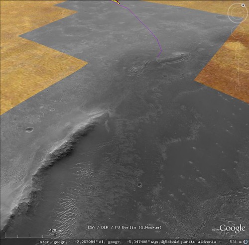
Here's mine:

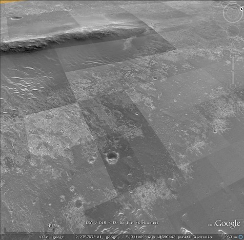
It's a mosaic of CTX and HiRISE that I put together in Photoshop for traverse planning. I used Photoshop so I could take care of shading differences between overlapping images. I also used the lowest emission angle images to minimize topographic distortions to the map projection (which only corrects for the MOLA long-wavelength topography). At this scale, you can't see the HiRISE at full resolution, of course...
I made the mosaic so we'd have continuous HiRISE coverage of our route all the way to Endeavour.
When we're "done" with Endeavour, I'll have to make another map, I suppose!

-Tim.
Tesheiner
Feb 6 2011, 07:54 PM
I thought it might be time to resurrect this topic.
Once we're done with Santa Maria, Opportunity will be out of the current background picture in a matter of weeks.
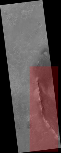
Click to view attachmentI spent some time today reviewing the process required to have HiRISE coverage from Santa Maria until Cape York, which basically was: slice one of those big JPEG2000 pictures in 8k x 8k pieces, register the pieces to match with the portions already covered at high resolution, and render them with MapTiler. With a bit of patience and a couple of beers here's the result.
Click to view attachmentVoila! Ground coverage at 25cm/pix for the remaining path.
Click to view attachmentNow, what I need is some place to host the whole thing.
elakdawalla
Feb 6 2011, 10:24 PM
I'll be glad to host it. I can do it tomorrow -- Super Bowl today
Robert S
Feb 7 2011, 10:27 AM
Awesome!!! Can't wait for it to be uploaded, GREAT WORK !!!
Tesheiner
Feb 8 2011, 07:10 AM
Thanks, Emily, for the support and for hosting this big map.
Hello everyone! Follow this link to see the path to Cape York at HiRISE resolution.
http://planetary.s3.amazonaws.com/gmars_ma...41_1775_RED.kml
brellis
Feb 8 2011, 08:01 AM
Thanks E.T. and Emily!
p.s. - happy birthday!
fredk
Feb 8 2011, 03:19 PM
This is fantastic! Thanks Tesheiner and Emily.
Thanks, both, VERY much. I can't overestimate how useful that will be for my blog. Just fantastic.
SFJCody
Feb 8 2011, 10:50 PM
Fantastic! Much better than my earlier unfinished attempts!
elakdawalla
Feb 8 2011, 11:11 PM
Okay folks, I've now edited
the first post in this thread to include all the base images.
Unless you have made edits to the base map layers in Google Mars, I recommend that you
download and use this kml file, which contains all three of the base map extensions, neatly named and credited. If you use this version, all of the image files are being hosted remotely, on the Planetary Society's space on the Amazon S3 server.
brellis
Feb 8 2011, 11:34 PM
I've found my religion, and it is Google Mars, via Saints Emily and Eduardo! Thanks so much
elakdawalla
Feb 8 2011, 11:34 PM
Don't forget to thank SFJCody -- he did the lion's share of the work getting earlier map updates done.
eoincampbell
Feb 9 2011, 12:31 AM
Thank you one and all for mapping,hosting and posting this... Just Awesome
Robert S
Feb 9 2011, 09:02 AM
I am so pleased right now that words can't describe it! EXCELLENT WORK. I am also happy that you have it all covered on the first topic now!
You guys are the best, many thanks to all of you who have made this possible!
vikingmars
Feb 9 2011, 11:30 AM
QUOTE (brellis @ Feb 9 2011, 12:34 AM)
I've found my religion, and it is Google Mars, via Saints Emily and Eduardo! Thanks so much
It reminds me a guy from Lehman Brothers early 2008 saying "My religion is the Stock Market"...

MoreInput
Feb 24 2011, 09:14 PM
Also from me very much thanks for the maps: Let's set the sail to Cape York!
elakdawalla
Apr 14 2011, 04:06 AM
There's a lovely new color view of the northwest rim of Endeavour:
http://www.uahirise.org/ESP_021892_1775This makes me wonder what parts of Opportunity's path have been covered in color. It's a question I know I could answer myself if I had the time, but I don't. If I were going to answer it, I'd figure out which images crossed Opportunity's path and then identify the regions lacking color coverage.....
ElkGroveDan
Apr 14 2011, 04:18 AM
eoincampbell
Apr 14 2011, 04:51 AM
Thanks for posting that beautifully colored view...
I notice the related context swath was out-with Oppy's current travails...
Is HiRISE planned to continue on Oppy's trek, by any routine ?
Happy HiWISHES
Astro0
Apr 14 2011, 08:02 AM
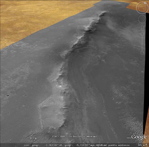
This is a start on the colour coverage with the latest images.
Click to view attachmentIf anyone would like a
larger version (17.7mb)
Stu
Apr 14 2011, 05:14 PM
Tweaked the new HiRISE image of Cape York to make it look a little less garish, hopefully a little more natural, and then, just for fun - so not claiming mega-accuracy - dropped some 'virtual Oppys' onto it at various places, to show the scale of the features at Cape York...
Click to view attachmentThis might be useful for our lower-tech members who can't access HiRISE images via the IAS Viewer, or the Google Mars images.
Edit: more pix at:
http://roadtoendeavour.wordpress.com/2011/...ew-of-cape-york
Explorer1
Apr 14 2011, 05:36 PM
Oh wow!
Once we get on that color patch, that'd be as good a place as any to proclaim official 'arrival', right? For something this big, there's few well-defined borders....
eoincampbell
Apr 15 2011, 05:23 AM
Lovely view and I like those possible routes, Stu. Might the team forego those excursions in pursuit of the clays at Tribulation?
KrisK
May 19 2011, 10:30 PM
Lately I've been working on HiRISE GE extension of Endeavour rim, the area south of Cape York. As a result I uploaded this kmz example. The procedure was as follows:
1. cropped PSP_010341_1775_RED using JP2_PDS/PDS_JP2 ("Area" option)
2. converted JP2 to png using "convert" (ImageMagick)
3. loaded png to GE, tuned North, South etc. coordinates and finally saved as kmz
Surely this method is not optimal. As a consequence I have one big image being loaded so GE hangs a little bit while loading. But later it works ok
At the beginning I wanted to use MapTiler (just as it was done in previous posts) but it produced strange results for this big png file. My tests with smaller example files looked more optimistic with that program.
Here are some screenshots:
 http://www.flickr.com/photos/55907406@N08/...088526/sizes/m/http://www.flickr.com/photos/55907406@N08/...088544/sizes/l/http://www.flickr.com/photos/55907406@N08/...088528/sizes/l/http://www.flickr.com/photos/55907406@N08/...088534/sizes/l/
 (here it looks that I need to work more on that

)
I decided to upload kmz maybe sbd would like to use it...
https://rapidshare.com/files/1768082589/tes...deavour_rim.kmz
Tesheiner
May 20 2011, 06:08 AM
That sounds great!
But, as you said, it's not optimal given the file size; actually, my laptop almost freeze during 1-2 minutes and finally finishes with a big "X" (can't display) instead of the real picture. I'll suggest you to keep working with MapTiler but splitting the big source file into smaller (e.g. 8000x8000) pieces first.
QUOTE (KrisK @ May 20 2011, 12:30 AM)
At the beginning I wanted to use MapTiler (just as it was done in previous posts) but it produced strange results for this big png file.
Could you detail it a little bit?
QUOTE
That's due to small differences in the lat/long coordinates you are using (in relation to the map I made). I can provide you with some data that should solve it, if you want.
KrisK
May 21 2011, 03:59 PM
QUOTE (Tesheiner @ May 20 2011, 08:08 AM)
Could you detail it a little bit?
Here you can see result:
http://www.flickr.com/photos/55907406@N08/...320902/sizes/m/Finally I decided not to use MapTiler. Instead I wrote my own bash script to create super_overlays. The following link was very helpful:
http://code.google.com/intl/pl/apis/kml/do...l#superoverlaysAt this stage I can say that I almost there:
 http://www.flickr.com/photos/55907406@N08/...795813/sizes/m/
As you can see there is a brightness difference between tiles. Have to think what is the origin of the problem...
Below is the area (size 2^n) that I want to overlay in GE:
width = 16384
height = 3x16384
so I have three squares 16384x16384. Currently I work with the first square.
QUOTE (Tesheiner @ May 20 2011, 08:08 AM)
That's due to small differences in the lat/long coordinates you are using (in relation to the map I made). I can provide you with some data that should solve it, if you want.
Yes please
...Previously I made the alignment mostly by hand now I have the following strategy:
1. take N,S,E,W out of LBL for full HiRISE product....DONE
2. recalculate N,S,E,W for my cropped area....DONE
3. add/subtract deltaLAT, deltaLON to perfectly match the existing overlay...TBD
So I suppose your data will allow me to finish step 3 right?
Tesheiner
May 21 2011, 09:39 PM
Mmm, more or less.
I'm providing some of the data I used to create the 8k x 8k tiles you already see on Google Mars and are hosted by TPS. So, if you use them and extrapolate the coordinates to the 16k x 16k tiles you want to create, they should match 100% with the current map. Note that I'm not saying that they are accurate (they aren't); they are only good for creating new maps matching with the current ones.
Lat/Long coordinates of PSP_010341 upper left corner: -2.07473360826446, -5.44490800928163
dLat/dLong of a pixel on the original picture: 4.21926255562616E-06
KrisK
May 22 2011, 04:55 PM
QUOTE (Tesheiner @ May 21 2011, 11:39 PM)
Lat/Long coordinates of PSP_010341 upper left corner: -2.07473360826446, -5.44490800928163
dLat/dLong of a pixel on the original picture: 4.21926255562616E-06
Thanks for the numbers. They were very helpful. It looks I have a perfect match:
 http://www.flickr.com/photos/55907406@N08/...683084/sizes/m/
Btw, asking out of curiosity...in LBL we have: MAP_RESOLUTION = 237098.79009322 <PIX/DEG> which gives:
1/237098.79009322=4.21765121452889e-6 but we are using 4.21926255562616e-6
Why is there a difference?
Oh and the problem with the brightness among tiles was caused by Google Earth. Somehow GE had problems using png's which I was creating using Image Magick "convert" program. Switching to jpg's resolved that issue.
Anyway...FINISHED!!!
 http://www.flickr.com/photos/55907406@N08/...292143/sizes/m/http://www.flickr.com/photos/55907406@N08/...842018/sizes/m/Zipped kml's download link: https://rapidshare.com/files/2039227902/end...ur_west_rim.zip
Edit: added another link just in case...
http://hotfile.com/dl/118744535/aaffb88/en...st_rim.zip.htmlThe only missing thing is the black area which could be removed. I don't know but maybe I'll do it somewhere in the future.
Zeke4ther
May 23 2011, 04:50 AM
Great work! Well done!
Tesheiner
May 23 2011, 09:11 AM
QUOTE (KrisK @ May 22 2011, 06:55 PM)
Btw, asking out of curiosity...in LBL we have: MAP_RESOLUTION = 237098.79009322 <PIX/DEG> which gives:
1/237098.79009322=4.21765121452889e-6 but we are using 4.21926255562616e-6
Why is there a difference?
As I said before, the data may not be accurate but is the one you have to use to match with the previous maps.
IIRC, I first calculated that value when attempting to match my version of ESP_011765 (the one covering the western detour) using MapTiler to SFJCody's version of the same map, which in other hand was already registered to the background covering Victoria embedded in GE. Later on, that value was used on subsequent maps to keep them matching together.
Ross Beyer
Jun 22 2011, 09:34 PM
As I had mentioned a long, long time ago, we (the Ames Planetary Content team) were working on constructing new HiRISE/CTX overlays in the Google Earth client for the Opportunity route. We're far enough along that I want to have you guys take them for a spin so that I can get your feedback.
The attached KML file has NetworkLinks that point to our servers at Ames.
As far as geo-position goes, we decided to leave Victoria Crater where it is, and adjust the surrounding images. At some point in the future (I've been told "after the mission is over" as a time frame), there will be a giant geolocation solution by members of the MER team, at which point we'd move everything to be consistent with that, but its far enough in the future that I'm not gonna worry about it right now.
Also, the HiRISE image that covers the Endeavor rim isn't just any HiRISE image, but an ortho-image made from a HiRISE terrain model, and if things work out the way that I want them to, by the time this basemap makes it into the client (end of summer? fall at the latest, I hope), the HiRISE terrain will be in there, too.
hendric
Jun 22 2011, 10:08 PM
Works very well from here.
Tesheiner
Jun 22 2011, 10:58 PM
From here too. It runs smoothly through the different levels of detail.
On the topic about geo-positioning there are, obviously and expected, differences with the maps we are using right now but it wouldn't take too much time for me to adjust my record of the route to this new HiRISE background; I only need to reposition some 15 "control points" I currently use on the map and all route points and ground features would be automatically aligned to the new background.
brellis
Jun 23 2011, 12:48 AM
It's always like Christmas morning surfing through the updated images on Google Mars. Thanks Ross, Tesh et al!
CosmicRocker
Jun 23 2011, 04:51 AM
QUOTE (Ross Beyer @ Jun 22 2011, 03:34 PM)
... if things work out the way that I want them to, ... the HiRISE terrain will be in there, too.
That would be truly awesome. I can hardly wait.
Many thanks to you and your team for the excellent work.
Ant103
Jun 23 2011, 07:43 AM
That's amazing ! Excellent work
!
Robert S
Jul 17 2011, 03:11 PM
Fantastic job!!!!
tim53
Aug 12 2011, 09:52 PM
QUOTE (Ross Beyer @ Jun 22 2011, 02:34 PM)
As I had mentioned a long, long time ago, we (the Ames Planetary Content team) were working on constructing new HiRISE/CTX overlays in the Google Earth client for the Opportunity route. We're far enough along that I want to have you guys take them for a spin so that I can get your feedback.
The attached KML file has NetworkLinks that point to our servers at Ames.
As far as geo-position goes, we decided to leave Victoria Crater where it is, and adjust the surrounding images. At some point in the future (I've been told "after the mission is over" as a time frame), there will be a giant geolocation solution by members of the MER team, at which point we'd move everything to be consistent with that, but its far enough in the future that I'm not gonna worry about it right now.
Also, the HiRISE image that covers the Endeavor rim isn't just any HiRISE image, but an ortho-image made from a HiRISE terrain model, and if things work out the way that I want them to, by the time this basemap makes it into the client (end of summer? fall at the latest, I hope), the HiRISE terrain will be in there, too.
Hi Ross:
I just completed a new basemap of CTX, MOC and HiRISE images in Arcmap that I'll be using for my localization work on Opportunity (I call this "HiThere!"). This map covers all of our traverse from Eagle Crater through Cape York, as well as all of Endeavour and Iazu Craters (since we can see so much of the interior of Endeavour, and Iazu is on our horizon). I first georeferenced the CTX low emission angle images to the HRSC and MOLA DEMs, then tied the HiRISE images to them (and each other, where they overlap). For Endeavour, there is still an annoying gap in the HiRISE coverage just east of center, so I used a couple of MOC images (3m/pixel) to fill that gap. Next step will be to correct the shading from one image to the next so the seams don't detract from the morphology. I've done this for the CTX background mosaic already, and I'm in the process of adjusting the HiRISE images. Next step will be to tile up and get the basemap into our planning software. But once that's done and the route is on it, exporting the path to applications like Google Mars ought to be straightforward. Much sooner than "after the mission is over", I'm hoping.
-Tim.
elakdawalla
Aug 13 2011, 02:32 AM
QUOTE (tim53 @ Aug 12 2011, 02:52 PM)
(I call this "HiThere!")

Apart from that, I applaud the rest of your post and hope to see the product before the mission is over!
tim53
Oct 31 2011, 08:35 PM
QUOTE (elakdawalla @ Aug 12 2011, 07:32 PM)
Apart from that, I applaud the rest of your post and hope to see the product before the mission is over!
This map is now completed. Stay tuned, as Trent Hare will be posting links to it on the USGS website.
While I consider the map "completed", I reserve the right to continue to update it as better/more images are acquired and I can georeference them to the base MOLA and HRSC topography maps. But I need to get cranking on the Gale basemap for localization and planning during Ops!
-Tim.
Zeke4ther
Oct 31 2011, 10:47 PM
cool!!
tim53
Nov 17 2011, 10:08 PM
Hi all!
Sorry this took so long to finish (at least Opportunity is still going!), but Trent Hare of the USGS Flagstaff, has posted my new basemap on a couple websites for quick viewing. These sites are temporary, so I don't know how long they'll be up. There's also a downloadable kmz file for placing in Google Mars. I tried it, and it works, but a colleague here couldn't get it to display. There are some issues - like too hard a stretch - that will be dealt with in future postings.
From Trent:
QUOTE
You can share this also - but warn them it might go away as I can't keep this site live forever .
-------------
But I slapped together an on-line tiled version of your mosaic. Think of "zoomify" but the measure distance tool works geodesically. I think I cached beyond the image (hence the large black area on the right).
http://webgis2.wr.usgs.gov/MER_Meridianni/ Here is the cache for GE too (Does it even work for you ???):
http://webgis2.wr.usgs.gov/ArcGIS/rest/ser...ml/mapImage.kmz most simple site (only zooming):
http://webgis2.wr.usgs.gov/ArcGIS/rest/ser...pServer?f=jsapi Rest interface with some funky information listed:
http://webgis2.wr.usgs.gov/ArcGIS/rest/ser...ianni/MapServerThere's also an FTP site for downloading a JP2 version of the file:
ftp://pdsimage2.wr.usgs.gov/pub/pigpen/ma...se/MER_mosaics/ And the associated readme text file:
ftp://pdsimage2.wr.usgs.gov/pub/pigpen/ma...25cm_README.txt .
I've only given this a quick look, so I apologize if there are issues that I've missed. The map itself needs a couple of corrections that I'll get back to after I return from the Curiosity launch week after next. I've got it into our planning software here for localization and traverse planning. Most annoying (to me) are some residual shading differences that I need to work on some more. The worst of these got that way when Fred Calef and I decided not to include a pair of MOC images over a gap in the HiRISE coverage, as they weren't a significant improvement in resolution over the CTX background mosaic and didn't have the dynamic range - I'd adjusted the shading of the HiRISE image to match the MOC, so it is darker than the CTX background.
In addition to making these kinds of corrections, I plan to make revisions as more data is acquired and released by HiRISE and as time allows.
I hope some here find the file useful. Enjoy!
-Tim.
P.S. Sample screen grab of mosaic with Opportunity path from Eagle to Sol 2777:
Nirgal
Nov 17 2011, 11:11 PM
QUOTE (tim53 @ Nov 17 2011, 11:08 PM)
Image Information:
Lines: 224000
Samples: 160000
That's 35 Gigapixels: Cool
Thanks especially for posting the full resolution version: much appreciated.
Phil Stooke
Mar 25 2012, 09:11 PM
These really are fantastic pictures. I can see I'll be looking at this a lot when I start illustrating the Opportunity route later this year. I suggested to Tim that he re-map the whole area at Microscopic Imager resolution so we could zoom all the way from CTX to HiRISE to reprojected Navcam to Pancam and finally to MI. But he thought that might overtax even his computer. Poo! Time for an upgrade...
Phil
Tesheiner
Aug 12 2012, 10:23 PM
Some people already mentioned that the background maps at Curiosity's landing site were updated. Actually, there was an update not only to that part of the planet but a much more global one, incluing changes here at Opportunity's site too. You might remember that HiRISE coverage on GE was only available around the landing site and Victoria, and there was and effort here at UMSF to extend that coverage up to Endeavour (see Emily's
blog). Later on, Ross Beyer of NASA/AMES mentioned about a working project and provided us access to newer and great background layers (see
here). Now, it looks like those ones have been finally released and integrated on the "mainstream" Google Earth / Mars database.
Well, not only that.
Zoom in at the Opportunity site, double-clicking on the "MER Opportunity Rover" layer, and you will see that the route path embedded on GE which was cut short right after Victoria has been updated too and covers the ground up to the last driving sol. Also, the "ground features" along the route were also updated and are the same ones I use in my route map.
Coincidence? No. Have a look to the bubble which opens after clicking on the link at the "MER Opportunity Rover (USA)" layer.
Click to view attachmentSome time ago, I was asked permission to integrate my route map updates into Google Earth in a way that they could be viewed not only by the people here but also by *anyone* on Internet using GE. We agreed a mechanism to do that (a sort of pipeline) so if everything is working correctly (and it was until the last drive) the path "embedded" on GE should be updated too in a short time. I like it.
Floyd
Aug 12 2012, 10:36 PM
Congratulations Tesheiner. Thanks for all your great work here, and now the whole globe can follow Opportunity's moves.
SFJCody
Aug 13 2012, 03:05 AM
Awesome stuff! Thanks hugely for all your tireless efforts over the years.
CosmicRocker
Aug 13 2012, 04:10 AM
Excellent, Eduardo!
Stu
Aug 13 2012, 06:33 AM
That's fantastic Eduardo! After all these years of hard work following and recording Oppy's great trek you deserve recognition for your hard work.
climber
Aug 13 2012, 07:37 AM
Congratulations Eduard
Tesheiner...
This is a "lo-fi" version of our main content. To view the full version with more information, formatting and images, please
click here.
