Yep, the ripples are big. But Opportunity has crossed by this kind of terrain plenty of times. Perhaps it won't be safe to drive 70m on a single day but we'll get to that crater for sure.
PS/OT: Mapping will have to wait for tomorrow. I've just finished restoring my home computer to a previous (and working) state. Google chrome stopped working yesterday and I finally got it back on business again. It's time to go to bed.
Full Version: Post Marquette Island
"how big ARE those dunes? "
Not too big - check out Tesheiner's last small route map. It clearly shows that the larger drifts are close to the current position, but that they can be bypassed easily just like the last few drives got past even bigger drifts. The terrain around the crater is going to be easier than where we are now. The HiRISE images are much better than rover panoramas for assessing the terrain.
Phil
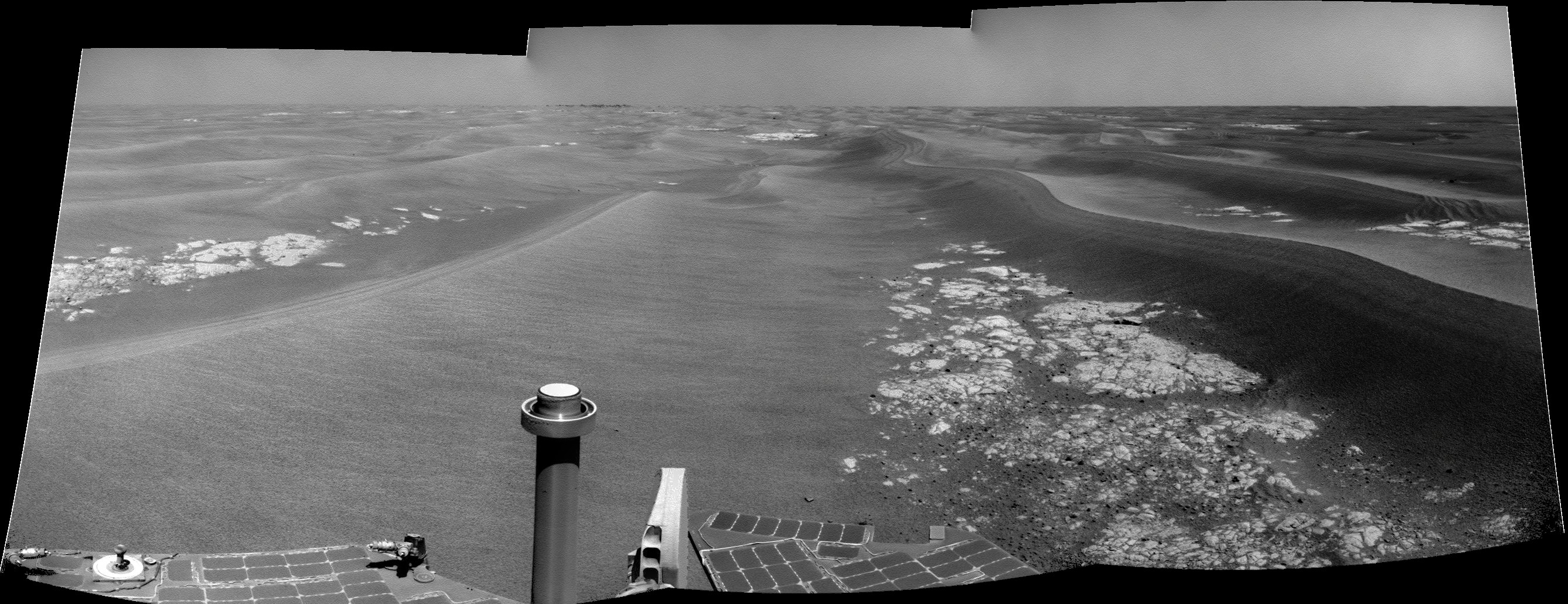
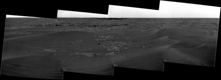
Sol 2128 pancam & navcam drive direction pans


QUOTE (Ant103 @ Jan 19 2010, 08:09 PM) 
Sol 2128 pancam & navcam drive direction pans
 Fourmi 103, j'aime bcp votre pano du bas très poétique et évocateur des dunes de Mars...
QUOTE (vikingmars @ Jan 19 2010, 08:57 PM)
Fourmi 103, j'aime bcp votre pano du bas très poétique et évocateur des dunes de Mars... La traduction automatique doit donner des choses interessantes sur cette phrase! (surtout le bcp!). Dans le genre facile à traduire je me demande ce que va donner:"et par dessus le marché, il m'a fauché mon oseille".
Sorry guys, just having some fun but not realy OT.
QUOTE (climber @ Jan 19 2010, 10:01 PM)
Sorry guys, just having some fun but not realy OT.
"Messieurs, honni soit qui mal y pense !" (Edouard III d'Angleterre)
Merci Olivier 
Adding the color version with on more frame to the right
Adding the color version with on more frame to the right

We're getting closer... About 70m closer.
This is from today's downlink; two navcam pics (for the time being).
Click to view attachment
This is from today's downlink; two navcam pics (for the time being).
Click to view attachment
New navcams up... Oh, I can almost smell those rocks now...
http://twitpic.com/yyx71
C'mon, pancams, where are you..???
http://twitpic.com/yyx71
C'mon, pancams, where are you..???
Looking to the latest route map, we're at almost 100m from the crater. Only two more driving sols.
Click to view attachment
Click to view attachment
Really looking forward to seeing new pancams... think we'll see some real detail around the crater.
I gave an Outreach talk today - to a Probus Club (50 or so retired professionals, inc quite a few chemists, engineers, etc) - and the people there were absolutely fascinated by the journeys of the Mars rovers. Quite a few, it has to be said, knew nothing about them at all, but they were v impressed by their longevity and achievements.
I gave an Outreach talk today - to a Probus Club (50 or so retired professionals, inc quite a few chemists, engineers, etc) - and the people there were absolutely fascinated by the journeys of the Mars rovers. Quite a few, it has to be said, knew nothing about them at all, but they were v impressed by their longevity and achievements.
Can't wait for pancams too. And I'm wondering if we're already seeing ejecta from Conception. In the new navcam:
http://qt.exploratorium.edu/mars/opportuni...NGP0693R0M1.JPG
it looks like there may be ejecta at the far end of the large stretch of pavement between us and Conception (and maybe even closer). And based on Tesheiner's map that looks about right for the limit of ejecta.
http://qt.exploratorium.edu/mars/opportuni...NGP0693R0M1.JPG
it looks like there may be ejecta at the far end of the large stretch of pavement between us and Conception (and maybe even closer). And based on Tesheiner's map that looks about right for the limit of ejecta.
Nice! The far rim of Endeavour, I assume?
Not Endeavour. Those bits are from Iazu. The sky is quite clear though. I hope we see more soon.
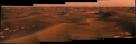
While we wait for the experts (James, Ant etc ), here's a quick artist's view of the current drive direction.
Click to view attachment
Enjoy
), here's a quick artist's view of the current drive direction.Click to view attachment
Enjoy
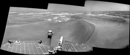
Nice one, Astro0! And the view in 3D...
Click to view attachment
Some more hills visible on the horizon, yes, but not as many as I'm sure many of us were expecting. Hmmm. I think we're unlikely to get our long-awaited "heck of a view" until we're quite a way past Concepcion...
Click to view attachment
Some more hills visible on the horizon, yes, but not as many as I'm sure many of us were expecting. Hmmm. I think we're unlikely to get our long-awaited "heck of a view" until we're quite a way past Concepcion...
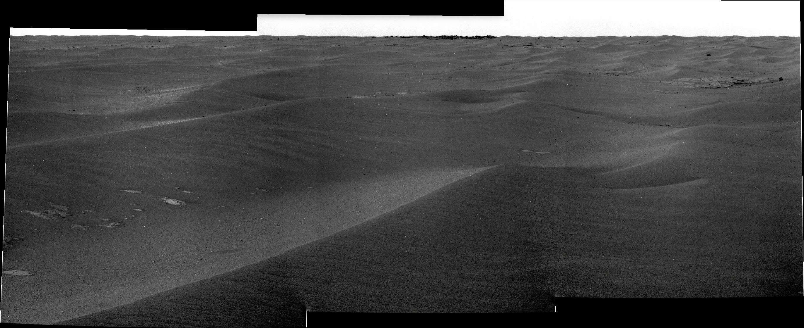
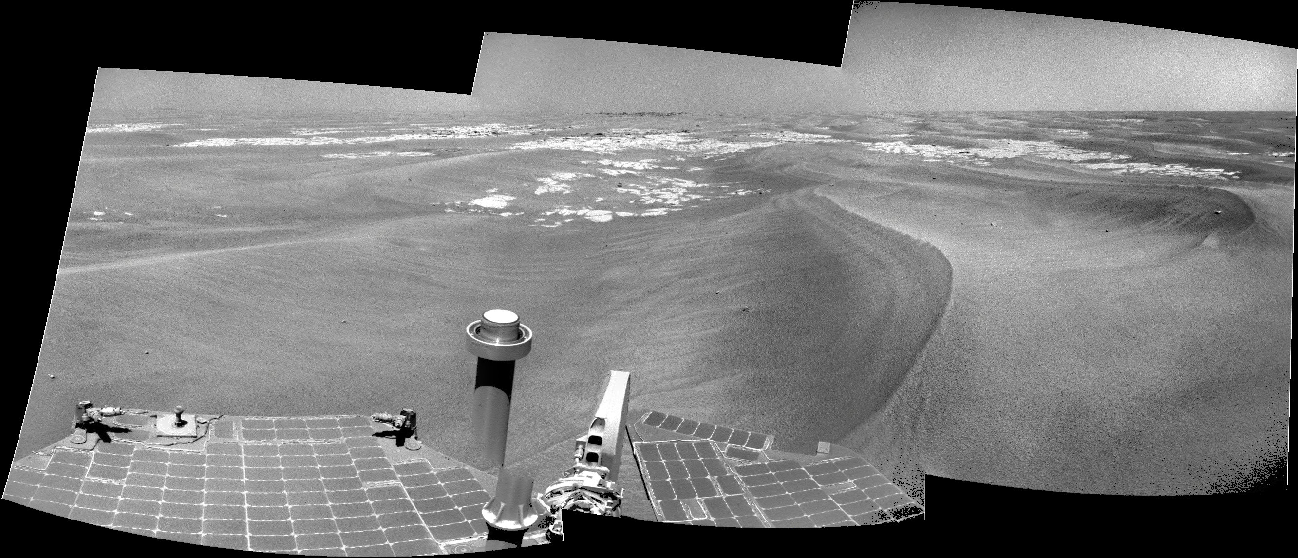
Sol 2130 drive direction pans
Can't wait to be at Conception to have this "Heck of a View"

Can't wait to be at Conception to have this "Heck of a View"
QUOTE (Stu @ Jan 21 2010, 07:34 AM)
Some more hills visible on the horizon, yes, but not as many as I'm sure many of us were expecting. Hmmm. I think we're unlikely to get our long-awaited "heck of a view" until we're quite a way past Concepcion...
Hard to tell for sure, but those rolling hills doesn't seams that far away, may be half a km? Hoppefully we'll climb one of them and get THE view we all expect since it'll also have a scientifict value.
QUOTE (fredk @ Jan 21 2010, 05:37 AM)
Not Endeavour. Those bits are from Iazu. The sky is quite clear though. I hope we see more soon.
I am delighted in anticipation...
QUOTE (climber @ Jan 21 2010, 09:42 AM)
Hard to tell for sure, but those rolling hills doesn't seams that far away, may be half a km?
As Fredk says those are the hills of Iazu Crater which iirc are actually ~40km away. The clear atmosphere at the moment can play tricks.

I read climber as referring to the rolling hills on the nearer horizon in front of Iazu. We only see a small part of the horizon so far: I think there will already be be other distant features visible to the right and left of that view. Also, as Conception breaks the horizon we must still have at least a metre to climb to reach it. I definitely expect to see more from there.
My take is that those are just more big ripples a little beyond Conception.
Hopefully we are near the top of the rise, it would be nice to have a distant horizon to look at (and Phil-o-vision ) again. But personally I'm not expecting a 'hell-of-a-view' for a long time yet.
Hopefully we are near the top of the rise, it would be nice to have a distant horizon to look at (and Phil-o-vision
) again. But personally I'm not expecting a 'hell-of-a-view' for a long time yet.
" it would be nice to have a distant horizon to look at (and Phil-o-vision ) again"
With these new glasses my astigmatism has been corrected, so Phil-o-vision may not work any more!
Phil
With these new glasses my astigmatism has been corrected, so Phil-o-vision may not work any more!
Phil
I love the suspense of these approaches. It reminds me of that first creep toward Endurance and how exciting that was, and how tantalizing those protruding white cliffs were and the slow march toward Erebus and what a visual disappointment that one was. Of course I will never forget the first glimpse of Victoria.
QUOTE (ElkGroveDan @ Jan 21 2010, 04:41 PM)
Of course I will never forget the first glimpse of Victoria.
Neither David B. will
QUOTE (ElkGroveDan @ Jan 21 2010, 03:41 PM)
I love the suspense of these approaches.
I'm with you there Dan...remember the time?
http://marsrovers.jpl.nasa.gov/gallery/pre...e-B081R1_br.jpg
http://midnightmarsbrowser.blogspot.com/20...ia-in-view.html
Rove!!!
As ngunn said, Conception is about a metre or so higher than here, so we should have a better view from there (at least if we can clamber up onto the rim). But I don't think we'll see more of Iazu than we have in the past (on sol 1987, eg, we had a great view).
What intrigues me most is whether we may start to see completely new features to the south and SW. There are some hills to the S-SSW, and Bopolu Crater to the SW. Both are farther than Iazu, but with the air clear I think geography will be the limiting factor.
What intrigues me most is whether we may start to see completely new features to the south and SW. There are some hills to the S-SSW, and Bopolu Crater to the SW. Both are farther than Iazu, but with the air clear I think geography will be the limiting factor.
Quick reminder of just where we are...
Click to view attachment
I know I've stuck up for stopping and studying meteorites and rocks recently, and I always will, if one presents itself for our rover to investigate, but I'm enjoying the anticipation of seeing new things on the horizon too. It's an almost primal thing, isn't it? How many people here love being on ships just so they can stand outside, leaning against the railings, looking out to sea, waiting to glimpse a line of land on the horizon? Or go hill climbing, and aren't happy until they reach the summit and can see the next hill, and the one beyond that? As babies we fight and struggle to stand and see our new world from a couple of feetb higher. As kids we climb trees so we can look out over the park and see the houses beyond. Older, we seek out top floor restaurants to dine in, and pay to ride on big wheels, for the view. And that's what makes following the missions of Spirit and Oppy so exciting and exhilarating. We're all standing together on the deck of a virtual ship, sailing over the martian dune seas, looking out for the next wonder to appear on the horizon.
This is a golden time, my friends. A golden time.
Well said, Stu.
Our eager anticipators may find this interesting:
http://www.lpi.usra.edu/meetings/lpsc2010/pdf/2638.pdf
It includes a map of the projected way ahead, with contours - it can stand some enlargement, don't just view it at 100%. It seems that within 1 km or so Opportunity will crest the top of a local ridge and look out over a substantial downward slope. The views won't change at Conception, but they will only a few weeks after that.
Phil
Very good information. Thanks for the link Phil.
That's quite a droolsome prospect Phil...!
Just try not to dribble on me!
Phil
Phil
Hey! That's a really good piece of info. Thanks Phil (and Tim53 too).
Also I have to say that each and every paragraph in section "Rover Localization" is familiar for me too.
Also I have to say that each and every paragraph in section "Rover Localization" is familiar for me too.
Evening All.
As a first post please don't savage me if I'm missing something obvious/ say something stupid/waste all your valuable time!
I just wondered, especially given Spirit's ongoing wheel problems, if we had any information on how Opportunity's RF wheel is behaving on the journey from Marquette Island to Conception?
Neil
Welcome to UMSF, Neil! Hope you enjoy being here as much as we all do. You've joined at an exciting time, that's for sure!
You've joined at an exciting time, that's for sure!
Wow, that's a great find, Phil! It does look like we may have a "heck of a view" in another km or so. Hopefully we'll get a nice panorama to the south, including several Endurance-to-Victoria class craters in various stages of erosion, as well as the west rim of Endeavour. It's good to see "mini-Endurance" on the proposed route as well.
Looking at that map reminds me of an odd Victoria-sized crater to our south. The crater shares the cape-and-bay structure of Victoria, but what's odd about it is that it's quite elliptical. When I first saw it, I thought there was some mapping projection problem that distorted it from circular to elliptical. But looking at the map from this post for example, you can see other craters nearby that are circular. Here's a crop:
Click to view attachment
I guess it could be two overlapping craters, but maybe more likely is that the bays have eroded more deeply in some directions than in others.
Click to view attachment
I guess it could be two overlapping craters, but maybe more likely is that the bays have eroded more deeply in some directions than in others.
Thanks, Phil. It'd be nice to get our hands on that topo map.
A few interesting quotes:
-- "The situation will start to improve within the next 2 kilometers, however, as Opportunity begins a descent down an 80m slope toward Endeavour crater, much of it containing broad outcrop exposures." It'll be exciting to see what changes occur as we go down slope, presumably where less deflation has occured so the bedrock might exhibit clearer indications of what conditions were like as it was deposited.
-- "[gravel pile] origin and preservation in isolated patches is as yet unknown, so future visits to these features, identified along the path ahead, are planned." I know we've speculated on what these piles are before; is there a summary of prevailing ideas?
I've been looking at the map contained in the pdf and I'm not sure but I think it might contain some kind of misalignment. If you look east of 'mini-Endurance' to the jagged black line where two images are spliced together you see the same exposure of Meridiani bedrock on each side of the image seam about 400m apart.
This paper is a gem!
Welcome to UMSF.
I don't remember any comment about how the RF wheel is behaving but stay tuned. Today is Thursday and it's when a status report is usually posted on the official MER web page.
QUOTE (NW71 @ Jan 21 2010, 07:09 PM)
I just wondered, especially given Spirit's ongoing wheel problems, if we had any information on how Opportunity's RF wheel is behaving on the journey from Marquette Island to Conception?
Welcome to UMSF.
I don't remember any comment about how the RF wheel is behaving but stay tuned. Today is Thursday and it's when a status report is usually posted on the official MER web page.
... and the pictures from today's drive (sol 2131) are on the net!
http://qt.exploratorium.edu/mars/opportuni...cam/2010-01-21/
http://qt.exploratorium.edu/mars/opportuni...cam/2010-01-21/
Sorry if my post is a bit offtopic, but I don't know where to write it. It's my first post anyway, I don't speak a perfect english, so please, be comprehensive.
I know that people from NASA is looking for names of ships that made expeditions to name rocks and features on Mars, some of them scientific, in XVI - XVIII century. There is a scientific spanish expedition that took place in the XVIII century. Nobody has translated it to english in the wikipedia as a single article, but you can find some information here, and in the spanish article here (Malaspina Expedition). The frigates were called "Atrevida" and "Descubierta" ("Daring" and "Discovered"). I know that is not very known outside from Spain, so I wanted to tell it here.
I am sorry if I have made something wrong, it was not my intention. But I wanted to give you this idea. I read you since 3 or 4 years, but I don't have anything interesting to say here, I only learn from you.
Bye from Spain and I keep reading you.
Some interesting info about why Marquette Island was studied so long by Oppy...
http://www.nasa.gov/mission_pages/mer/news/mer20100121.html
http://www.nasa.gov/mission_pages/mer/news/mer20100121.html
QUOTE (Stu @ Jan 21 2010, 09:39 PM)
Some interesting info about why Marquette Island was studied so long by Oppy...
http://www.nasa.gov/mission_pages/mer/news/mer20100121.html
http://www.nasa.gov/mission_pages/mer/news/mer20100121.html
It is an amazing achievement for a machine designed to last 90 days to travel more in 2009 (year 6) than any previous year. I appreciate sheer distance is not the ultimate measure of this mission but it is still an accomplishment that reflects fantastically on all those involved with these rovers.
Go Oppy!

QUOTE (SFJCody @ Jan 21 2010, 09:24 PM)
I've been looking at the map contained in the pdf and I'm not sure but I think it might contain some kind of misalignment.
Good eye! You're right about that, as you can clearly see if you compare that map with the one I just refered to, that's in this post.
About tosol's drive: I wonder why it was so short, considering that there's plenty of pavement between us and Conception:
http://qt.exploratorium.edu/mars/opportuni...PWP0683R0M1.JPG
One more drive and we're there...
Click to view attachment
I hope someone on the MER team has a "Big Book of Names For Big Martian Rocks", 'cos they're gonna need it after tomorrow...
Click to view attachment
Click to view attachment
Click to view attachment
I hope someone on the MER team has a "Big Book of Names For Big Martian Rocks", 'cos they're gonna need it after tomorrow...
Click to view attachment
Click to view attachment
QUOTE (Stu @ Jan 21 2010, 02:39 PM)
Some interesting info about why Marquette Island was studied so long by Oppy...
http://www.nasa.gov/mission_pages/mer/news/mer20100121.html
http://www.nasa.gov/mission_pages/mer/news/mer20100121.html
Very cool stuff. Minor correction though, basalt is a rock type, not a composition. This analysis shows that Marquette Island is a mafic igneous rock that based on its very coarse grain size, formed deep below ground. This make Marquette Island a chunk of gabbro, not basalt. I know, I know, pedantic...
Mmm, I think the whole Yazu crater is becoming visible in this pancam: http://qt.exploratorium.edu/mars/opportuni...PWP2363L6M1.JPG
This is a "lo-fi" version of our main content. To view the full version with more information, formatting and images, please click here.