
Full Version: Landing Site Imagery
What's so tricky about it? Doesn't look like anything Phoenix wouldn't handle to me. It's definitely going to wind up with some small tilt when it lands, with some luck it just might be tilted towards the south.
Yep, I agree... I'd much rather our bird touches down here than in one of those Death Star trenches...! 
QUOTE (ugordan @ May 23 2008, 07:54 PM) 
What's so tricky about it?
Isn't there a scale law somewhere that says a surface that looks smooth at one scale will be rough at the next scale down? It looks very smooth on scales of tens of metres, but a successful landing needs (some value of) smoothness at a scale of 0-9m.
Lawks! now I'm worrying myself
What I'd really love to see would be Doug's simulations of post-landing HiRISE images reprojected on these images... I can't quite visualise the scale of the vehicle in these landscapes.
QUOTE (imipak @ May 23 2008, 11:20 PM)
I can't quite visualise the scale of the vehicle in these landscapes.
Yep! it's what I was to ask too! Stu, can you add a scale bar?
I would say that Doug entry in the competition will be close but I think the terrain will be a little bit not thta flat. Only 47 hours to go!
QUOTE (ustrax @ May 23 2008, 10:52 AM)
I can't avoid to think, looking at that image, that this is a tricky ground...tricky tricky...
Yeah...reluctantly, I have to agree. Assuming that this is a max resolution image, it sure looks like we have numerous 'rilles' of at least 0.5m in elevation (or depression!) spaced rather closely together. Gordan mentioned earlier that we might think about getting ready for some slanted landscape views...think he's right.
She's gonna make it, though, and in fact make it look easy after the fact. GO PHOENIX!!!!
QUOTE (Stu @ May 22 2008, 03:47 PM)
Well, I've been wandering around the latest HiRISE Phoenix landing site image, and I've found some very interesting (well, I think they are anyway!) features that suggest it's at least possible we might see some decent surface relief... A couple of these images have me really puzzled, to be honest, because the lighting conditions are very confusing. So I'm not sure if they're real features, casting shadows, or some strange kind of lens flare effect. Anyway, take a look experts, and see what you make of these...
Click to view attachment
What's that then?
Click to view attachment
... and that? A quite high ridge with frost on the top?
But this is making me scratch my head in a not-too-good way...
Click to view attachment
That looks like either a steep-sided trench, or a very narrow, steep ridge, depending on how I look at it. What do you think? Either way, landing on that would give Phoenix's pix a tilting horizon, wouldn't it..?
Feel free to ignore, I'm just killing time before making tea...
Click to view attachment
What's that then?
Click to view attachment
... and that? A quite high ridge with frost on the top?
But this is making me scratch my head in a not-too-good way...
Click to view attachment
That looks like either a steep-sided trench, or a very narrow, steep ridge, depending on how I look at it. What do you think? Either way, landing on that would give Phoenix's pix a tilting horizon, wouldn't it..?
Feel free to ignore, I'm just killing time before making tea...
What is the resolution of these images?
Resolution: the usual 1:1 on IAS Viewer which I think corresponds to 30cm pixel...
If it's the map projected imagery, it's normally 25cm/pixel.
Doug
Doug
I've been taking a second look at the HiRISE image of the Phoenix landing, in particular the large scale light and dark patterns.
The large scale darker areas such as the area where Phoenix landed appears to be darker because of the prominent dark polygons. The large scale lighter area in contrast lack the prominent dark polygons, a second difference is the rougher appearance with more relief at scales larger than the polygons.
The difference between the light and dark areas near Phoenix is apparent in the HiRISE image of the area around Phoenix, I've included a couple of closeups the show the polygons in the dark areas.
Click to view attachment
Looking at an area somewhat farther north in the same HiRISE image the dark areas look somewhat like ponds in the image, appearing to fill a low lying area.
Click to view attachment
Obviously a pond of water cannot form on the surface of Mars. Water is not stable at at the low atmospheric pressure and would vaporize quite quickly.
Perhaps instead the dark areas may be areas where a water table exists temporarily below the surface. The polygonal patterns imply that a freeze thaw cycle occurs in the area. When the ice melts below the surface water may travel from the higher rough terrain down into lower areas forming pools just below the surface.
This could explain the correlation between the dark polygons and the areas with the lowest relief and would imply that Phoenix landed over an area where water may collect below the surface or at least may have collected below the surface at some time in the past however long ago that may have been.
I was thinking that "THE" HiRISE landing site image was PSP_0022490_2485 and the location was +68.2, 234.3 deg. I've been trying to match to the orbital views with Phil Stooke's Polar Pans but have had -zip- success. The landscape has a truly fractal appearance and I've not seen many landmarks. Did I take a preliminary locations as gospel?
Anyway, I don't think we're seeing frozen ponds of water, nor a frozen shallow groundwater table. Remember, Mars has significant polar drift, and what is now polar was once equatorial a brief few hundred million years ago. Relative recent surface conditions do not allow for standing bodies of water, and whatever liquid could form quickly evaporated. I believe that the source of the ice we are finding will be hoarfrost with interbedded regolith.
I may be completely off base here, but we'll see what the chemistry of the site is and what further digging shows.
--Bill
When I was looking at the Hi-Rise of the Phoenix Lander on the surface I can see channels that look like small river channels. Did anyone else notice this ?
Channels ?
Channels ?
QUOTE (MahFL @ Jun 23 2008, 12:15 PM)
Channels?
Maybe very large sub-surface cracks -- part of a fractal landscape with cracks and polygons of multiple size scales.
I believe these are channels in question. I only bracketed a few, there are a lot more visible if you look carefully.
Click to view attachment
Click to view attachment
QUOTE (Keatah @ Jun 23 2008, 12:38 PM)
I believe these are channels in question.
It looks to me like you have diagrammed very large cracks bordering a very large polygon!
Interesting to revisit the images shown earlier in this thread (e.g. post 186 - upper image) that appear to show (as suggested) isolated areas of exposed ice, perhaps in natural trenches of some sort. They appear quite consistent with widespread subsurface ice and it's neat to see the ice showing itself occasionally like this.
http://www.unmannedspaceflight.com/index.p...st&p=114268
Also in post 195:
http://www.unmannedspaceflight.com/index.p...st&p=114413
Steve
http://www.unmannedspaceflight.com/index.p...st&p=114268
Also in post 195:
http://www.unmannedspaceflight.com/index.p...st&p=114413
Steve
Found a neat video on the Photomodeler web site where they use the software to make 3D models from Phoenix stereo pairs. They do one of the lander legs and also a trench:
Photomodeler 3D reconstruction of Phoenix stereo pairs
Photomodeler 3D reconstruction of Phoenix stereo pairs
Might want to be careful with that Photomodeler. It brought my PC (a middle of the road model) to its knees. But the little I was able to see of it was impressive.
Thanks for posting that, Joe. That is some very nifty software. Too bad it is so expensive. I'd like to get it, but I can't justify the expense.
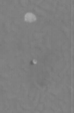
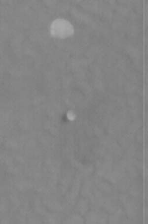
Deliberate "self portrait" shadow shot or just coincidence? A simplistic color composite based on Phoenix SSI raw images, sol 030:
Click to view attachment
A lower Sun angle with longer shadows would be more spectacular, but without a wide-angle NAVCAM type lens the full shadow might even get too big to fit in a ISS field of view - at least for the entire spacecraft. Then with the need to take multiple images you get more of that color banding due to the shadows moving of course...
Airbag
[Edit: Titles have now been added to the sol 30 page, and this one is from a sequence called "1378-8: SSI Solstice Image", so no coincidence! This shadow is thus the shortest noon one.]
Nice.
Now try viewing that with 3D specs (reversed, with left eye blue) to see that shadow floating ABOVE the ground!
This is a trick I have used in our physics lab to make 3D shadow shows - illuminate objects with two colour spotlights side by side and view the cast shadows with 3D specs.
Now try viewing that with 3D specs (reversed, with left eye blue) to see that shadow floating ABOVE the ground!
This is a trick I have used in our physics lab to make 3D shadow shows - illuminate objects with two colour spotlights side by side and view the cast shadows with 3D specs.
QUOTE (ngunn @ Jun 26 2008, 10:39 AM)
Now try viewing that with 3D specs (reversed, with left eye blue) to see that shadow floating ABOVE the ground!
Cool! Even more bizarre is to use the glasses the "right way" around, then the shadow looks like it is at a the bottom of a shallow lake that has a "rocky" water surface.
Airbag
QUOTE (MahFL @ Jun 23 2008, 12:15 PM)
When I was looking at the Hi-Rise of the Phoenix Lander on the surface I can see channels that look like small river channels. Did anyone else notice this ?
I think Percival Lowell did.
What are these for?
Looks like the lowest resolution possible of the horizon and the sky???
any guesses?
<sol 29, 30>
Click to view attachment
Look at Marks page - they are described as sky water observations. Solar filtered ( thus long exposure and noisy ) horizon obs.
Doug
Doug
QUOTE (ahecht @ Jun 26 2008, 11:54 PM)
I think Percival Lowell did.
BROTM (= Best Reply Of The Month)!
QUOTE (ahecht @ Jun 26 2008, 04:54 PM)
I think Percival Lowell did.
Although Lowell thought he saw "man"-made canals. As for seeing evidence of water channels generally on this very dry world, Lowell has plenty of modern company. In fact, the word "water" almost seems to inhabit every other sentence in the history of Mars scientific inquiry and ruminations, relative lack of said substance notwithstanding.
QUOTE (Airbag @ Jun 26 2008, 02:23 PM)
[Edit: Titles have now been added to the sol 30 page, and this one is from a sequence called "1378-8: SSI Solstice Image", so no coincidence! This shadow is thus the shortest noon one.]
Except that this image was taken at almost 7pm...
QUOTE (jmknapp @ Jun 27 2008, 06:28 PM)
Although Lowell thought he saw "man"-made canals. As for seeing evidence of water channels generally on this very dry world, Lowell has plenty of modern company. In fact, the word "water" almost seems to inhabit every other sentence in the history of Mars scientific inquiry and ruminations, relative lack of said substance notwithstanding.
There are billions of tonnes of water on Mars. It's mostly frozen though..........
QUOTE (fredk @ Jun 27 2008, 01:56 PM)
Except that this image was taken at almost 7pm...
I sit entirely corrected; the azimuth of 110 degrees is also a giveaway that this image was taken looking almost due East, i.e. it is an early evening shot. So, this is the shortest shadow for around 7pm
Next time I will be more careful...
Airbag
QUOTE (jmknapp @ Jun 27 2008, 12:28 PM)
Although Lowell thought he saw "man"-made canals. As for seeing evidence of water channels generally on this very dry world, Lowell has plenty of modern company. In fact, the word "water" almost seems to inhabit every other sentence in the history of Mars scientific inquiry and ruminations, relative lack of said substance notwithstanding.
The point I was trying to make is that the human brain is very good at connecting the dots, especially in low contrast images, and see lines where there are none.
QUOTE (ahecht @ Jun 27 2008, 12:37 PM)
The point I was trying to make is that the human brain is very good at connecting the dots, especially in low contrast images, and see lines where there are none.
Absolutely right. Especially given that in Lowell's time, it was generally assumed that the Moon and other planets (especially Mars, given its telescopically visible polar ice cap and seasons) had intelligent beings living on them. Even when I grew up, about 75 years later, it was still assumed that Venus was a habitable jungle world. In a very real sense, then, Lowell was just seeing what he assumed he might see. At the time, few had reason to doubt his vision.
-- HDP Don
QUOTE (Airbag @ Jun 26 2008, 03:23 PM)
Deliberate "self portrait" shadow shot or just coincidence? A simplistic color composite based on Phoenix SSI raw images, sol 030:
[attachment=14835]
[Edit: Titles have now been added to the sol 30 page, and this one is from a sequence called "1378-8: SSI Solstice Image", so no coincidence! This shadow is thus the shortest noon one.]
[attachment=14835]
[Edit: Titles have now been added to the sol 30 page, and this one is from a sequence called "1378-8: SSI Solstice Image", so no coincidence! This shadow is thus the shortest noon one.]
Looks like a bit of "opposition effect" here, and would be interesting to examine this at the highest possible solar elevation.
Steve
P.S. I'm unsure how to show the attachment in my quote, but you can see it in post #219.
Hello everyone, I'm a newbie again (felt scared off last time). I have been lurking for some considerable time since my first registration. Now I feel, that I can contribute in a more meaningful manner.
A couple of images from Phoenix below & some confirmation & to share a thought / idea.
If my maths is correct, Phoenix lies approx 1,303 KM / 809 miles away from the North Pole?
Below, I had a go at working on the central portion of the colour pan looking north. I have cropped out the section from Azm 350 deg, to 10 degrees, therefore due north is dead centre.
There are three low rises visible on the horizon? Pingos perhaps? Any thoughts.
Click to view attachment
Below is the view centred on Azm 151.58 degrees, showing two large boulders. The nearer one, I wonder, could that be examined in high resolution through all filters on the SSI & that data be matched by HiRISE of Heimdall Crater, to see if that boulder is a match? I suspect the one right on the horizon is too far away? That large boulder to the north of the backshell is very interesting. I could not find it on the HiRISE image of the landing site of Phoenix & components.
My guess is that this boulder would have been large enough to have been seen, or is it deceptive, smaller & closer to Phoenix than I'm imagining?
Click to view attachment
Also I thought this knarled up piece of rock looked very interesting. I have cropped & enlarged it.
Click to view attachment
Does anyone know if any Midnight Sun observations are going to be made? Perhaps a time lapse movie of the Sun swooping low over the northern horizon? Also this would be a good time for Azm 90 & 270 degree views & for glows / high cloud studies/ Martian Parhelia. Any thoughts?
Hopefully I will be feeling more confident once I've been back a while.
{Edited: Added some text}.
Andrew Brown.
QUOTE (3488 @ Jul 1 2008, 12:40 PM)
The nearer one, I wonder, could that be examined in high resolution through all filters on the SSI & that data be matched by HiRISE of Heimdall Crater, to see if that boulder is a match?
I assume you mean the one I've arrowed in the inset:
Click to view attachment
I think I've identified it on the hirise view (arrow). The azimuth looks right (a bit "left" of the backshell) and the distance too (comparable distance to the heatshield). Obviously its colour is a close match to the surroundings, but you can see a shadow in the hirise shot which looks right.
Andrew, interesting image that, looking due north . . .
QUOTE (fredk @ Jul 1 2008, 04:51 PM)
I assume you mean the one I've arrowed in the inset:
Click to view attachment
I think I've identified it on the hirise view (arrow). The azimuth looks right (a bit "left" of the backshell) and the distance too (comparable distance to the heatshield). Obviously its colour is a close match to the surroundings, but you can see a shadow in the hirise shot which looks right.
Thank you so very much, that's it. The positioning on the HiRISE image is perfect, 151.5 degrees Azm from Phoenix. That is definitely it. I really hope that the boulder will be a target of interest, when the SSI is used to cherry pick interesting features.
Below, near the WNW horizon, I think I may have spotted a small impact crater, at the bottom of this frame, I've cropped & enlarged. I know, it's rubbish compared to the professionals here on UMSF, but I thought this would be of interest. Also blocks & boulders on the hills?
Click to view attachment
QUOTE (glennwsmith @ Jul 1 2008, 06:30 PM)
Andrew, interesting image that, looking due north . . .
Thank You. Yes I like that image very much. It is a crop from the colour swathe released a while back, but I altered the contrast & brightness a little bit & the result is what you see. Carry on straight up the middle, & eventually you will come to the pole.
The image I cropped it from is below. Also the due north point is in the very centre.
Click to view attachment
Andrew Brown.
( Edit - remove foolish attempt at stretching the wrong bit of Andrew's image... !!)
It looks suggestive to me, but I haven't the time or especially the skills to search in that direction for candidate features on an orbital view.
PS No need to feel intimidated, we don't bite! I, at least, have a lot less skill with imagery than you've already demonstrated
EDIT: ...and to prove it, I completely misinterpreted your post and did an excited stetch of the horizon, convinced I could see a typical crater...
This is a big part of what I like about UMSF -- the international aspect. "Carry on straight up the middle, and eventually you will come to the pole" -- the essence of British matter of fact mode. Of course, we will never be able to top the romance language mystique of the "Ultreya Abyss"!
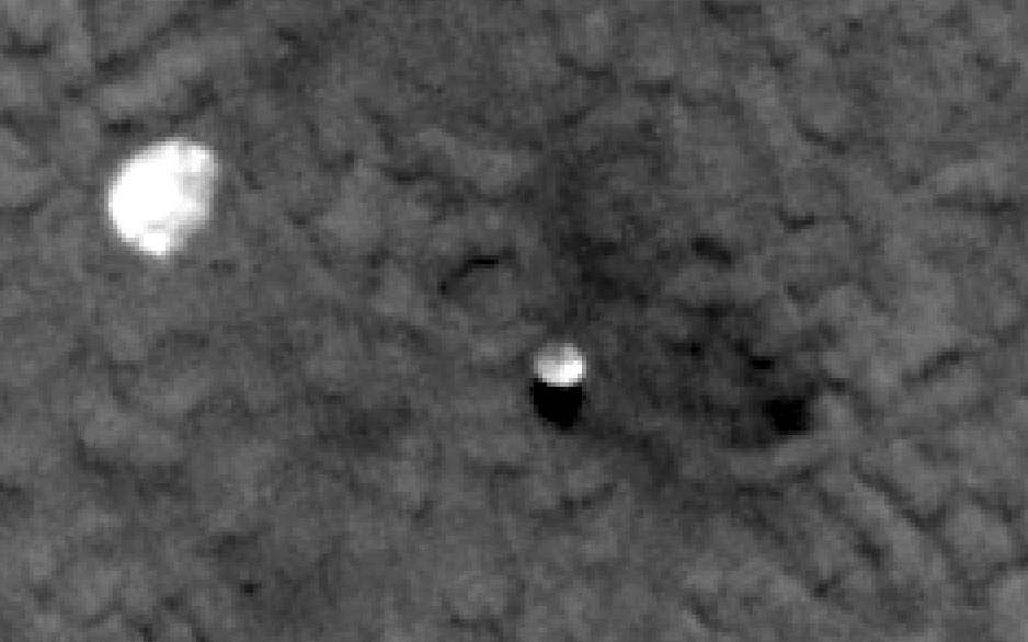
I need some help. The HiRISE team has released a new image of the Phoenix landing site, taken on June 16 (sol 21). The dynamic range in this image is big enough that detail in the parachute is lost to saturation in the version that I can view with IAS viewer, and I'm traveling and not on a connection reliable enough to download any of the big images. Is there someone out here who can get me a segment of the RED image maybe in a 16-bit format that preserves the detail in the parachute?
--Emily
--Emily
QUOTE (elakdawalla @ Jul 15 2008, 05:23 PM)
Is there someone out here who can get me a segment of the RED image maybe in a 16-bit format that preserves the detail in the parachute?
I looked at the JP2 images--not sure if the following have more detail than the largest wallpaper on the HIRISE site, but they're different anyway:
Those are just JPG crops, with a little processing--not sure how to get a 16-bit format.
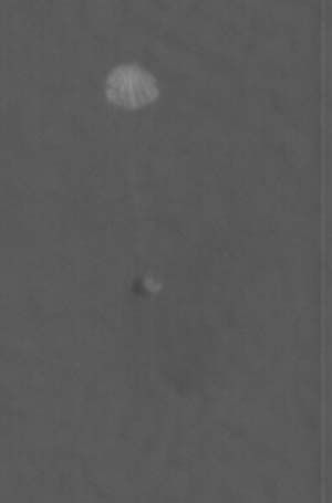
I'm impressed you can see the coloured stripes on the parachute! HiRise just keeps amazing me.
Agreed. The latest shot is about the sharpest I've seen of all the landers, especially impressive is the red backshell and parachute with the lines clearly visible. You can clearly relate it to the ground view of the backshell. The lighting angle is excellent as well. Great stuff.
Thanks to slinted for sending me TIFF versions, much obliged.
Yeah, seeing the colored stripes is amazing. Also, you can see the lighter color at the center of the solar panels where there is more light-colored metal than dark-colored solar cells.
There is at least one more image of the landing site, taken 5 sols post-landing, but they don't have it on the release manifest, according to what I've been told. Fortunately the wait for PDS release is very short for HiRISE
--Emily
Will we be able to stack these images? Or are they taken from diffrent angles?
QUOTE (elakdawalla @ Jul 16 2008, 01:01 PM)
Thanks to slinted for sending me TIFF versions...
Could one of you post the (16 bit?) tiff crops somewhere?
Yes, I'll do that in a bit. --Emily
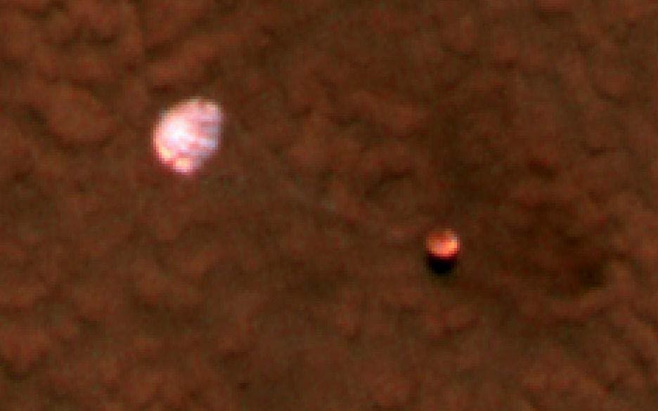
Looks like as far as the chute stripes go, the most detail is in the blue-green image:
PSP_008855_2485_BG13_1.jpg:
PSP_008855_2485_RED5_1.jpg:
PSP_008855_2485_IR11_1.jpg:
I guess that makes sense, as the stripes are red.
The above are crops from the EDR images (IMG), converted to JPG.
PSP_008855_2485_BG13_1.jpg:
PSP_008855_2485_RED5_1.jpg:
PSP_008855_2485_IR11_1.jpg:
I guess that makes sense, as the stripes are red.
The above are crops from the EDR images (IMG), converted to JPG.
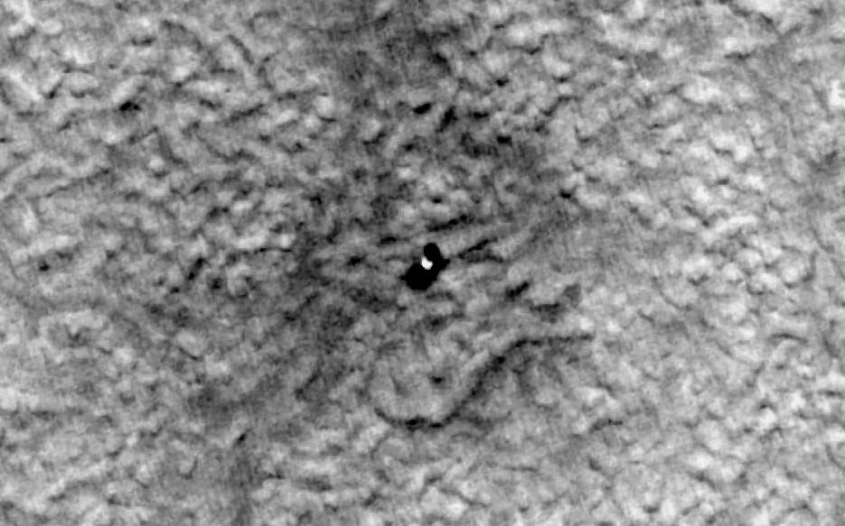
Speaking of different viewing angles, that's exactly what I am hoping for any pair of HiRISE images of the same target. Below is what results from making an anaglyph with the pre-landing image of the landingsite and the latest image with the hardware. North is up. The resolution is half of the normal HiRISE image. Added brightness and contrast.
Emily,
Looking at your blog, I found something very funny.
I first looked at the parachutte image and then sckroled down to "Buzzed by a binary" ...where the picture shown looks very much like the parachutte one with a poorest definition
Looking at your blog, I found something very funny.
I first looked at the parachutte image and then sckroled down to "Buzzed by a binary" ...where the picture shown looks very much like the parachutte one with a poorest definition
This is a "lo-fi" version of our main content. To view the full version with more information, formatting and images, please click here.