
Full Version: The Geology of Jezero Crater
This thread is for those rockhounds among us to discuss the new terrain we'll see as Perseverance scoots around her new home. Let's get dirty & technical!
QUOTE (nprev @ Feb 24 2021, 02:41 AM) 
This thread is for those rockhounds among us to discuss the new terrain we'll see as Perseverance scoots around her new home. Let's get dirty & technical!
Rule #1
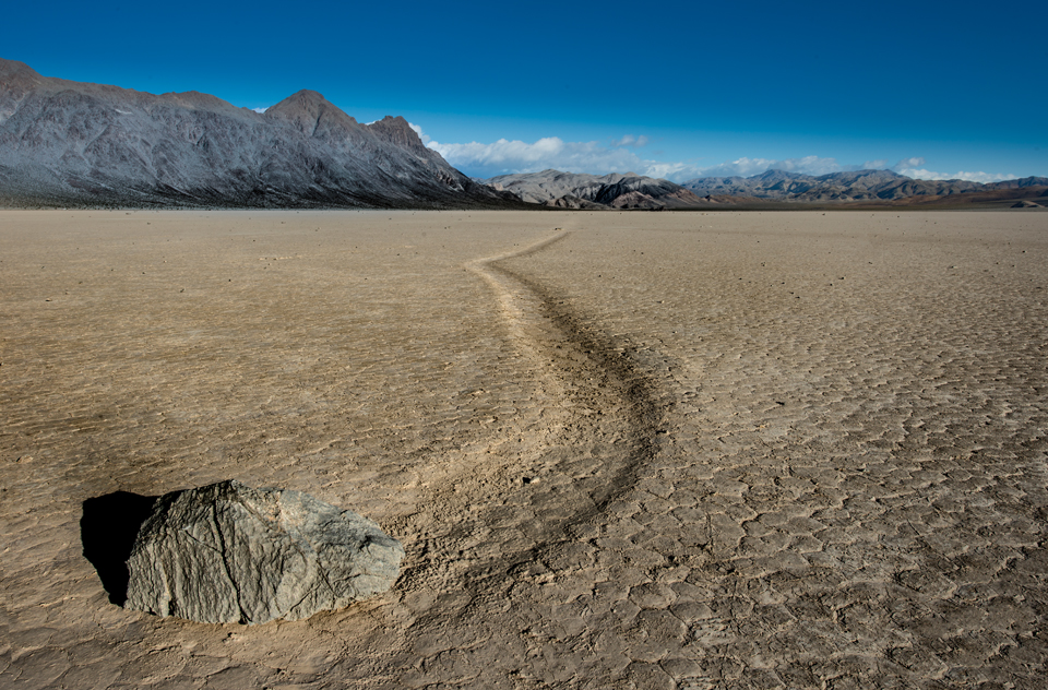
The physical processes of weathering can cause rocks to move in ways you don't expect.
Is it indeed "Geology" and not "Aresology" or some-such?
QUOTE (dougkeenan @ Feb 24 2021, 03:13 AM)
Is it indeed "Geology" and not "Aresology" or some-such?
testing the mod's patience I've gone with the rule that "*-ology" is research done by an on site "*-ologist".
By my measure, we have lots of "geologists", only 12 Apollo "seleneologists", and we're eagerly waiting for "aresologists".
This has been a discussion since the 1960s. I remember a very good piece on it in a paper about Mars by Luciano B. Ronca in about 1965.
This is how it works. 'geo-' means land, not planet Earth, though it can be used for the planet by extension from the main idea. Geography is the study and depiction of different lands (around the Mediterranean, originally, for the Greeks). Geology is the study of what the land is made of. Geomorphology is the study of the shape of the land and how it is shaped. Geodesy of course is extending the concept to the planet, but at its root 'geo-' means land.
And another point if that's not enough. If geology is the study of the Earth, we can have Selenology for the Moon and Areology for Mars, but how far do you want to take it? A different word for the study of every planet, moon and asteroid? Will Callistologists meet Ceresologists and Enceladologists at LPSC? Ultimately that is a ludicrous situation for people who are all doing the same kind of work, so a common term is desirable, and the one we use is 'geology'.
Phil
QUOTE (Phil Stooke @ Feb 24 2021, 03:52 AM)
And another point if that's not enough. If geology is the study of the Earth, we can have Selenology for the Moon and Areology for Mars, but how far do you want to take it? A different word for the study of every planet, moon and asteroid? Will Callistologists meet Ceresologists and Enceladologists at LPSC? Ultimately that is a ludicrous situation for people who are all doing the same kind of work, so a common term is desirable, and the one we use is 'geology'.
Phil
Phil
Well said.
However, I DO look forward to a time when we have "A different word for the study of every planet, moon and asteroid."
In much the same way we say "Doctor" in general but then differentiate between phlebotomist, proctologist and optometrists.
Ideally, we have "*-ologists" who work on site. However, if we get to the wonderful stage where people can devoting their careers to the research of an individual world, with unique combinations of composition and what components are solid, liquid or gas (e.g. water on Mercury, Earth, Pluto) then we should call the people who "learn that world" by the name of that place they know like a second home.
If we can accept about 75 medical "specialties", we can accept world-specific "specialties."
QUOTE
PHYSICIAN CODING
• Adult Intensivist
• Allergy
• Anesthesia
• Bariatric Medicine/Surgery
• Burn/Trauma
• Cardiac Catheterization
• Cardiology
• Cardiovascular Surgery
• Colorectal Surgery
• Dermatology
• Electrophysiology
• Emergency Medicine
• Endocrinology
• Family Practice
• Gastroenterology
• General Surgery
• Geriatrics
• Gynecologic Oncology
• Hematology/Oncology
• Hepatobiliary
• Hospitalist
• Infectious Disease
• Internal Medicine
• Interventional Radiology
• Medical Genetics
• Neonatology
• Nephrology
• Neuroradiology
• Neurology
• Neurosurgery
• Nuclear Medicine
• Obstetrics & Gynecology
• Occupational Medicine
• Ophthalmology
• Oral Surgery
• Orthopedics
• Otolaryngology / Head & Neck Surgery
• Pain Management
• Palliative Care
• Pain Management
• Palliative Care
• Pathology: Surgical & Anatomic
• Pediatric Intensivist
• Pediatrics
• Pediatric Surgery
• Physical Medicine
• Plastic & Reconstructive Surgery
• Podiatric Surgery
• Psychiatry
• Pulmonary Medicine
• Radiation Oncology
• Radiology
• Rheumatology
• Surgical Oncology
• Thoracic Surgery
• Transplant Surgery
• Urology
• Vascular Surgery
• Wound Care
ASC SPECIALTIES
• Bariatric Surgery
• ENT
• General Surgery
• Gastroenterology
• Neurosurgery
• Obstetrics & Gynecology
• Ophthalmology
• Oral/Dental Surgery
• Orthopedic Surgery
• Pain Management
• Pediatric Surgery
• Plastic Surgery
• Podiatric Surgery
• Urology
• Vascular Surgery
HOSPITAL CODING
• Ambulatory Clinics
• Cardiac Catheterization Labs
• Diagnostic Radiology
• Emergency Department
• GI Endoscopy Labs
• Inpatient Acute Care
• Interventional Cardiology
• Interventional Radiology
• Same Day Surgery
• Small Specialty Hospitals
• Surgical Pathology
HCC AUDITS
• HCC Audits
AMBULANCE CODING
• Ambulance Coding
Because this forum is now old enough to drive, there is of course a thread for this topic of semantics:
http://www.unmannedspaceflight.com/index.php?showtopic=6615
http://www.unmannedspaceflight.com/index.php?showtopic=6615
QUOTE (HSchirmer @ Feb 23 2021, 07:32 PM)
However, I DO look forward to a time when we have "A different word for the study of every planet, moon and asteroid."
Ideally, we have "*-ologists" who work on site. However, if we get to the wonderful stage where people can devoting their careers to the research of an individual world,
Ideally, we have "*-ologists" who work on site. However, if we get to the wonderful stage where people can devoting their careers to the research of an individual world,
How would you then distinguish a volcanologist from a geologist on Mars, just to name one? Or how about meteorologist? They are all *-ologists.
I think just adding the name of the rock in front of the field of study is sufficient: "Mars geologist". Simple, effective, everyone knows the subject. No need to invent new words. Absent the name and it's implicit that it's Earth.
....aaaand, were done with the pedantry.
Let's talk about rocks. On Mars.
Let's talk about rocks. On Mars.
QUOTE (nprev @ Feb 24 2021, 07:16 AM)
....aaaand, were done with the pedantry.
Let's talk about rocks. On Mars.
Let's talk about rocks. On Mars.
Thank you nprev!
QUOTE (Don1 @ Feb 23 2021, 09:11 PM)
Some resources:
A recent USGS geological map of the Jezero Crater region (big pdf)
LPSC 2021 abstract: Mineralology of Jezero
LPSC 2021 abstract: Jezero floor unit
LPSC 2021 abstract: Carbonates in Jezero
A recent USGS geological map of the Jezero Crater region (big pdf)
LPSC 2021 abstract: Mineralology of Jezero
LPSC 2021 abstract: Jezero floor unit
LPSC 2021 abstract: Carbonates in Jezero
The link above to the abstract on carbonates in Jezero is an inadvertent duplicate of link to the the Jezero floor abstract. This is the correct link to the abstract on carbonates in Jezero: LPSC 2021 abstract: Carbonates in Jezero
For now, we have a mission that'll be exploring that floor unit, which isn't the reason why Perseverance came to Jezero but it's a matter of fate that we'll have the best set of instruments ever to reach another planet rolling over and exploring that. We're going to read the history of Mars in reverse, which is quite different from Curiosity, which hit oldest units in Gale early, then rolled upwards and forwards in time.
I like the Hundal, et al paper that compares the Jezero layering with that of Isidis. I wonder about Jezero vs. Gusev. For Spirit, the floor unit was a showstopping barrier that prevented the rover from making any direct contact with the history of the river+lake environment. The Columbia Hills ended up being a bit of a consolation prize, and a surprise, where water vented upwards after the lake was gone. I don't know if Perseverance will find anything similar in Jezero, and I doubt it, since we can see the 2km to the delta and it looks flat, but maybe there'll be some equivalent. In the short term, I think we're going to learn about the nature of a sort of "impact gardening" that took place on a massive scale on Mars, flinging rocks and boulders long distance, mantling the ancient landscapes. As such, I can't see any reason why it would be very different here than in Gusev, but maybe the individual regional impacts will make for a different story.
I'm struck by how many rocks peeking up through the sand and dust seem to hold to one general contour just at or very slightly above the surface. Does this mean that erosion has worn a once-deeper layer down a bit, and if so, what was so effective in planing these rocks down? Chemical or aeolian erosion?
QUOTE (JRehling @ Feb 24 2021, 05:00 PM)
I'm struck by how many rocks peeking up through the sand and dust seem to hold to one general contour just at or very slightly above the surface. Does this mean that erosion has worn a once-deeper layer down a bit, and if so, what was so effective in planing these rocks down? Chemical or aeolian erosion?
I'd guess a basin wide layer of hard sediment, could also be "natural cement" or caliche.
I'm in the "Newark Basin" area that stretches from Lancaster Pa to New York City. Material laid down in anaerobic deep lakes during wet conditions is very hard stone, while material laid down in shallow oxidizing water on the dry lake is very soft stone. There are several very hard layers of rock laid down in paleo lake Newark which you can easily trace for over 70 miles. You'd expect a similar effect in Jezro for large areas of horizontal sediment- material laid down in wet times should be harder and form resistant "terraces".
Interesting, in Newark basin, they're tracing climate variations / Milankovich cycles by reading oxidation states of the rock. They're actually THEN using that data to recreate what Earth's orbit, precessions and tilts were. This circumvents the chaos / "the butterfly effect" which generally precluded accurate simulations of Earth's orbital characteristics backward more that about 60 million years ago, by actually "reading" what the values were from 223 million to 199 million years ago. It should be VERY interesting to see if Curiosity and Perseverance can achieve something similar on Mars!
QUOTE
Mapping Solar System chaos with the Geological Orrery
https://www.pnas.org/content/pnas/116/22/10664.full.pdf
https://www.pnas.org/content/pnas/116/22/10664.full.pdf
What we see now in the near distance is not thought to be sedimentary layers formed in the lake. It is material emplaced as ejecta from impacts and aeolian deposits. Perseverance is not resting on the bottom of the lake. It is resting on material that is covering the bottom of the lake.
https://pubs.er.usgs.gov/publication/sim3464
"Volcanic ash or eolian airfall deposit that drapes underlying topography."
https://pubs.er.usgs.gov/publication/sim3464
"Volcanic ash or eolian airfall deposit that drapes underlying topography."
QUOTE (JRehling @ Feb 24 2021, 09:55 PM)
What we see now in the near distance is not thought to be sedimentary layers formed in the lake.
Agreed - I was thinking about the delta and Van Houten cycles.
QUOTE (Cyclicity @ Climate , and Time scales")
Orbital forcing in the Newark basin is revealed as a hierarchy of lake level cycles that controlled by precipitation and evaporation changes controlled by precession-related celestial mechanical cycles.
https://www.ldeo.columbia.edu/~polsen/nbcp/cyclcicity.html
https://www.ldeo.columbia.edu/~polsen/nbcp/cyclcicity.html
The consensus seems to be that the crater floor was flooded by lava some 300 million years after the lake dried up which embayed sedimentary/deltaic deposits. There has been some erosion of the delta material since then so a proportion of the aeolian deposit that JRehling noted drapes underlying topography could well be of deltaic origin. The area west of the Isidis basin, including Jezero crater reveals olivine‐carbonate lithology; in Jezero crater concentrated at the Western rim with some deposits in the delta. Given the dearth of carbonates elsewhere despite what seems to have been plentiful water in a CO2 atmosphere it will be really interesting if Perseverance can determine why it was preserved in this particular area.
JRehling...." I think we're going to learn about the nature of a sort of "impact gardening" that took place on a massive scale on Mars."
Most possible, but using that term here is akin to lighting a blue touch paper.
JRehling...." I think we're going to learn about the nature of a sort of "impact gardening" that took place on a massive scale on Mars."
Most possible, but using that term here is akin to lighting a blue touch paper.
One detail in the Sol 3 panorama that's especially informative is the northernmost (furthest right) delta face. I cropped it and moreover turned up contrast in the red channel to bring out a subtle color contrast.
The first thing I notice is that here, as elsewhere, the delta's eastern slopes are mainly smooth, with the expected sedimentary layers covered. The layers are visible, though, more than in other places in the delta. The route plans we've seen would never bring Perseverance close to this area, instead heading well south, where outcroppings are from the landing site hard to see. The mission team may gamble that with any route that ascends the delta, the layers will nonetheless make themselves apparent closer up.
I'm also struck by the fact that the layers are not horizontal. There has been tilting since the lake dried up.
My manipulation of the color contrast was intended to explore the smooth mantling of the delta slope, and I think the patchy variation speaks to two types of material. The darker, greener material appears to be talus derived from the delta itself, while the brighter, redder material is the global coating of dust, which is universally present in this photo in the near distance, the far distance, and atop the delta. What's not clear is how much the contrast seen in the patchiness has to do with changes in texture versus abundance of one material versus the other, but that may be one and the same: Where larger pieces of talus exist, we see the rough sides of them, and elsewhere, the global dust unit covers it up.
As Perseverance approaches the delta, we will begin to see more pieces of the delta that moved downslope. However, the area just east of and below the delta will likely be a jumble of pieces from different layers, and while each of those rocks will be individually interesting, the jumbling will deny us information about which piece came from which layer, and may be something the mission planners choose to move past fairly quickly, opting to get sooner up and to the layers themselves, where each unit studied will come with the context provided of which unit in the delta is that unit's home.
QUOTE (JRehling @ Feb 25 2021, 04:29 PM)
I'm also struck by the fact that the layers are not horizontal. There has been tilting since the lake dried up.
Most river delta deposits slope downward when they hit a much larger lake or ocean.
Similarly, the first sediment to drop out of the current is the heaviest- the largest and most incompressible gravel and grit. The further from the delta mouth you get, the finer, and more "hydrated" the sediment becomes. When the delta is eventually compressed or dries out, there's more "shrinkage" in the more distant sediment beds.
Delta erosion
At distances of a few hundered meters to a kilometer away from the current edge of the main delta deposits, there are a few isolated hills which could be classified as Inselbergs or outliers. Here is an example:
https://mars.nasa.gov/maps/location/?mission=M20&site=jez&mapLon=77.40930318832399&mapLat=18.444092466139594&mapZoom=15&globeLon=77.42958068847659&globeLat=18.463327291058505&globeZoom=12&globeCamera=0,-4882.8125,0,0,1,0&panePercents=0,100,0&on=Current Position$1.00,Waypoints$1.00,Surface View$1.00,Landing Ellipse$1.00,Rover Path$1.00,Labels$1.00,Basemap$1.00,North East Syrtis Base Map$1.00://https://mars.nasa.gov/maps/location...e Map$1.00
A typical, geological interpretation of such isolated hills is that they were once connected to a main, better preserved area, here the delta, and became disconnected by erosion. The Inselbergs would be therefore witnesses to a former, larger extent of the delta, and in german such features are called Zeugenberg (witness = Zeuge). Given the similar appearance in terms of height and a flat top and a spatial correlation with the edge of the delta, this to me would be the preferred interpretation of the formation of this hills. This could be tested by examining the local stratigraphy of the delta and the hills with the expectation that there should be a good match.
If this is the case, the delta was eroded back from its largest extent. This is to be expected during the time when the lake started to retreat to below delta levels. The current, abrupt edge of the delta is also more likely to have been shaped by erosion than being an original feature. Growing deltas tend to taper out into deeper water and transition into fans, leading to gentle slopes of a few degrees.
One question then becomes where did the significant mass of eroded delta sediments go ? Perhaps there have been mass balance studies but one possible candidate is the smoother appearing material covering the plane just below the slope of the delta in a ring a few km wide in places. This ring appears to be less cratered than the center of the crater.
Following the discussion it is also possible that the youngest sediments now are exclusively aeolian, and from impact dust and debris, and that eroded, reworked, and redeposited delta sediments are completely hidden below a top soil, accreted layer. And beneath both of those, there could be original lake bottom sediments. So it may make sense to investigate the craters closer to the rover which could have excavated deeper lake bottom sediments. But the safest place to get fluvial, water dominated, pristine material for sampling is probably right at the face of the current edge of the delta.
A few thoughts, mainly on the importance of the outliers surrounding the current delta.
QUOTE (Andreas Plesch @ Feb 26 2021, 10:44 PM)
Delta erosion
...
A few thoughts, mainly on the importance of the outliers surrounding the current delta.
Excellent summary....
A few thoughts, mainly on the importance of the outliers surrounding the current delta.
So, have any graduate students made a vacuum-formed crater and experimented with filling it with sediments and varying the water / sediment ratio to see what it takes to recreate the delta?
(Asking as "that kid" who filled the little red wagon with cement, sand & stone, dropped marbles to create craters for an "authentic" moonscape for the Mattel 'Space 1999 Eagle' to land on...)
Good post Andreas. The isolated hills have been nominated by some as delta remnants although I haven't been able to find confirmation that their minerology matches the delta. If they are remnants then the erosion between them and the delta must have occurred in the (geologically short) gap between the crater drying and the lava flood. The attached image shows that the lava embayed the delta and I have marked what may be an example of embayed delta material eroding down below the lava level. But the lava would have covered the delta bottom sets and part of the foresets, preventing further erosion of the lighter materials. Jezero is a big crater and aeolian eroded material from the delta would not be particularly evident.
QUOTE (serpens @ Feb 27 2021, 12:00 AM)
If they are remnants then the erosion between them and the delta must have occurred in the (geologically short) gap between the crater drying and the lava flood.
Question- why couldn't that be later aeolian weathering? Similar to what roto-rootered away hundreds of meters / yards of sediment at Gale crater?
Is there a consensus about whether the deposit is ash, (dry then flooded, or deposited in a lake) or extrusive lava?
QUOTE (HSchirmer @ Feb 26 2021, 07:41 PM)
Question- why couldn't that be later aeolian weathering? Similar to what roto-rootered away hundreds of meters / yards of sediment at Gale crater?
Is there a consensus about whether the deposit is ash, (dry then flooded, or deposited in a lake) or extrusive lava?
Is there a consensus about whether the deposit is ash, (dry then flooded, or deposited in a lake) or extrusive lava?
Well, I admit I did not take a detailed look at the latest geologic map, linked above, before. But it more or less confirms a few of my assumptions. The outliers are indeed mapped as the same unit (NHjf2, Jezero fan unit 2) as the main delta, and it explains that the Jezero floor unit (Njf) is covered near the delta by a smooth layer: "Dark, smooth surface texture near unit NHjf2 is due to a dark mantle deposit or erosional lag derived from erosion of unit NHjf2.". The Jezero floor unit itself is revised from lava flood flow to ash and/or aeolian airfall deposits (not sure if that was by consens), and is older than the delta, but still seen as lacustrine, so possibly deeper water deposits. In addition there should also be clastic, distal flan floor deposits. These may have been mostly muddy and as such more easily blown away once the lake bed was exposed as they are not to be found.
The floor unit then embays and sits above the Lower etched unit, also seen as volcanic ash falling into the lake. Thanks, serpens, for pointing out that nice contact. It looks to me like an erosional window into that deeper unit which is also lacustrine.
Delta erosion could have occurred by water in the manner of retreating waterfalls which is geologically efficient and does not take much geologic time (cm to m per year if water is regularly flowing). [Still strange to me looking at preserved billions of years old units, possible on a planet without plate tectonics which just sits there.]
The geologic map shows hills or outliers about 2km to the _east_ of the rover, as Jezero fan unit 2, farther from the delta as I first thought. This would mean that the delta was perhaps about double the radial length, or 4 times the area (and volume and mass ignoring changes in thickness), at an earlier point than what remains today. Hard to see that all that eroded material could have been transported very far away but it looks like it could have been. perhaps even out of the crater into the regional sink, Isidis Planitia ?
The nice lobes of the delta as seen today could have been preserved by preferential erosion preserving orginally larger lobes. Perhaps the outliers are remnants of just the larger lobes reaching out into the basin.
The possibility that the mafic floor unit is sedimentary has been floated for some time but the general consensus is that it is a volcanic deposit. As with Curiosity I am sure that Perseverance will clarify satellite assessments of this part of Jezero. Shahrzad et al. Crater Statistics on the Dark‐Toned, Mafic Floor Unit in Jezero Crater, Mars (Geophysical Research Letters) determined the average thickness of this deposit at the margins to be ~13.0 ± 0.8 m. https://www.hou.usra.edu/meetings/lpsc2020/pdf/1608.pdf raises the possibility that it could be pyroclastic rather than effusive.
HSchirmer's question on whether the gap between outliers and the delta could be later aeolian erosional is well taken. My take is that if this were so then the mafic deposit would have embayed the area rather than covering it. However we will probably need to wait for next years LPC to get Perseverance's analysis.
HSchirmer's question on whether the gap between outliers and the delta could be later aeolian erosional is well taken. My take is that if this were so then the mafic deposit would have embayed the area rather than covering it. However we will probably need to wait for next years LPC to get Perseverance's analysis.
QUOTE (serpens @ Feb 27 2021, 03:28 AM)
The possibility that the mafic floor unit is sedimentary has been floated for some time
I guess that's where we're talking past each other - I'm thinking of ashfall into a lake as sedimentary, I seems like you're considering ashfall as volcanic? I have to admit, that's a tough call to make...
QUOTE
UNDERSTANDING THE CONTINUITY OF REGIONAL UNITS IN THE MARS 2020 JEZERO AND NORTHEAST SYRTIS REGIONS: IMPLICATIONS FOR THE ORIGIN OF THE MAFIC UNIT(S).
50th Lunar and Planetary Science Conference 2019 (LPI Contrib. No. 2132)
"If so, the presence of this mafic unit across a large regional extent and its draping occurrence on topographic slopes (especially on Jezeros rim) is highly suggestive of clastic deposition, perhaps via airfall, rather than by a volcanic flow origin."
"If the mafic unit is indeed the same unit at both NE Syrtis and Jezero, then this would likely preclude a volcanic flow origin n3
and instead favor a draping emplacement mechanism, such as ashfall deposition or other clastic sedimentary mechanism. "
https://www.hou.usra.edu/meetings/lpsc2019/pdf/2271.pdf
Does anyone know which rock Perseverance will examine first? Could it be the one with the "holes" in it right next to one of its wheels?
No news on that yet. Things are just ramping up after the software switch so we will see soon.
Phil
Phil
Click to view attachment
This image was cropped from the mastcam-z pan. It appears the wind scouring of the "holey rocks" at the base of the rover show a prevailing direction occurred for a long period of time. If aeolian deflation of the delta occurred, then the sediments likely were deposited in that direction.
If the hardness of the holey rocks and delta deposits can be assessed, then the total mass lost to erosion would have an estimate. I also wonder if the wind helped scour some of those holes larger?
QUOTE (Marz @ Feb 27 2021, 12:38 PM)
Click to view attachment
This image was cropped from the mastcam-z pan. It appears the wind scouring of the "holey rocks" at the base of the rover show a prevailing direction occurred for a long period of time. If aeolian deflation of the delta occurred, then the sediments likely were deposited in that direction.
If the hardness of the holey rocks and delta deposits can be assessed, then the total mass lost to erosion would have an estimate. I also wonder if the wind helped scour some of those holes larger?
This image was cropped from the mastcam-z pan. It appears the wind scouring of the "holey rocks" at the base of the rover show a prevailing direction occurred for a long period of time. If aeolian deflation of the delta occurred, then the sediments likely were deposited in that direction.
If the hardness of the holey rocks and delta deposits can be assessed, then the total mass lost to erosion would have an estimate. I also wonder if the wind helped scour some of those holes larger?
Vesicular basalt can look a bit like the holey rocks:
_(14838828059).jpg/640px-thumbnail.jpg)
This example is from Hawaii and also has some Olivine in it. The texture is quite common in basalts and less common in pyroclastic deposits. The holes are trapped gas bubbles forming during degassing. Pumice would be an extreme example.
I think these holey rocks would make an attractive target for testing all the instruments. Not sure if similarly textured rocks had been observed before and they seem to be in-situ, eg. bedrock which would help with understanding the mapped unit as a whole.
While these "holey" rocks appear light in color around the rover, the rocks that were blasted clean by the descent stage nozzles appear dark, just like the basalt example above. I'd say that's probably what they are.
QUOTE (Andreas Plesch @ Feb 27 2021, 02:24 PM)
Vesicular basalt can look a bit like the holey rocks:
Yes, I think the crater floor rocks in the vicinity of the rover are expected to be volcanic in origin (based on orbiter data) with the holes caused by gas bubbles. In the mastcam image, small rocks and sand can be seen inside the vesicles, which can act to abrade features much faster. Perhaps that debris is simply from the retro-rocket plume stirring stuff up though.
There's a chance the linear features on those rocks were not caused by wind and instead from how the igneous rock formed, but my hunch is they show an extremely long-term prevailing wind for Jezero.
If the crater floor is covered by ash or other volcanic material, if Perseverence heads up the delta toward the inflowing river bed, would it be able to find any of the original river- or lake-bed shallow enough that its instruments can reach it? I suppose this area is a major destination for the helicopter.
QUOTE (Marz @ Feb 27 2021, 06:38 PM)
This image was cropped from the navcam pan. It appears the wind scouring of the "holey rocks" at the base of the rover show a prevailing direction occurred for a long period of time. If aeolian deflation of the delta occurred, then the sediments likely were deposited in that direction.
Very interesting- those grooves look VERY much like what you find in glacial till - rocks that were held in place by soil as ice was flowing over them, or small pieces of rock that were held in place by ice which flowed over other rocks. It should be fairly easy to determine, as the orientation of the grooves should quickly reveal if weather or wether is responsible. QUOTE (Marz @ Feb 27 2021, 06:38 PM)
If the hardness of the holey rocks and delta deposits can be assessed, then the total mass lost to erosion would have an estimate. I also wonder if the wind helped scour some of those holes larger?
The voids/vugs are fairly small, for aeolian 'pot holes" but most DO seem to have the signature of water-worn potholes, a single abrasive rock in each chamber. If should be easier to know what is happening after a few more rocks are imaged.
It's virtually certain that some of the material from the lake pebbles here and there would be part of the regolith around Perseverance, but lacking context, they won't be as valuable to study as the rock in layers where the relative ordering is known.
The original lake bed is certainly not within reach soon. That said, the end of the lake was probably not a completely binary event, and there may have been some time near the end when the lake was first dry, and then later got a little bit of temporary recharge. The 2020 USGS publication about Jezero notes the possibility that the landing site had been reworked with later lacustrine environments. This would be of interest, but clearly secondary interest, as a place that was "habitable" for a few days or months would be much less interesting than a place that was "habitable" for a million years.
Remember, Spirit completely failed to access the original lakebed of Gusev, but surprisingly found evidence of aqueous evolution in the Columbia Hills. While we certainly don't see a Columbia Hills very close to Perseverance now, it would be hard to rule out later aqueous activity in the layer where it landed. But the actual delta layers are going to take a while to access.
Curiosity reached Yellowknife Bay on Sol 125. Perseverance has about twice that distance to go before reaching the delta, and it's possible that the morphology of the edge of the delta will keep us from touching that material without considerably longer traversals to the south (or north). I don't think we've had a chance yet to see the material wherever it is where Perseverance will first sample the delta layers. And we possibly will still be saying that in June and July.
QUOTE (HSchirmer @ Feb 27 2021, 01:33 PM)
..... I'm thinking of ashfall into a lake as sedimentary, I seems like you're considering ashfall as volcanic? ....
Ashfall has a volcanic provenance but I don't believe that the mafic floor unit was formed under such a process. I feel it is is probably effusive, pyroclastic maybe perhaps. Time and Perseverance will tell. The gap between the outlying remnants and the delta indicates that there was significant erosion with step back of the delta front measured in kilometres before the MFU was formed. This would support the assessment that the MFU formed some 300 million years after the lake dried up.
Andreas image (post #29) seems indicative of aeolian erosion with flutes / stretched vesicles.
Yes, these lineations may have formed from aeolian erosion, indicating prolonged surface exposure (perhaps when there was still more of an atmosphere). The apparent stretching may be from obliquely cutting through vesicles. Since the holes seem to appear on all sides of imaged examples, I think it is less likely that they are potholes from scouring and milling. But it would be insightful to drill to see if there are similar holes in the interior of a large block.
I would also the envision the drying of the lake as a longer process, with wetter and drier periods. Are there thoughts on potentially multiple lake filling events ? After drying up substantially ?
Here is a cool new image of that outlier, first pointed out over in the general thread:
https://mars.nasa.gov/mars2020-raw-images/p...6_110085J01.png
There is nice stratigraphic layering, perhaps cyclic, and what appears to be a thick layer of foresets prograding outwards, above halfway up the slope or so. It may be possible to find the same sequence in the main delta (if and when the rover can get closer).
Great look at the layering in the outlier, Andreas.
Another possibility would be to find a match between those layers and the ones in the crater wall, in case this is something that formed before the delta and remained intact through martian history.
Another possibility would be to find a match between those layers and the ones in the crater wall, in case this is something that formed before the delta and remained intact through martian history.
QUOTE (JRehling @ Feb 27 2021, 09:42 PM)
Great look at the layering in the outlier, Andreas.
Another possibility would be to find a match between those layers and the ones in the crater wall, in case this is something that formed before the delta and remained intact through martian history.
Another possibility would be to find a match between those layers and the ones in the crater wall, in case this is something that formed before the delta and remained intact through martian history.
For convenience, reproduced here, with grey lines indicating potential foresets in a massive layer:

QUOTE (Andreas Plesch @ Feb 27 2021, 08:24 PM)
Vesicular basalt can look a bit like the holey rocks:
This example is from Hawaii and also has some Olivine in it. The texture is quite common in basalts and less common in pyroclastic deposits. The holes are trapped gas bubbles forming during degassing. Pumice would be an extreme example.
I think these holey rocks would make an attractive target for testing all the instruments. Not sure if similarly textured rocks had been observed before and they seem to be in-situ, eg. bedrock which would help with understanding the mapped unit as a whole.
If thats Vesicular basalt then isbit safe to say we havent landed in an area that was aquactic
Opportunity and Curiosity both found rocks that were formed in aquatic environments. The shape of a rock isn't the only thing to know about it.
QUOTE (Blue Sky @ Feb 27 2021, 07:39 PM)
If the crater floor is covered by ash or other volcanic material, if Perseverence heads up the delta toward the inflowing river bed, would it be able to find any of the original river- or lake-bed shallow enough that its instruments can reach it? I suppose this area is a major destination for the helicopter.
The helicopter is a demonstration mission, it's not flying anywhere to view stuff, it's only doing 3 short demo flights as far as I know.
this is a high-level description of the regional geology of Jezero with the relative ages:
https://phys.org/news/2021-02-geologists-pe...rance-site.html
https://phys.org/news/2021-02-geologists-pe...rance-site.html
QUOTE (Andreas Plesch @ Feb 28 2021, 04:14 AM)
For convenience, reproduced here, with grey lines indicating potential foresets in a massive layer:
This post correlates to Demko's post #392 in the Perseverance Lands In Jezero Crater thread. The direction of sediment flow raised by Tim's assessment has implications for the original size and configuration of the delta and potentially interactions between the two deltas.
QUOTE (Marz @ Feb 28 2021, 09:42 PM)
this is a high-level description of the regional geology of Jezero with the relative ages:
Good summary- TLDR version- Exploring Mars is like "Russian Dolls with logarithmic crater sizes.
1) A lunar sized body obliterated the entire northern polar region of Mars leaving the "North Polar Basin." This impact is about the same class as the collision that created the Earth's moon.
2) At the southern edge of the "North Polar Basin" a smaller impact creates Isidris basin, roughly 950 miles across. This impact crater is about 7x the diameter of the 'dinosaur killer' crater at Chicxulub.
3) At the western edge of the Isidris impact basin, an impact created Jezro crater, about 30 miles across. This is roughly comparable to the size of the "Chesapeake Bay" impact crater on the US east coast.
4) Perseverance landed east of "Belva Crater" which is an impact crater on the delta deposits that is roughly the size of "Meteor Crater" in Arizona.
If caves created by ancient running waters
existed in this region, would they have likely
already been spotted by orbital imaging?
Far as I know, all Martian caves known so far are
attributed to vulcanism, right?
existed in this region, would they have likely
already been spotted by orbital imaging?
Far as I know, all Martian caves known so far are
attributed to vulcanism, right?
Hat tip to serpens for finding a paper about coastlines of 2 possible high stands of Mar's northern ocean.
The paper also 'raises' three interesting possibility about Jezro crater. First, Jezro appears to have formed at the shoreline of Mar's highest northern ocean, the basin floor could have been below sea level. Very interesting - were the oceans around long enough to become salty?
Second, Crustal deformation associated with the Tharsis bulge & Isidris gravity anomaly appears to have caused the area of Isidris where Jezro crater is to slowly sink almost 2km. Very interesting to ask whether Jezro dropped fast enough that it might have occasionally been under the waves of the northern ocean. A very interesting side effect of the entire Isidris basin slowly dropping is that it might have preserved many layers of shallow water sediments, which is VERY interesting for recreating climate records. A similar situation (slowly sinking land creates a long-lived but always shallow lake which records climate changes) is what is being used to turn Van Hounten cycles into a"Geological Orrey" to determine the parameters of Earth's orbit millions of years ago.
Finally, Jezro appears to have remained above the 2nd northern ocean, but water flowing through Jezro ending up in an inland sea filling the Isidris basin.
QUOTE (serpens)
An interesting abstract from LPSC 2021 which includes...
https://www.hou.usra.edu/meetings/lpsc2021/pdf/1605.pdf
The paper is https://www.hou.usra.edu/meetings/lpsc2021/pdf/1605.pdf
QUOTE
ARE WE VISITING THE COASTLINES OF MARS? LOAD-CORRECTED PALEO-OCEAN LEVELS AT
JEZERO, OXIA PLANUM, AND GALE. R. I. Citron , M. Manga , D. Hemingway and A. Plattner
Link to one of papers cited as a reference in the LPSC 2021 paper
JEZERO, OXIA PLANUM, AND GALE. R. I. Citron , M. Manga , D. Hemingway and A. Plattner
Link to one of papers cited as a reference in the LPSC 2021 paper
QUOTE
Lithospheric structure and tectonics at Isidis Planitia, Mars
J. Andreas Ritzer ∗, Steven A. Hauck, II -2009
https://artscimedia.case.edu/wp-content/upl...icarus_2009.pdf
J. Andreas Ritzer ∗, Steven A. Hauck, II -2009
https://artscimedia.case.edu/wp-content/upl...icarus_2009.pdf
The paper also 'raises' three interesting possibility about Jezro crater. First, Jezro appears to have formed at the shoreline of Mar's highest northern ocean, the basin floor could have been below sea level. Very interesting - were the oceans around long enough to become salty?
Second, Crustal deformation associated with the Tharsis bulge & Isidris gravity anomaly appears to have caused the area of Isidris where Jezro crater is to slowly sink almost 2km. Very interesting to ask whether Jezro dropped fast enough that it might have occasionally been under the waves of the northern ocean. A very interesting side effect of the entire Isidris basin slowly dropping is that it might have preserved many layers of shallow water sediments, which is VERY interesting for recreating climate records. A similar situation (slowly sinking land creates a long-lived but always shallow lake which records climate changes) is what is being used to turn Van Hounten cycles into a"Geological Orrey" to determine the parameters of Earth's orbit millions of years ago.
Finally, Jezro appears to have remained above the 2nd northern ocean, but water flowing through Jezro ending up in an inland sea filling the Isidris basin.
QUOTE (serpens @ Feb 28 2021, 05:42 PM)
This post correlates to Demko's post #392 in the Perseverance Lands In Jezero Crater thread. The direction of sediment flow raised by Tim's assessment has implications for the original size and configuration of the delta and potentially interactions between the two deltas.
Yes, agreed. I was more cautious in my interpretation but had the same impression regarding the lower set of foresets, in the shaded, right portion. In fact, I think now that the lower massive bed can be traced all the way to the base of the cliff on the right side where it is exposed again. There is the implication that there were two large scale cycles of progradation followed by regression and possibly erosion which is very typical and commonly observed in terrestrial analogues.
Perhaps just coincidence but the pre-Tharsis high stand coverage reflects the extent of olivine/carbonate deposits.

A couple of things interest me here (inset of ESP_068294_1985_RED.jp2 on the HiRISE site - endlessly fascinating image) and was wondering what others think. The released proposed track goes well south of this area yet there is much to explore here a couple of km north of Perseverance and it look like it was quite dynamic geologically in the past.
The circular volcano-like feature that I first thought was a mesa that had been separated from the main delta does not appear to be directly associated with the delta. It may have been formed by volcanism or some upwelling of plastic material other than magma. Looking closely at the plain surrounding the feature there is a network of linear fractures and a large apron of material extending to the west. To me this looks like an ice rink that has cracked up under the pressure of something very heavy. Maybe the mass of upwelled material?
There is a very picturesque v-shaped bay (It looks like Jaws about to bite Brody) in the delta that looks tantalizing. There seems to be a clearly delineated interface between the upper delta at its base in the western end of the bay (pointy end of the V) and the lower unit. These seem to be distinct units and it would be great to get the supercam and other instruments on both.
The southern arm of the bay is formed by an independent linear section of the delta that appears to have separated from the main body of the delta and created a narrow valley leaving a prominent butte at its head. It would be interesting to look at the walls of that valley more closely. There is also a partial crater at the northwestern end and a continuation of the valley beyond with another crater. these craters would give a closer look at the deeper stratification within the delta.
Finally something else that fascinates me is the faint arcuate dark feature linking the larger crater to the east of the inset through two smaller craters to its northwest. Maybe just a coincidence, but its an interesting connection between these craters.
I hope Percy gets there. Any other thoughts about interesting geologic targets?
This is a "lo-fi" version of our main content. To view the full version with more information, formatting and images, please click here.