QUOTE (PaulM @ Dec 7 2017, 06:04 AM)

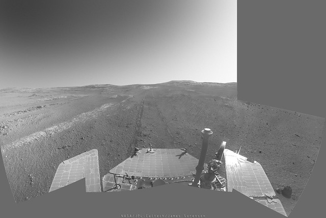
Where opportunity is headed downhill there are active sand dunes which would ensure regular cleaning took place.
Hmmm... I think that where there's sand accumulation there's a dip in strength of winds. That's why the dunes get bigger and bigger. In the past we have seen cleaning events near clean bedrock.
QUOTE
There is an argument for parking opportunity for two years there in any case because of the radio experiment that can be done to investigate the core from a parked lander.
If there was one I never heard of it. SS never mentioned that. Parking the vehicle for two years would be a major operational nightmare. We have only FIVE rover planners left which would still need to earn a living for those two years, so we would need to find another job for two years. After this forced pause, resuming operations would be quite difficult. It was so when we had to park Spirit for months at a time. I can't imagine what it would be like to resume driving after two years.
I liked doing the radio experiment on Spirit, I found it mind bogglingly cool and was part of the team to support it but I hope we can postpone this to when Oppy's wheels fall off or the motors stop responding to our commands. We have tested driving our testbed with only four active drive actuators...
Paolo