fredk
Jun 1 2010, 04:36 PM
I think there are a number of reasons to start a new thread. Squyres has confirmed we have turned east. We've passed the solstice and sunlight is now improving. Also we should be past the worst of the dunes now.
And, we've finally gotten new pics down!

And for the first time I can recall, the jpl site has beaten exploratorium! Here are the lookbacks after the 2252 and 2254 drives:
http://marsrovers.jpl.nasa.gov/gallery/all...KCP1795R0M1.JPGhttp://marsrovers.jpl.nasa.gov/gallery/all...NDP1777R0M1.JPGFor those who don't know, the jpl site is one sol out of synch. You should add one sol to those numbers (2252 and 2254) to get the actual sols.
There was a new drive on sol 2256:
http://marsrovers.jpl.nasa.gov/gallery/all...Q8P1212R0M1.JPG
Phil Stooke
Jun 1 2010, 05:07 PM
Thanks, Fred!
Phil
MarkG
Jun 1 2010, 05:13 PM
In regards to the discussion in the previous thread concerning the "geo"morphology of the benches around the Endeavour crater rim hills, this is one case where many possible explanations will be resolved [maybe] by the ground-truth of rover examination.
My personal working idea is that there were periods characterized by seasonal ice cover, which would be sometimes mobilized by bottom-ice-surface melting/brine-ing, which led to the ramp erosion seen in Victoria. On a larger scale, that could lead to some features seen on the Endeavour rim, which have some glacial-looking aspects (thinner ice, in the scenario I'm thinking of). They could be evaporite or wave benches, too, but the situation remains murky (and mostly below freezing, too).
We will also be descending from the rise we have been traveling on into darker-looking stuff, which may be the darker sediments seen a few feet down the the craters examined. One wonders if the pavement will be quantitatively different there.
Looking forward to the unknown...
Tesheiner
Jun 1 2010, 06:32 PM
QUOTE (fredk @ Jun 1 2010, 06:36 PM)

I'm waiting for the navcam mosaic from this same site to update the map... Meanwhile, say that based on the ripples' direction that was a SE drive, at least on it's latest portion.
Astro0
Jun 2 2010, 02:18 AM
Phil's 1km annotated map on the 'distant vistas' thread and Tesh's route map, make for a nice combined view of the rest of Opportunity's journey to the East (east-south-east-ish).
Click to view attachmentSo close and yet, still so far away. Go Oppy!
nprev
Jun 2 2010, 02:22 AM

...beautiful, yet sobering!
DFinfrock
Jun 2 2010, 02:39 AM
We now know the naming convention to be used on Endeavour:
QUOTE
"Well, Endeavour was one of James Cook's ships, so the places along the rim of Endeavour will be named after places discovered and explored by James Cook on his Endeavour expedition," he informed. And the spot where Opportunity will make first 'landfall' will receive one of those names, he added. A quick review of historical accounts indicates that Opportunity on arrival, and perhaps even as she gets nearer to her destination, will explore locations and targets nicknamed Tahiti, Huahine, Borabora, Raiatea, Sydney Cove, Botany Bay or Saint Helena. Time will tell."
Let's put Botany Bay in reserve... until such time as Oppy actually discovers Martian botany.

walfy
Jun 3 2010, 04:40 AM
A few maps on Oppy's present distance from "landfall," using references closer to home. Present location of rover is roughly in the upper-right corner. I used Phil's 1 km annotated map, the grid of which is partially visible on the path. This will be one historic push. Go Oppy!
Click to view attachmentClick to view attachmentClick to view attachmentClick to view attachmentHere's reference familiar to some...!
Click to view attachment
nprev
Jun 3 2010, 05:19 AM
Hey, really useful context, Walfy, thanks!

QUOTE (walfy @ Jun 3 2010, 05:40 AM)
A few maps on Oppy's present distance from "landfall," using references closer to home.
You, Sir, are a
genius! Thanks for those, really useful. I might have a couple of requests for you later...

nprev
Jun 3 2010, 05:50 AM
Thought somehow you might, Stu.
This is a brilliant idea for outreach!
QUOTE (nprev @ Jun 3 2010, 06:50 AM)
Thought somehow you might, Stu.
This is a brilliant idea for outreach!
...and a brilliant and perfect addition to our August 14th
Solar System Scale Model...!

Explorer1
Jun 3 2010, 08:09 AM
I can't recognize that last one walfy; where is that?
Still a good idea, as long as they have a label!
walfy
Jun 3 2010, 08:23 AM
[quote name='walfy' date='Jun 2 2010, 08:40 PM' post='160468']
A few maps on Oppy's present distance from "landfall," using references closer to home. Present location of rover is roughly in the upper-right corner. I used Phil's 1 km annotated map, the grid of which is partially visible on the path. This will be one historic push. Go Oppy!
Oops! I should have written "upper-left corner" for the present location of the rover on those reference maps. The last mystery location is Oppy's birthplace at least where she was assembled, and where the drivers do their driving, I'm assuming, could be wrong. Namely, JPL.
Explorer1
Jun 3 2010, 08:25 AM
Yes, I had the feeling it would be JPL, thanks for confirming it!
Keep on trucking Oppy...
Oersted
Jun 4 2010, 12:07 PM
Walfy, thx for those pictures, it is a very good idea, previously used to show the scale of the various craters we have visited.
And as to the new heading.... "Go East, old woman!"
- Mars IS different
elakdawalla
Jun 4 2010, 08:40 PM
All posts dealing with the possible problem that showed up with the PMA actuator on sol 2257 have been split to a
new topic. Let's keep this one for the driving!
HughFromAlice
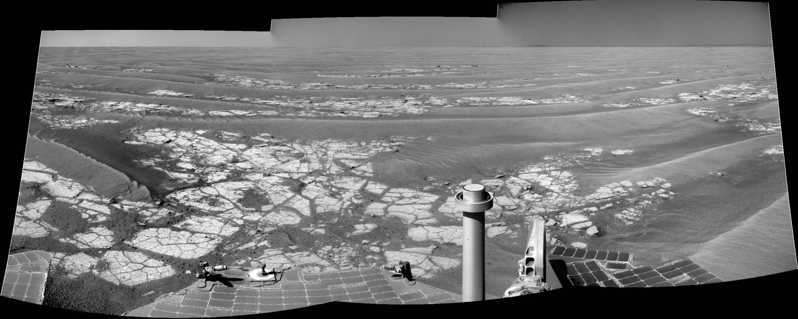
Jun 6 2010, 01:31 PM
Navs from 2255 - bit hard to get even brightness/decent colour etc. But good to have a bit of spare time, have fun on my new Dell M6500 laptop + try out Corel5 Photopaint + start posting again
! Might get round to posting full size image on Flikr.
See reposted pic as just below................
ngunn
Jun 6 2010, 02:43 PM
Nice, but I think that 'new' mountain on the left is an art-effect.
Looking at the raw you used I can just about see where it came from. Here's the view from the other camera though, and there's no sign of it:
http://marsrovers.jpl.nasa.gov/gallery/all...DP1777R0M2.HTML
HughFromAlice
Jun 6 2010, 09:16 PM
QUOTE (ngunn @ Jun 7 2010, 12:13 AM)
'new' mountain on the left is an art-effect.
Oh no! I thought that I had discovered a new mountain and was going to ask it be named Mount Alice after my home town!!!! I have digitally blasted it off the face of Mars and reposted a v2 without artifact
 Click to view attachment
briv1016
Jun 12 2010, 05:48 AM
2270 looks like a driving sol.
Tesheiner
Jun 12 2010, 07:49 AM
Yup, and including an east pointing navcam mosaic at end-of-drive.
Tesheiner
Jun 13 2010, 06:22 PM
Tosol's drive has already finished and there's already some data at the tracking web telling that 70m were covered in an almost due east heading.
Besides, the pointing info associated to the "post-drive" navcam mosaic tells the PMA is behaving well.
All good space news today.
Tesheiner
Jun 14 2010, 06:26 PM
BrianL
Jun 14 2010, 11:35 PM
I'm a bit surprised at how ripple-y it still looks, believe it or not. (Sorry)
kenny
Jun 14 2010, 11:57 PM
The maps shows it's just a short section of low dunes, then we're on linked pavements....
lyford
Jun 15 2010, 02:36 AM
QUOTE (BrianL @ Jun 14 2010, 03:35 PM)
I'm a bit surprised at how ripple-y it still looks, believe it or not. (Sorry)
Thank you for keeping alive the punmanned spaceflight legacy!
nprev
Jun 15 2010, 02:46 AM
Painful.
fredk
Jun 15 2010, 09:30 PM
New pics are finally at the jpl site. It's nice having Endeavour in our drive-direction sights:
http://marsrovers.jpl.nasa.gov/gallery/all...FVP2446R1M1.JPG
elakdawalla
Jun 15 2010, 09:34 PM
Endeavour in the drive-direction sights...now THAT will make for an especially awesome approach movie!
Stu
Jun 15 2010, 09:36 PM
Thank **** for that; I've been having serious withdrawl symptoms...
BrianL
Jun 16 2010, 03:21 AM
Haven't we all. Exploratorium: it's a good thing. Cobbles ahead, but we'll have to approach slowly. Mars has put up speed bumps.
Aah, so good to be moving again, seeing pictures again. I am so addicted to MERs. Makes me wonder what I'll do when... if... no, I won't go there.
Poolio
Jun 16 2010, 03:21 AM
Tim Parker's latest
map update shows that another 70m or so was achieved heading due east on sol 2272.
Tesheiner
Jun 16 2010, 06:07 AM
Oh, I missed that drive. I'll update mine later on.
MahFL
Jun 16 2010, 12:14 PM
Is Oppy going slightly uphill ?
fredk
Jun 16 2010, 02:29 PM
Why do you ask? We should be going very slightly downhill now since we crested the ridge a while back.
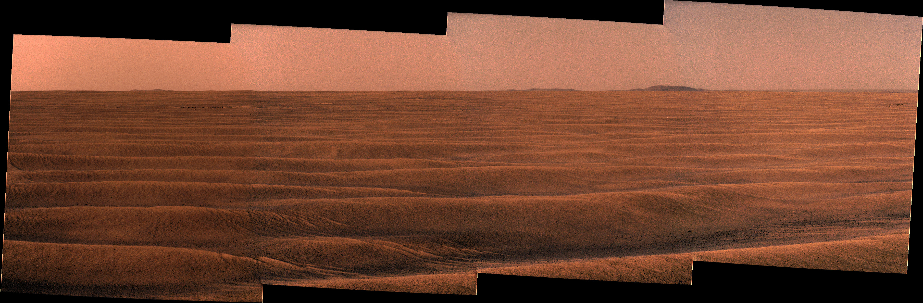
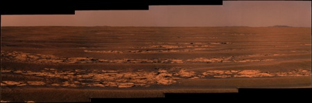
Ant103
Jun 16 2010, 02:42 PM
Sol 2271 drive direction in color
... showing unusal details on the hill of the right
ElkGroveDan
Jun 16 2010, 03:19 PM
Ant's panorama shows the high crater on the SE slope of Endeavor that I've been watching for. It's also an indication of just how clear the skies must be. That crater is about 32 km away!
(the scale is probably off a bit in this comparison)
Drkskywxlt
Jun 16 2010, 03:31 PM
QUOTE (ElkGroveDan @ Jun 16 2010, 10:19 AM)
Ant's panorama shows the high crater on the SE slope of Endeavor that I've been watching for. It's also an indication of just how clear the skies must be. That crater is about 32 km away!
(the scale is probably off a bit in this comparison)
Is that the circular feature on the tall hill on the right side of the panorama? Do you know that's a crater from the orbital imagery?
ElkGroveDan
Jun 16 2010, 03:38 PM
Yes and yes.
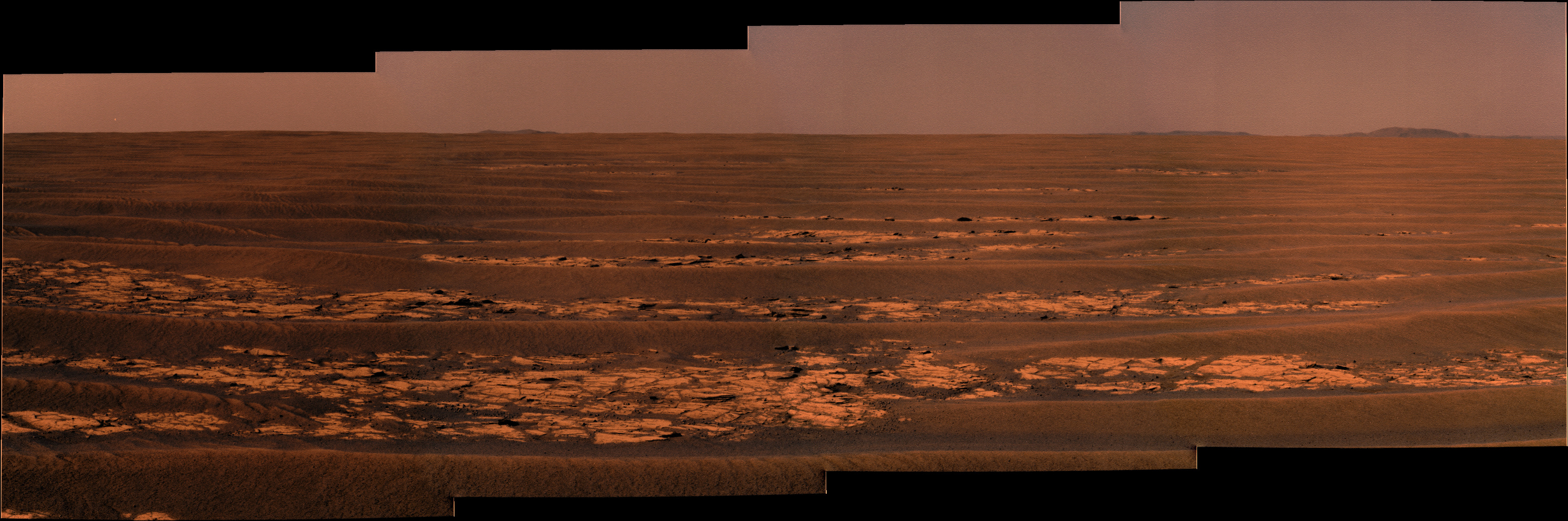
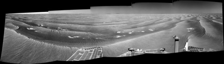
HughFromAlice
Jun 16 2010, 03:56 PM
Quick stitch and colour of Nav Cams from Sol 2270 - stayed up a bit later than I meant!!! Doing this is too absorbing!
Probably worth doing a better job on it so I may repost if I get the time - work is very busy.
Anyway hope it gives you guys some enjoyment.
Click to view attachment
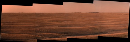
Ant103
Jun 17 2010, 03:11 PM
Sol 2272

Steve Holtam
Jun 17 2010, 06:06 PM
Awesome image Ant! Looks like smooth roving to me. Go Oppy!
Tesheiner
Jun 17 2010, 09:00 PM
Robert S
Jun 18 2010, 07:54 AM
Tesheiner
Jun 18 2010, 05:23 PM
Actually, it's several sols in the past.
The latest info on this subject has been tweeted by Scott Maxwell: Yesterday's uplink did not make it onboard. We're not sure why it happened this time, but it does happen. Today: repeat yesterday's drive. AFAIK, it means no drive on sol 2275 (i.e. right now) but on sol 2276.
Ant103
Jun 18 2010, 09:33 PM
Sol 2272
Still have a very good transparency
.
Ant103
Jun 21 2010, 02:46 PM
Sol 2274 navcam. The sky is to be particulary in a good transparency.
Tman
Jun 22 2010, 08:45 AM
Yes, fine weather currently, also the shadows are so dark.
On the MER website we've got now a nice east corridor
http://marsrovers.jpl.nasa.gov/mission/tm-...nity/index.html
fredk
Jun 22 2010, 09:15 PM
The latest images include multispectral pancams of this area:
http://marsrovers.jpl.nasa.gov/gallery/all...00P2555R1M1.JPGPotential meteorite, roughly centred, one quarter down from top of frame?
This is a "lo-fi" version of our main content. To view the full version with more information, formatting and images, please
click here.