Help - Search - Members - Calendar
Full Version: MEX VMC - Back on, and online!
Unmanned Spaceflight.com > Mars & Missions > Orbiters > Mars Express & Beagle 2
Pages: 1, 2, 3, 4, 5, 6
Paolo Amoroso
QUOTE (ormstont @ Sep 4 2008, 05:56 PM) *
In particular you should take a look at the ones from the 29th August - there's something really strange on those pictures. Seems to be large (~100km is my rough calculation) and very bright, casting a dark shadow on the planet and the shadow is detached from the object. Doesn't seem to be anything on the map there so I'm puzzled...ideas on a postcard?!

Any Phobos/Deimos solar eclipses at the time the images were taken? However, the images probably span a time interval a bit too long.


Paolo Amoroso
Stu
I may be wrong (probably am) but think this might be the area...

Click to view attachment

More than prepared to be proved totally wrong! smile.gif

EDIT: hmmm, looking at other images in the new release batch I'm not so sure. Fun to try tho. smile.gif
remcook
cool, looks like a volcano eruption smile.gif it's not a cloud?

what's the artifact right above it in Stu's image (near the limb, the rectangle thing...looks like a a line of a few pixel copied several times.)
ustrax
I've been far away for so long that I've become a sceptic... tongue.gif

Sorry but to me it looks like an optical illusion...no shadow casted by the apparent object, it looks to me like the shadow is from an elevation on the ground and the supposed "object" is a crater, you can see by going through the images that the shine varies and if you turn a picture 90º you loose that impression of something hovering over Mars...

Hope I'm wrong... wink.gif
Stu
How about a meteoroid impact that sent up a big dust cloud? Unlikely, I know, but wouldn't that be cool? smile.gif

(This is where someone from MRO, Odyssey or MEx butts in and says "Well, actually, we did see something but we weren't going to say anything yet..." wink.gif )

EDIT: An "optical illusion"? Okay, where's the REAL Ustrax? What have you done with him?!?! laugh.gif
ustrax
I'm here... rolleyes.gif
This is what I mean:
Click to view attachment

Looks to me that the brightness of the crater on the right and what I call crater on the left looks, going through the images, the same from one to the other...

But I may be taking too much Canydril... tongue.gif
Paolo Amoroso
QUOTE (ustrax @ Sep 5 2008, 05:55 PM) *
[...] it looks to me like the shadow is from an elevation on the ground and the supposed "object" is a crater, you can see by going through the images that it's shine varies and if you turn a picture 90º you loose that impression of something hovering over Mars...

Isn't the area too far from the terminator to have such a prominent shadow?


Paolo Amoroso
ustrax
In this specific image it looks to me that the shadow is derived from elevations on the terrain to the left and the "object" has fainted in a considerable way.
ormstont
Just to put my two cents in, you're right that the "object" fades a lot towards the end of the observation. It could well be that we're seeing something like the face on Mars - just a combination of light and shadow that looks like something we want to see. Nonetheless there aren't any major features I can see on the Mars map that would give rise to such a large flare/shadow. In ustrax's plot the crater identified is (I believe from looking at the Celestia file) Copernicus.

Using Ian Musgrave's Registax techniques he describes here http://astroblogger.blogspot.com/2008/08/w...-over-mars.html, combined with ugordon's colour processing script, I wonder if it's possible to clean up the image and see if we can place it more precisely on a map of Mars. Would be great to see what more it could teach us!

P.S. Top theories so far include trick of the light, cloud or (a long shot, but a cool one) an impact event plume...
ustrax
dear Ormstont, I am sorry to be a bit limited in terms of software for the moment but if that carter is indeed Copernicus then, looking at Google Mars, I see a bright patch to the right of the crater (marked) that could be the "culprit"...assuming that I am getting the right orientation and scale... wink.gif
Click to view attachment
ugordan
It definitely appears to be atmospheric as the shadow moves below it (click to enlarge):


It seems to have dissipated at the end. Based on the rough 100 km size estimate I get a height in excess of 100 km (around 110 km, but the uncertainty is rather large) if my back-of-the-envelope calculation is right using this 3x magnified bit:


If it's an ordinary cloud, what would make it so circular at that altitude and would it dissipate quickly in sunlight? If it's an impact plume, wouldn't we expect a darker color and much lower and more persistent plume?
Juramike
Nice animation, Gordan!

As you've shown, the shadow seems much longer in the earliest images, just what you'd expect as the sun peeped up over the horizon.

-Mike
ustrax
QUOTE (ugordan @ Sep 6 2008, 08:02 PM) *
It definitely appears to be atmospheric


I keep my thought after seing your animation...
the shadow seem to me to be originated on an elevation to the right, as the sun decreases in the horizon the shadow decreases and so does the brightness in the circular feature. I keep my guess: they are not related...
Paolo Amoroso
QUOTE (ugordan @ Sep 6 2008, 09:02 PM) *
It definitely appears to be atmospheric as the shadow moves below it (click to enlarge):

The movement of the feature suggests that a few hours earlier it was in the night side of Mars beyond the terminator, possibly looking like the bright terminator projections observed telescopically, e.g. the projection seen at Lick Observatory on 5 July 1890 (from Chapter 6 of Sheehan's The Planet Mars).


Paolo Amoroso
ugordan
QUOTE (ustrax @ Sep 6 2008, 10:11 PM) *
the shadow seem to me to be originated on an elevation to the right

You do realize it would have to be an awfully big topographic high, don't you? We're talking about objects 100 km in size and the shadow is something like twice that size, even well past the terminator. That would put Olympus Mons to shame, no?

Furthermore, the shadow isn't simply getting shorter, it's actually disappearing at the same time the bright circular object (let's call it 'cloud' for discussion's sake biggrin.gif ) is disappearing.
TheChemist
QUOTE (ugordan @ Sep 6 2008, 11:43 PM) *
You do realize it would have to be an awfully big topographic high, don't you? We're talking about objects 100 km in size and the shadow is something like twice that size, even well past the terminator. That would put Olympus Mons to shame, no?


The typical anti-Ustrax that posts lately here. Now he sees an inverse abyss laugh.gif
ustrax
QUOTE (TheChemist @ Sep 6 2008, 09:47 PM) *
The typical anti-Ustrax that posts lately here. Now he sees an inverse abyss laugh.gif


laugh.gif Now you got me in my new strategy...to assume there's nothing special in order to be surprised in the end of it all...

I DON'T want Oppy headed towards Ithaca!
(See what I mean?... wink.gif )

QUOTE
You do realize it would have to be an awfully big topographic high, don't you?


No I don't... tongue.gif
ugordan
QUOTE (ustrax @ Sep 6 2008, 11:21 PM) *
Now you got me in my new strategy...to assume there's nothing special in order to be surprised in the end of it all...

Congratulations and welcome to the club known as The Pessimist. I hope you'll enjoy your stay!
ustrax
QUOTE (ugordan @ Sep 6 2008, 10:23 PM) *
Congratulations and welcome to the club known as The Pessimist. I hope you'll enjoy your stay!


Thanks but I believe it won't be long enough to be enjoyed in its full splendor... rolleyes.gif
siravan
QUOTE (ugordan @ Sep 6 2008, 02:02 PM) *
Based on the rough 100 km size estimate I get a height in excess of 100 km (around 110 km, but the uncertainty is rather large) if my back-of-the-envelope calculation is right using this 3x magnified bit:


How do you calculate the height? My back-of-envelop calculation based on the ratio and of the shadow to the object size and its distance from the object is more consistent with an altitude half the object size (50 km if the diameter is 100 km).
ugordan
Yep, it appears I messed up the calculation of (at least) illumination incidence angle using the shadow shape, I did an inverse tangent of a/b instead of inverse cosine of b/a. That, by itself, lowers the end result to some 80-ish km, which might still be wrong. 110 km was no doubt suspicious, being at upper fringes of the atmosphere.
Paolo Amoroso
QUOTE (Paolo Amoroso @ Sep 6 2008, 10:12 PM) *
The movement of the feature suggests that a few hours earlier it was in the night side of Mars beyond the terminator, possibly looking like the bright terminator projections observed telescopically, e.g. the projection seen at Lick Observatory on 5 July 1890 (from Chapter 6 of Sheehan's The Planet Mars).

The date and time on the drawing can be read clearly only on the printed edition of the book: "1890, July 6d 9h 25m P.S.T."


Paolo Amoroso
ugordan
Here's a new version of VMC2RGB, this time implementing the adaptive Homogeneity-Directed interpolation, snatched from dcraw (algorithm was based on the work of Keigo Hirakawa, Thomas Parks, and Paul Lee) as slinted suggested earlier. It's not a groundbreaking improvement and your mileage may vary, but if you take care of how you process the images wou might end up with slightly sharper images. See below for 2x enlarged inset comparing the old and new algorithm, with identical processing in Photoshop:


The target image in question was greatly boosted in saturation and sharpened so it's pretty noisy, but shows more details:
Click to view attachment

Download it here: Click to view attachment

EDIT: I discovered a bug when using the new algorithm that clips some saturated pixels to zero, it's now fixed.
stevesliva
Does fog cast a shadow? Would it be forming above an ice-filled crater in the southern hemisphere?

Or perhaps a leeward cloud that dissipates in the sunlight?
ormstont
Ok...more info on our strange cloud...we've got a lot of the Mars Express scientists at ESOC today for planning meetings and I showed the images to our OMEGA team who are the MEX cloud experts! They've only had a quick chance to look so far but they were very excited, hopefully I can chat with them again later in the day. They also said that if the altitude was indeed 80km (I credited you all with doing the analysis for us...and they loved the animations!) then the feature is almost certainly an ice cloud. I'll keep you all posted on any more info I get!
remcook
yes, I think 80 km is a normal altitude for these mesospheric clouds, but I think these are normally not that bright, especially when looking down on it.
For instance, the CO2 clouds reported here are not visible:
http://www.esa.int/esaCP/SEMC4JZ7QQE_index_0.html
What latitude is this roughly? Apparently, mesospheric clouds are common around the equator:
http://www.agu.org/pubs/crossref/2007/2006JE002805.shtml
This article came up here before and shows similar clouds+shadows:
http://www.esa.int/esaCP/SEM1DV3MDAF_index_0.html
ormstont
Wow...you beat me to posting the link wink.gif I've just been chatting again with the Omega team (the ones that wrote that paper that your last link is based on)...if anyone knows Mars clouds it's them! We had a quick look at surrounding features and worked out the VMC cloud would be around 18 degrees South and 162 degrees East, which would put it close to the equator but still away from a common region of these clouds (based on Omega observations).

More generally all the MEX instrument science teams responded very warmly to the results produced by yourselves and other VMC contributors and may even see about giving us more VMC observations as a valuable contribution to Mars Express science. We'll put it all up on the VMC website though as always, as soon as it's down on the ground (next dump should be Friday/Saturday, so look for more new pics at the start of next week!).
elakdawalla
I'd like to include one of the VMC crescent images in my "Year in Pictures" roundup for The Planetary Report but am so far not happy with what I have been able to produce. Attached is the result of my fiddling with the crescent image from the "Best of 2007" feature. But I need an image from 2008 for this roundup. There are a lot of crescent shots in the archives from the spring and summer of 2008, though most of them appear to be saturated. I'm going to keep fiddling with the data -- these images are really fun -- but I know there are lots of people here who are better than I am at making pretty Mars color images and am hoping that one of you will be able to come up with something more spectacular than I can.

--Emily
ugordan
All 2008 crescents indeed appear to be severely overexposed. The closest thing to a non-overexposed crescent view are images from June and July, but they're already at a fairly fat phase. Here's one of the later ones:

It's looking down on the southern hemisphere with a high cloud peeking over the terminator.

If you're willing to put up with overexposed high phase shots and have an image that doesn't really scream "this is Mars", might I suggest one from that sequence showing clouds at the terminator that was brought up here, from Feb 14th.
FWIW, either Mars isn't terribly reddish at those high phase angles or the VMC data is very noisy, or both. Getting anything out of those thin crescents except a greenish hue seems like an exercise in futility.
ormstont
So, looks like our other MEX instrument teams are working hard to find out more about our strange cloud - looks like we could be in for more too - they said that this is the season we'd be expecting these clouds on Mars (although the VMC cloud is larger and more pronounced than anything seen before!). Will keep you posted when I hear more!

For the crescent images - sorry that they're all really saturated - those problems were one of the reasons I've moved to doing the 4 exposure step cycle (even though it cuts down the number per observation of properly exposed images) you see on the current images. The nice thing about the saturated images are that we see the features in the night side, over the terminator (I know...excuses, excuses!!). I promise to try harder at the next crescent season! Of course - any suggestions on how best to set the exposures or timing of images let me know - you're the operators of this camera!
ugordan
I'd be interested in knowing what the difficulties are in adjusting exposure for a given observation. Is it the uncertainty of how bright Mars will be at certain phase angles?

While we're at the subject of exposures, knowing how long each raw image was exposed would be of additional help in processing.

An unrelated observation - it seems to me that if only we had a flatfield frame for the VMC we'd be able to get much better images out of it. A lot of the noise seems static on the detector.
ormstont
Well, part of the difficulty is that we have no way of predicting how bright Mars will be in a given location at a given phase angle. I'm sure one exists but our aim is always to allow the public to guide VMC activities - as I say, you are the operators of this instrument. If anyone comes up with a way of predicting it then I'd be more than happy to implement it!! I implemented the 4 step exposure setting as a workaround for this - guaranteeing whatever the observation we should get some well-exposed shots.

That's a good point about knowing the exposure settings - I'll see how we can work that into the routine flow of information and processing of each image. For a guideline though, the first image of every observation is always 14ms. For the rest of the observations I'd have to look for you on Monday at work, will do that and get back to you then.

For the flat field - I'm vaguely aware of what the term means - would it be a long exposure image with the spacecraft pointed at space? If you let me know roughly what I need to command MEX/VMC to do then I'll try and schedule a slot when we can do it. I know I use this as a mantra...but it's everyone's instrument, you let us know what to do!
ugordan
QUOTE (ormstont @ Sep 13 2008, 10:23 PM) *
would it be a long exposure image with the spacecraft pointed at space?

That would be a dark frame, used for figuring out how the background signal increases with exposure (varies with temperature, hot pixels, etc). Part of wanting the exposure setting comes from the desire to have a rough model for dark background - two separate exposure images of a same target will produce different colors for different amounts of background signal. For example, a short exposure with VMS typically shifts overall colors towards blue as the background (grayish) overwhelms the Mars signal.

A flat-field is usually produced by imaging a sufficiently bland target so any noise in the image is variations in pixel sensitivity, crud in the optics, vignetting etc. This can be divided out from subsequent images to provide better S/N ratio. I don't expect we can get a look at a bland target now that we're at Mars, that sort of thing could have been done back on Earth, but then again this is not a scientific camera so most likely wasn't "calibrated" this way.
Tman
QUOTE (ugordan @ Sep 13 2008, 10:41 PM) *
A flat-field is usually produced by imaging a sufficiently bland target so any noise in the image is variations in pixel sensitivity, crud in the optics, vignetting etc. This can be divided out from subsequent images to provide better S/N ratio.

For example, the Mars Rover's lenses have also a couple of "noises" by now, beside their vignetting.
This image shows clouds on sol 1647 and this image from sol 1645 only the dirt on the lens. As a "fieldwork" flatfield you can use the inverted sol 1645 image for some clearing.
Paolo Amoroso
QUOTE (ugordan @ Sep 13 2008, 10:41 PM) *
I don't expect we can get a look at a bland target now that we're at Mars, that sort of thing could have been done back on Earth, but then again this is not a scientific camera so most likely wasn't "calibrated" this way.


Would this Iris technique for extracting a flat field from science images, or something similar, be useful with VMC images?


Paolo Amoroso
ormstont
Ok, get what you're going for there - the only suggestion I could possibly make for an in-flight test would be an exposure of Mars at low altitude that's long enough to blur out any surface detail (although I guess that would probably saturate the detector too).

I'll see at work tomorrow if any tests were made pre-launch although I think most of the dirt/objects/scratches(?) we see on the optics came after Beagle 2 ejection. VMC is right underneath the Beagle ejection mechanism so there might have been outgassing or debris from the pyro bolt firings that separated Beagle (some small objects can be seen moving away from the spacecraft in the Beagle separation images).

Based on this possibly the technique that Paolo mentions with this software could be helpful? Would certainly be great if we could extract the artefacts from each image.

Finally, you mention what we really need is a flat-field. Would a dark frame be helpful too? I've never tried VMC pointed away from Mars, so would be interested to see what happens (more out of engineering curiousity)!
ugordan
I don't personally think a dark frame would be all too useful for purposes of processing images alone - the detector is 8 bit and the majority of the noise is flatfield related noise. That said, I wonder how long an exposure can you get wih the VMC? It's a wide angle imager so we can forget about imaging individual stars probably, I wonder if it'd be possible to capture the Milky Way glow at least? It would probably depend on how fast dark current builds up with exposure.
jekbradbury
I am trying to organize the images by position in the orbit, but the quoted orbital period(s) on the Mars Express website (there are two different numbers on different parts of the site) don't seem to match the images. Taking the time since the beginning of 2008 modulo the orbital period of 24180 seconds should put the partial disc images near each other, but doesn't. What is the actual orbital period? Alternatively, would the SPICE kernels have this data?
ormstont
QUOTE (ugordan @ Sep 14 2008, 07:43 PM) *
That said, I wonder how long an exposure can you get wih the VMC?

Ok....first off - the VMC exposure range is pretty wide. There are two exposure ranges supported -
  • 0.4 ms to 191.6 ms in increments of 0.8 ms
  • 200 ms to 95800 ms in increments of 400 ms
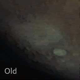
The widest range tested was in our first two observations in 2007, the first where we almost missed the planet here: 2007-01-28 Observation, and the second where we got our first disc image here: 2007-02-26 Observation. I'll look up the exposure ranges used here for you, but I know we only just touched the longer range.

For a long exposure test pointed at deep space I might see what I can schedule as I'd be interested to see how VMC performs in those conditions too, I'll keep you posted on my progress.

QUOTE (jekbradbury @ Sep 14 2008, 10:57 PM) *
I am trying to organize the images by position in the orbit

Not sure exactly what you're trying to do here, but please let me know a bit more and I'll see how we can help. If you mean what point in the orbit, almost all VMC observations were taken just after apocentre. If you mean ground location it's a bit more tricky as the MEX orbit precesses in Argument of Periapsis to allow our pericentre to not only be over different longitudes but also different latitudes (although longitude obviously varies rapidly with Mars spinning, the latitude precession is much slower, over the course of a year).

QUOTE (jekbradbury @ Sep 14 2008, 10:57 PM) *
What is the actual orbital period? Alternatively, would the SPICE kernels have this data?

Ok...the MEX orbital period has changed throughout the mission. SPICE kernels will give you a full, complete and accurate definition of the MEX orbit, but there are some shortcuts you can take. If you go to the MEX SPICE server here: ftp://ssols01.esac.esa.int/pub/data/SPICE/MEX/kernels/ and go into the orbnum directory you'll find a .ORB file that lists all the MEX orbits. The column OP-Event UTC APO gives the apocentre time for each orbit - so the period is the duration between any two adjacent values in this column. For even more detail on the MEX orbit you can use the EVTM_ files at the auxilliary data server here: ftp://ssols01.esac.esa.int/pub/data/ESOC/MEX/ (Just take the highest version number file for the latest).
jekbradbury
That was exactly what I was looking for. Taking into account the actual average period for the time period of these images, they are correctly placed in the orbit. I had hoped there would be some pictures at every point in the orbit, but it seems the images are in two sections: a ~1hr period near apocenter, and another ~1hr period near pericenter. My goal was a simple animation of what VMC sees on a typical orbit, not taking into account phase or ground location, just trying to show the varying size and brightness of the disk. I'm assuming operations (downlink etc.) and other instruments prevent this from being done, but one VMC image every ~5 minutes for one full orbit would make for one amazing animation.
Juramike
I finally downloaded Celestia (slaps head, why did I wait so long?) and poked around Mars on the date of the observation time to line up the features (thanks for the suggestion, Gordan!).

The location of the cloud feature in post 14, this thread was identified (highlands around Kepler Crater [-47S, 220W])
and the caption/location of the mosaic in this post was identified and corrected.

Color me embarrassed.

-Mike

[EDIT: Oh great. This post is right at the top of the page...terrific...]
Juramike
Interesting how both the "mystery cloud" picture and the putative dawn cloud (post 35) are both located around the highlands of Terra Cimmeria.

Is this a known cloud zone?

-Mike
ormstont
QUOTE (jekbradbury @ Sep 16 2008, 03:56 AM) *
...it seems the images are in two sections: a ~1hr period near apocenter, and another ~1hr period near pericenter....I'm assuming operations (downlink etc.) and other instruments prevent this from being done

Yep, you're right there - it's mainly instrument operations that constrain us to those windows. Aspera, a Swedish experiment looking into space plasma and energetic atoms aims to be on permanently to get a good dataset. However, every 3-4 orbits (~once per day) we have to perform a reaction wheel offloading and orbit maintenance, which means firing the thrusters. When we do this Aspera shuts down for an hour because the thruster plumes would interfere with their measurements. This thruster activity is always placed right after apocentre for maximum activity and that gives us our ~1 hour VMC window. Sometimes though these are impacted as you say by ground station passes a that's why we get our average frequency of 2-3 obs per week.

The VMC obs just after pericentre are much rarer and happen when we perform a orbit change, here we have to fire the thrusters to achieve this but the point of highest efficiency is at pericentre. Therefore Aspera shuts down and we get a relatively low-altitude VMC observation (assuming Flight Dynamics don't choose that period to obtain tracking data from the burn).

QUOTE (jekbradbury @ Sep 16 2008, 03:56 AM) *
one VMC image every ~5 minutes for one full orbit would make for one amazing animation.

You're very very right here too (you could come work for us!), we'd all love to do a full orbit animation! As this would require agreement from all the other instruments though it will require quite some negotiation. I'm constantly on the look-out for chances though, but don't want to impact our prime science mission. The other slight problem is that the VMC packet store (like a directory on a computer) is limited to 60 images, so we'd have to ask nicely for another instrument to lend us their packet store wink.gif

QUOTE (Juramike @ Sep 16 2008, 06:21 AM) *
Color me embarrassed.

Lol....we all get embarrassed - how do you think we felt when we got our first VMC images and they looked like this: http://www.esa.int/SPECIALS/VMC/SEM4SJEVL2F_1.html#subhead4 ?! At least it makes for a cute story in the history of VMC wink.gif I'll ask Daniel to update the captions for your images on the website. Even if they're of a slightly different location they're still great work!
Juramike
It's baaaack!

Another cloud sequence at sunrise over Terra Cimmeria taken one month after the post 35 cloud movie. This shows a much more impressive series of clouds. These are located near Electris Crater [-45S, 150W] in Terra Cimmeria.


Click to view attachment
(click to animate GIF)

The brightish crater at center is Copernicus crater at [-50S, 170W]. There was another dimmer cloud visible near the terminator just to the ESE of Copernicus crater but it wasn't as photogenic (or on all the frames).


All these used the first image (the most exposed) in the sequence of 4 exposures. These are beautifully spaced in 10 minutes steps for a neat time-lapse sequence of 1 h.

Terra Cimmeria seems to be a breeding ground for these clouds (3 for 3!). Might be nice for the next scheduled observation run that views Terra Cimmeria near the terminator to use the longer exposure times, and space the images at shorter time periods (3 to 5 min.). Then you can get a neat smooth movie, or do image stacking to pull up the contrast on a particularly nice set.

-Mike
ormstont
Interesting that we might have a cloud factory on our hands! I'll ask around and see if anyone here has any ideas why there should be clouds generated around this region. The instrument team did indicate to me though that we're going into a "cloud rich" season at the moment, so maybe it's just coincidental that most of our terminator shots recently have been around this region?

Also...I promised to update you on the exposure settings used. I'm still trying to work out a way to pass exposure information on every image through our automated processing chain. However, all recent images have used the 4-step exposure settings, with looping values of 0.4 ms, 6.8 ms, 14 ms and 22.8 ms.

For changing the exposure settings to better catch clouds - this is very possible, I'll try and have a look at what we can do and when we can do it - maybe come back to you and ask you to define your very own VMC observation wink.gif
ormstont
Just a quick plug - got some more lovely shots from last week of the volcanoes...just gone up on the VMC website wink.gif
Juramike
The thing that's been puzzling me is the appearance of the middle "rolling" cloud in the the sequence above. From the orientation of the image (S is roughly at top), it appears that the cloud stuff is moving/growing from S to N.

I would have thought that if there is a global redistribution caused by the CO2 freezeout at the cold high South Pole during the S hemisphere winter, then the overall circulation pattern (especially near the S pole) should go from N to S. This is in direct contrast to the image sequence.

This could be a parallax effect due to changing viewing angle, making the clouds way the heck up there. Or the "rolling" impression could be due to the cloud actually growing N towards the daylight due to the sun starting to warm and mix the upper layers of the atmosphere. (Kinda like the morning clouds you see here on Earth, just on a bigger scale).

I'm going to see if I can add the shorter exposure images (which I guess must be the 14 ms images) into the sequence to make a better resolution movie.

-Mike

djellison
I love this camera.
Juramike
Here is an attempted mosaic of the "relatively clear and kinda undistorted parts" of the MEX VMC images covering August 4-September 11, 2008.
(It's still a work in progress - mosaic is too strong a word, I was overlaying these images on the USGS Mars Map - it's more analogous to what the psycho killer guy was doing in "The Silence of the Lambs")

Click to view attachment

Here is an EXCEL table I made that lists the image date, approximate time, and the most distinctive feature nearest the center of the image for those MEX VMC images. This will hopefully cut down on the frustration of trying to figure out the features on the image:Click to view attachment

-Mike
Juramike
There are few guarantees in life...
but finding clouds in morning light near [-45S, 193W] on Mars in one of them.

More MEX VMC images from July 6, 2008 and July 12, 2008 (impressive display) of sunrise clouds:

Click to view attachmentClick to view attachment

Both images lightly processed, the July 6 image came from the jpeg from the MEX VMC website, and the July 12, image was downloaded in RAW form, debayered through Gordan's latest tool, then pushed to grayscale, then contrast curve modified, and exposure modified. (All images rotated to fit the July 31st and Aug 31st orientation.)

This shows the identification of nearby craters:
Click to view attachment


-Mike

(For those of y'all keeping score: this is 4 sets of clouds out of 4 MEX VMC observations at this location.)
This is a "lo-fi" version of our main content. To view the full version with more information, formatting and images, please click here.
Invision Power Board © 2001-2024 Invision Power Services, Inc.