QUOTE (gallen_53 @ Jul 31 2008, 12:35 AM)

Thank you. I'll try it in the morning. Do you know where to find the Phoenix mass model, i.e. moments and products of inertia, center of gravity, etc.? Is there an aerodynamic model specific to the Phoenix 70 deg. aeroshell including Cm, Cmq, etc. accessible on the web? This information would be in the Lockheed-Martin databook for Phoenix but they're probably keeping it close to their vest. Thanks again.
Except for reference area, the 70deg aeroshell is exactly the same as Pathfinder, which is reasonably well documented at ntrs.nasa.gov . It's the same shell all US missions have used since Viking. I remember readng presentations comparing all of them, and like I said, aerodynamically they all act identically when using the proper reference area. Unfortunately, the best curve I saw for Pathfinder was of actual Cd (only) as a function of mach number, but only along the entry corridor it actually experienced. Cd really is the most important thing. As far as Cm and such go, the center of pressure at hypersonic speeds is always a bit behind the center of mass, so it is stable.
Search for these on ntrs.nasa.gov
2007 Mars Phoenix Entry Descent and Landing Simulation and Modeling Analysis
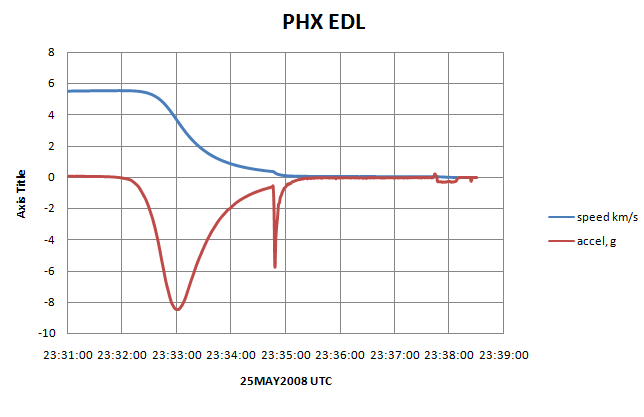
Mars Pathfinder Atmospheric Entry Trajectory Design (Contains accel vs time curve, Cd vs mach curve, and mass, cg, and inertia tensor for Pathfinder, among other things)
Mars 2007 Scout Phoenix Parachute Decelerator System Program Overview (For aerodynamics of parachute)
Mars Exploration Entry Descent and Landing Challenges
Also, the reconstruction is incredible in its detail. The comments attached to the spice kernels claim 5ms resolution, and from what I see I believe it. At this resolution, the accelerometers act like microphones, so you can see loud events in the acceleration curves.
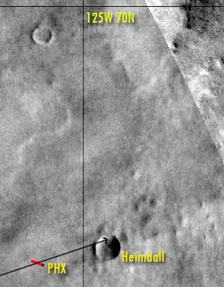
 With a little image processing, one can easily see the final descent trajectory of the Phoenix Lander with its plumes disturbing the top layer of the Martian surface. After the release of the lander from the backshell, the effect is barely seen first, but is becoming more obvious, until the final strong pulses before landing. Any better estimates ? Enjoy !

 )
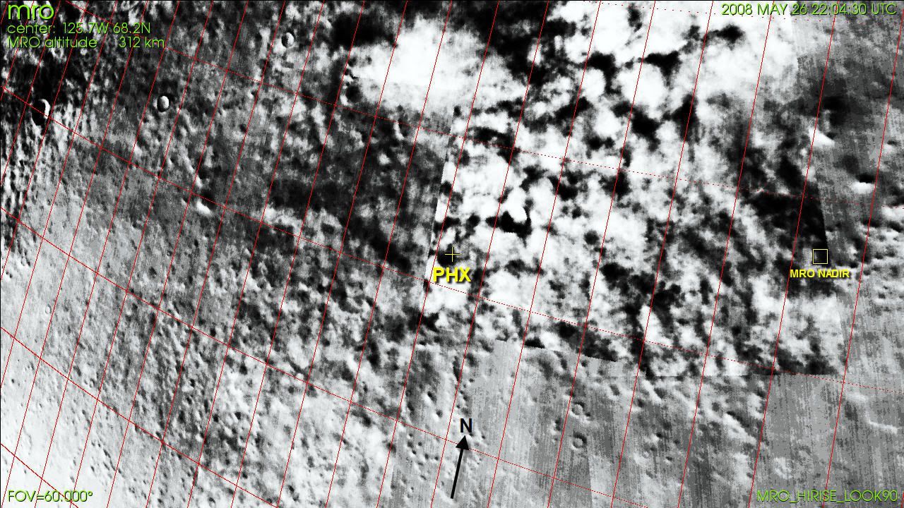
) Yellow line up is North.