Help - Search - Members - Calendar
Full Version: Back to work
Unmanned Spaceflight.com > Mars & Missions > Past and Future > MER > Opportunity
Pages: 1, 2
fredk
I think the return to driving deserves a new topic for Oppy. According to this new release, Oppy is back up to 300 Whrs, and had a small cleaning event! smile.gif

The release also gives a surprizing reason for the drive to the rim:
QUOTE
One reason the rover team chose to drive Opportunity closer to the crater rim was to be prepared, if the pace of dust accumulation on the solar panels increases, to drive onto the inner slope of the crater. This would give the rover a sun-facing tilt to maximize daily energy supplies. The drive was also designed to check performance of the rover's mobility system, so it included a turn in place and a short drive backwards.
That explains why they drove to this point on the rim - if they enter they'll face south, as it's still southern summer.
Sunspot
No more messing about on the rim or the plains, I think they really need to get Opportunity into the crater as soon as possible - it is, after all what they spent a couple of years driving for. The same with Spirit at Home Plate, the rover has been planning on driving up onto HP in the "next few days" for about 5 months.

One lesson from this dust storm is that they REALLY could lose the rovers at any time. Opportunity may have literally been a few watt hours of energy away from death.
fredk
New nav/pancam imagery peering over the rim into the abyss tosol at exploratorium. It looks to me like we've got dust on the left pancam, along the right edge of the frame. I'm sure it's not vignetting - pancams have only negligible vignetting. A sky view would confirm this. So it seems both left navcam and left pancam have been affected by dust.

You can see it easily comparing L2 and R2:Click to view attachment
Tesheiner
These new set of images was part of the usual "post-drive" imaging sequences.
Obviously, no drive was attempted but either cancelled or aborted.
fredk
Some new images down, pointed at the sky, presumably to characterize the dust on the pancams. Remember there's stretching involved in these jpegs, which probably exagerates the effect. But clearly both left and right pancam are affected:
http://qt.exploratorium.edu/mars/opportuni...00P2897L7M1.JPG
http://qt.exploratorium.edu/mars/opportuni...00P2897R1M1.JPG
fredk
And some news from New Scientist:
QUOTE
Opportunity has also started driving and was expected to arrive as early as Monday at a spot on Victoria crater's rim, where it will make some new observations. These will help the team evaluate science targets in the crater and possible routes to get inside.

Opportunity is getting about 300 watt-hours of energy per day, more than twice the level it was getting during the worst part of the storms. But it is still not enough to start the descent into the crater, Arvidson says: "We want to make sure if we have some mobility problems that there's energy to spare to get out of the problem areas."
Tesheiner
Opportunity drove a little bit tosol (1278).
One more step and were are into the crater!

Click to view attachment

Edited: Added this Q&D (quick and dirty) navcam mosaic.
Click to view attachment
Tman
It seems we have only to wait for a (safe) rise of the battery charging now and the ride will begin...
gallen_53
QUOTE (fredk @ Aug 26 2007, 04:11 PM) *
It looks to me like we've got dust on the left pancam, along the right edge of the frame. I'm sure it's not vignetting - pancams have only negligible vignetting. A sky view would confirm this. So it seems both left navcam and left pancam have been affected by dust.


Is this dust degradation now a permanent "fact of life" or is there any possibility that image quality could be restored, e.g. by a dust devil passing over the rover?
Malmer
QUOTE (gallen_53 @ Aug 29 2007, 09:12 PM) *
Is this dust degradation now a permanent "fact of life" or is there any possibility that image quality could be restored, e.g. by a dust devil passing over the rover?


its possible to remove the dust by using several averaged skyframes and use them as a flatfield. but it might also be a bit of scattering in the dust that causes blooming and that is harder to remove.
Edward Schmitz
There have been several instance of dust collecting on the Haz Cams and then dissipating. That's certainly possible here. However, it looks much worse than previous occurances. The effect on the right edge kinda looks to me like the dust was able to get into part of the camera. If that is the case, I think it would be permanent. Recent images have shown that it's not too sever. In a worst case, they could stop relying on the affected parts of the frame. Take images that overlap more. Use it as though it were an 800X1024 sensor.

I would like to know if the dust has invaded miniTES. That would be a much bigger problem. That could range from reduced sensitivity to completely unusable.
dvandorn
QUOTE (gallen_53 @ Aug 29 2007, 02:12 PM) *
Is this dust degradation now a permanent "fact of life" or is there any possibility that image quality could be restored, e.g. by a dust devil passing over the rover?

One more time -- there have never, ever, even once, even just maybe, *ever* been any dust devils spotted anywhere near Opportunity. All of Oppy's cleaning events have come from straight-line winds.

I know I sound like a broken record on this sometimes, but it's like wishing for a nice, refreshing blizzard in the middle of the Sahara, or expecting tornadoes at the South Pole. Some types of weather are just not observed at some locations, and dust devils are just not observed at or near Oppy's landing site.

That said, I have high hopes that the inner slopes of Victoria will intensify local winds (that old racetrack pattern) and that by dipping down into her, Oppy will be able to avail herself of cleaning events regularly.

-the other Doug
CosmicRocker
I like the "back to work" concept. Things are about to get interesting.

One thing I have been meaning to do for a long time is to take Tim Parker's nice HiRise contour map of Victoria and use it to make a scale that we can import as a movable layer on top of the contour map in an image editing program. I wanted to have a transparent scale that I could drag over the contour lines to measure the surface slopes in degrees.

To make a scale that would be useful over the whole map, it became apparent that it needed to be a circular scale, with the radius scaled in degrees. I'm attaching the scale, just in case someone else might like to measure slopes on that contour map. The scale was made for the full scale HiRise images at 25 cm/px. Note that some of the recent JPL route maps with contours are at other scales. To use the scale, put the center dot on a contour line, and measure the angle to an adjacent contour line. I labelled the three outer circles as 5, 10, and 15 degrees, but it became too cluttered trying to label the remaining circles. All of the circles are 5 degrees apart, so the circles in the scale are 5, 10,15,20, 25,30, and 35 degrees. It helps to zoom in to about 200% on the map when using this scale.

I am also attaching a crop of the contour map from Duck Bay. I used the scale overlay to measure the slope of the surface across parts of Duck Bay and I posted the measurements in degrees on that map. Using the scale, or studying the angles posted on the map, you can quickly get a feel for the slope angles by looking at the distance between the contour lines.
Click to view attachment
fredk
Thanks for the template, Rocker, I'm sure I'll find it useful.

There was a decent gust between sols 1275 and 1277, visible in the front hazcams. That appears to be after the gust we've heard about through official channels, so we can hope for a further increase in power.

http://marsrovers.jpl.nasa.gov/gallery/all...00P1151L0M1.JPG

And a hazy, near-sunset view of the sun from 1275:
gallen_53
QUOTE (dvandorn @ Aug 30 2007, 02:46 AM) *
I know I sound like a broken record on this sometimes, but it's like wishing for a nice, refreshing blizzard in the middle of the Sahara, or expecting tornadoes at the South Pole.


A zillion years ago, I was touring Saqqara, Egypt in the beginning of summer (not a good time to be there!). Needless to say, it was beyond hot. My brains were just getting cooked to a golden brown when this refreshing breeze came in from the west. I looked to the west and saw nothing but Saharan dune fields. I remember thinking at the time that it seemed a bit odd ...
stevesliva
QUOTE (dvandorn @ Aug 29 2007, 10:46 PM) *
One more time -- there have never, ever, even once, even just maybe, *ever* been any dust devils spotted anywhere near Opportunity. All of Oppy's cleaning events have come from straight-line winds.

Actually, thanks for saying it again. I hadn't made the connection yet, if you can believe that!
Edward Schmitz
QUOTE (dvandorn @ Aug 29 2007, 07:46 PM) *
One more time -- there have never, ever, even once, even just maybe, *ever* been any dust devils spotted anywhere near Opportunity. All of Oppy's cleaning events have come from straight-line winds.

-the other Doug

The absence of evidence is not evidence. We know next to nothing about the wind dynamics in Meridiani. The only evidence that we have come from pictures of the ground in a before and after state and power level changes on the rover. That's it. It seems a bit premature to declare that we know what is causing these cleaning events. I'm of the mind that it is not the result of dust devil activity. But at the same time, it seems reasonable to use the term 'dust devil' as a short hand for some kind of wind busrt of unknown origin.

It is my opinion that at best we can say it is unlikely that the cleaning events are the result of dust devils passing over the rovers.
Pavel
Wouldn't dust devil tracks be visible in Meridiani if there were dust devils there? It's not like the sand and the dust are too uniform in color in that region. Lack of the tracks is a pretty good proof that no dust devils have been present since the last major storm.
BrianL
Except for those really large dark tracks away from the rim where dust devils have swept them clean of dust.

wink.gif

Brian
dvandorn
I understand you're teasing, Brian, but, just for the record...

Dust devils are very specific weather phenomenah. The definition requires the formation of vortical wind structures large and energetic enough to raise surface dust into the air. Dust devils, again by definition, are visible as funnel-like or rope-like structures due to the dust entrained in their vortical structures.

Dust devils do not leave broad fan-like surface markings -- they tend to leave sinuous, worm-like tracks which do not vary in width by more than 20% to 30% along their lengths. The dust streaks emanating from Victoria begin at wind-stricture points along the crater wall and fan out to be several hundred percent wider by the time they fade to invisibility.

Calling every erosional or depositional wind event on Mars a dust devil is like calling any energetic wind event on Earth a tornado. It's an extremely poor, misleading, and just plain incorrect use of the term.

All that said, I'm really not as anal about this as it sounds. I just want to state the case clearly, and hopefully establish a level of terminology use on the forum that maintains us at an "impressively high level."

smile.gif

-the other Doug
jvandriel
Back in business again after the storm.

A panoramic view taken on Sol 1275 with the

R0 Navcam.

jvandriel
ElkGroveDan
QUOTE (dvandorn @ Aug 31 2007, 05:00 PM) *
Dust devils do not leave broad fan-like surface markings -- they tend to leave sinuous, worm-like tracks which do not vary in width by more than 20% to 30% along their lengths.

.. and they have a habit of tossing patio furniture into the pool.
jamescanvin
The L257 Duck bay image from yestersol (B1281)


As fredk pointed out, we have a dark band on the right edge of the left pancam probably due to dust. I'll need some new code to deal with the lower contrast in this area and so the mosaic is not great. I don't have the time to work on the problem at the moment so this'll have to do.

James
algorimancer
I had thought that the pancam head used a lens cover and tilted to point downward when not in use. If that's the case, why the dust on the lens? Was it so dusty that the occasional pics taken were sufficient exposure for the dust to accumulate? Or am I just remembering incorrectly?
djellison
It's not a particularly effective lens cover - it's not a good seal.

Doug
mcaplinger
QUOTE (algorimancer @ Sep 2 2007, 09:53 AM) *
I had thought that the pancam head used a lens cover and tilted to point downward when not in use.

AFAIK, the Pancam covers got pulled off at mast deployment and are now dangling from the head not doing anything. It's the MI that has a movable cover. The only way to limit dust on the Pancams is to point them down when not in use.
Del Palmer
I wonder if the need for Oppy to conserve power meant that it didn't always 'stow' the Pancam when not in use (the actuators would need to be heated at certain times of the day to allow it to be moved).
Edward Schmitz
QUOTE (dvandorn @ Aug 31 2007, 06:00 PM) *
I understand you're teasing, Brian, but, just for the record...

Dust devils are very specific weather phenomenah. The definition requires the formation of vortical wind structures large and energetic enough to raise surface dust into the air. Dust devils, again by definition, are visible as funnel-like or rope-like structures due to the dust entrained in their vortical structures.

Dust devils do not leave broad fan-like surface markings -- they tend to leave sinuous, worm-like tracks which do not vary in width by more than 20% to 30% along their lengths. The dust streaks emanating from Victoria begin at wind-stricture points along the crater wall and fan out to be several hundred percent wider by the time they fade to invisibility.

Calling every erosional or depositional wind event on Mars a dust devil is like calling any energetic wind event on Earth a tornado. It's an extremely poor, misleading, and just plain incorrect use of the term.

All that said, I'm really not as anal about this as it sounds. I just want to state the case clearly, and hopefully establish a level of terminology use on the forum that maintains us at an "impressively high level."

smile.gif

-the other Doug

I agree with your sentiment about establishing a high level of dialog.

By websters definition of dust devil - a small whirlwind containing sand or dust - it doesn't have to be very big. My major point from above is that not having evidence does not exclude dust devils as the causative agent. Our ability to monitor the wind activity in Meridiani is almost zero. The fact that we don't see surface prints could be due to the sensitivity of our instruments or that they just don't leave a visible trail. Dust devils on earth don't always leave a trail. That we haven't spotted any with the rovers may establish a upper limit on their frequencey but doesn't rule them out.

We've become very familiar with the behemoths that leave visible trails from space. This isn't necessarily the norm. I still am in the not very likely camp. I just don't see that it's been established that there is no D D activity in Meridiani.

I will concede that we shouldn't be calling phenomenon by the wrong name.
Tesheiner
I thought that we were just one step of entering VC, but after reading the latest MER update on TPS it seems that they are still planning to enter it by the other side of the bay.

QUOTE
"Opportunity is poised, literally with front wheels practically hanging over the edge of Victoria Crater, so we are right there at Duck Bay and very close to being ready to go in," said Squyres on his return from the Arctic. "We have a few tests we want to tick off before we go into the crater. But we're there."


QUOTE
On Sol 1278 (August 29, 2007), Opportunity bumped into a position right near the rim. Over the Labor Day weekend, the rover is slated to take new reconnaissance pictures of the planned entry point at Duck Bay, which is about 40 meters (131 feet) away. "We're a little concerned about what the dust storms might have done to change the terrain and the entry site," said Matijevic.
djellison
The plan was always the far side of Duck Bay. I've never seen anything to suggest that the choice of the best place to enter the crater has changed just because there has been a delay.

Doug
climber
I hope it'll be one of the last view of the plain for a while (note the still fuzy horizon)

Click to view attachment

BTW, quite some new picts today on Exploratorium.
Tesheiner
> I hope it'll be one of the last view of the plain for a while

Let's wait for today's images. I've just checked the planned sequences (a.k.a. "secret codes" laugh.gif ) and Opportunity might be on the move now or in a few hours. Another question is if we are going in (probably not) or just moving closer to the planned entry point.

CODE
01285::p1212::09::2::0::0::2::0::4::front_haz_ultimate_2_bpp_pri15
01285::p1312::07::2::0::0::2::0::4::rear_haz_ultimate_2_bpp_pri15
01285::p1832::01::2::0::0::2::0::4::navcam_1x1_site_frame_1_bpp
01285::p1988::04::6::0::0::6::0::12::navcam_3x1_paolos_plunge_SITE


Mmm, "Paolo's plunge" site? huh.gif
ustrax
QUOTE (Tesheiner @ Sep 5 2007, 10:54 AM) *
Mmm, "Paolo's plunge" site? huh.gif


Who's Paolo?! blink.gif
That sounds enticing... smile.gif
ustrax
I'll answer myself... wink.gif
SS revealed me the secret behind Paolo...:

"Paolo is one of our rover drivers. We've chosen the site for entry into the
crater based on his recommendations, and that's where we're headed."

This is it boys...
Downward Oppy! biggrin.gif

Oh...and on another issue of major importance here's our PI arctic reaction:
"The bear? How on earth did you guys hear about me and polar bears???" laugh.gif
nprev
QUOTE (ustrax @ Sep 5 2007, 08:17 AM) *
"The bear? How on earth did you guys hear about me and polar bears???" laugh.gif


laugh.gif laugh.gif laugh.gif ...UMSF sees all, knows all, tells all that is not copyright-protected, classified, proprietary, ITAR-addressed, or embargoed....
climber
QUOTE (ustrax @ Sep 5 2007, 05:17 PM) *
I'll answer myself... wink.gif
SS revealed me the secret behind Paolo...:

"Paolo is one of our rover drivers. We've chosen the site for entry into the
crater based on his recommendations, and that's where we're headed."

May be I've got the guy : http://www-robotics.jpl.nasa.gov/people/Pa.../personFull.cfm
Tesheiner
Headed to the entry point.
Here is the latest navcam mosaic taken on sol 1285.
Click to view attachment
And looking to these old tracks, do you all remember the excitement when we saw the crater for the first time around sol 950?
CosmicRocker
Eduardo: I surely can remember our excitement from that time. That is what drives our species toward explorations. wink.gif

I don't know how we missed this, but there is good news tonight. smile.gif
I've been looking back through earlier images, and it appears that the cleaning event may have taken place between sols 1269 and 1270. Notice the changes in the dust on the instruments and the hazcam lens in the attached animation. The optics and the instruments were cleaned. No wonder they are running back to Paolo's planned plunge point. biggrin.gif I can't wait to see the panels. cool.gif
Click to view attachment
Sunspot
"Spic-and-span solar panels boosting power" biggrin.gif
Jeff7
"Opportunity may have enough vitality to venture into Victoria Crater, the largest yet explored by either rover. "

Now wait just a darn minute. I think Gusev Crater is a wee bit larger than Victoria. biggrin.gif
Stu
Ladies and gentlemen... swear boxes at the ready...

Click to view attachment

Others will do that view much more justice, but I was just so swept away I thought I'd have a beginners go... tongue.gif
ElkGroveDan
Very cool Stu. Thanks
Stu
Apologies for my earlier effort, this is much more like it I think...

Click to view attachment
Indian3000
it's not perfect but, i'm happy for a first draft ... smile.gif

Click to view attachment
Tesheiner
We are back again almost to the point where we arrive at Victoria. smile.gif
Stu
Loving this view...

Click to view attachment
fredk
QUOTE (Tesheiner @ Sep 6 2007, 08:59 PM) *
We are back again almost to the point where we arrive at Victoria. smile.gif
Exactly. This navcam view shows nicely how close we were to the rim all those sols ago.

Ironically, it appears that our entry point will be extremely close to where we first parked on the rim. That first approach was exhilarating because we didn't know what the view would be like. This current approach is as exhilarating because we're going in! blink.gif smile.gif
mhoward
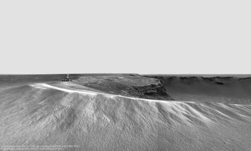
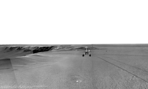
Couple slightly doctored views... The way they sort of match up is just a happy accident. They are actually "viewed" from different positions.


Edit: Oops.... flickr initially made them 'private' for some reason. It should be fixed now.
CosmicRocker
QUOTE (Stu @ Sep 6 2007, 06:41 PM) *
Loving this view...
Just wait. wink.gif cool.gif
Tesheiner
Just checked the imaging plan for tosol (1287) and it's almost all related to the MI.
Given that there's no visible rock target on the IDD workvolume I think they are probably taking pictures of those old tracks from sol 955 in front of the left wheel.

http://nasa.exploratorium.edu/mars/opportu...FIP1212R0M1.JPG

BTW, no driving planned for today.
No problem at all, since my bet at the entry pool was for sol 1313. tongue.gif

QUOTE (fredk @ Sep 7 2007, 02:46 AM) *
That first approach was exhilarating because we didn't know what the view would be like.

Just in case anybody wants to remember those moments I would recommend to read this old thread: Final Approach, starting at this post (sol 950) or this other one (sol 951).
This is a "lo-fi" version of our main content. To view the full version with more information, formatting and images, please click here.
Invision Power Board © 2001-2024 Invision Power Services, Inc.