Bobby
Apr 1 2007, 06:42 AM
According to Steve Squyres from The Planetary Society Web Site. Opportunity will enter Duck Bay after taking a toe dip into Valley Without Peril's for some quick imaging. She will first investigate The Dark Streak then head back to The Valley Without Peril for Possible first entry (teaser entry) then onto the main event at Duck Bay.

Discussion regarding this entry Point can start here
dilo
Apr 1 2007, 11:04 AM
I'm a little disappointed by the decision to eventually enter the Duck Bay.
I was convinced best entry point was in the S/E rim based on slope and illumination but, clearly, I missed other elements like sand coverage or, perhaps, time. In fact, SS underlined how is important to have a 6-wheel, healty rover to explore VC interior and we aren't sure about Oppy conditions six months from now.
I only hope this statement will not become an epitaph if Oppy loose one or more wheel functionalities while inside crater...

I really want to finish Victoria circumnavigation!
Tesheiner
Apr 1 2007, 01:49 PM
Well, it makes sense to enter at Duck Bay.
The goal is not to enter the crater but to investigate the rock outcrops at the walls I suppose... and the biggest ones are near Duck Bay.
I take these words from the MER update: "Things are about to get really interesting."
centsworth_II
Apr 1 2007, 06:11 PM
QUOTE (Tesheiner @ Apr 1 2007, 09:49 AM)

The goal is not to enter the crater but to investigate the rock outcrops at the walls I suppose...
And I've always thought that the layers of the wall outcrops at Duck Bay looked easy to get
up close to, unlike some we've been seeing lately.
BrianL
Apr 1 2007, 11:00 PM
QUOTE (Tesheiner @ Apr 1 2007, 07:49 AM)
Well, it makes sense to enter at Duck Bay.
The goal is not to enter the crater but to investigate the rock outcrops at the walls I suppose... and the biggest ones are near Duck Bay.
Not to mention the dead lizard.

Brian
MarsIsImportant
Apr 1 2007, 11:08 PM
I agree. Duck bay is the easiest entry for Oppy to reach a cliff. Now that it is later in the season illumination is not a serious problem at Duck Bay--it would have been, if they took it down that bay earlier. I also think Oppy can get out of Duck bay the same way it goes in. Again, Oppy can always do another toe dip somewhere else later, if it gets out of the crater. After ingress and egress, Oppy can continue circumnavigating Victoria counter-clockwise. There are some important cliffs on the south side of the crater too!
There is so much to do at Victoria! Let's complete the study of this northern area first. We'll worry about the rest later.
1219 still looks good for ingress! It will simply be a different bay than I expected. The time and distances still work out approximately the same.
Shaka
Apr 2 2007, 02:26 AM
Okay, I guess the
Final Decision is imminent. So is there any real advantage to Valley Without Peril over Duck Bay? (Apart from being here and now, rather than a couple of weeks travelling away?). Have we ever seen strata deeper than those at Duck Bay? If not, then presumably will will join the Ducks on a track something like this:
Click to view attachment Or has someone got a better plan?
CosmicRocker
Apr 2 2007, 05:12 AM
It seems that the final decision has been made, unless there is some new revelation between now and when they get back to Duck Bay. I think deeper strata have been seen, but the most accessible bedrock so far is that section observed in Duck Bay.
There is room for debate, but this truly is a lucky little rover. After arriving in Eagle Crater two strokes under par, the lie of the green after the long drive to Victoria seems to be sloping toward a birdie in Duck Bay.
I'm just guessing, but the people driving this machine must appreciate the fact that they are operating one of two 900 million dollar interplanetary Porsches. One could argue that there is a better boat ramp on the other side, but it may be time to crap, or get off the pot, as some might say.
dilo
Apr 2 2007, 05:36 AM
Hey, Shaka.. I think the red entry path is safer, I wouldn't see again Oppy fighting with a tall dune before to entry...

Bobby
Apr 2 2007, 06:12 AM
AFLAC AFLAC AFLAC

Shaka
Apr 2 2007, 06:34 AM
Hey, amico, you might be right, but have you calculated the
slope along the red path?
(This is scientific exploration, not the Olympic Downhill.) So far, nowhere in the Victoria annulus has proven too soft to traverse, so a little dune doesn't cause too many nightmares.
Che sara sara.O.K. Tom, we'll take it as a given that Steve knows he has to... er... make an expeditious movement.
BTW I've never seen a "900 million dollar Porsche"; I guess it has
all the options.

akuo
Apr 2 2007, 07:30 AM
Yes! Go Oppy go!
Duck Bay looked like the best place from the beginning, and I'm glad they are getting there.
Tesheiner
Apr 2 2007, 01:21 PM
QUOTE (Shaka @ Apr 2 2007, 04:26 AM)
So is there any real advantage to Valley Without Peril over Duck Bay?
IMO, one of the advantages of DB is because the rover would almost never be in the shadow when investigating the most accessible outcrops.
Edward Schmitz
Apr 2 2007, 05:29 PM
QUOTE (Shaka @ Apr 1 2007, 07:26 PM)
...then presumably will will join the Ducks on a track something like this:
Click to view attachment Or has someone got a better plan?
I would think that they'd go right down the middle of the chute, as long as there is exposed rock. Remember at Endurance. They found much deeper rock than they thought they would find. After a thorough investegation, they would get up close to the cliffs to image them as best they can. The slopes at the base of the cliffs look too steep to me.
ed
kenny
Apr 2 2007, 06:24 PM
Like BrianL, I'd be very keen to get a close-up view of The Lizard and the sub-herpeto block....
atomoid
Apr 2 2007, 09:38 PM
whats all this talk about 'dead Lizards' ? (this isnt of course a new euphonism for the 'soup dragon' is it?)
did the world pass right by while i was on siesta?
so the fox news headline should be: "Oppy goes 'streaking' then dives in with the ducks...
Floyd
Apr 2 2007, 11:24 PM
QUOTE (atomoid @ Apr 2 2007, 05:38 PM)
whats all this talk about 'dead Lizards' ?
see:
QUOTE (prometheus @ Oct 2 2006, 06:17 AM)
Anyone care to comment on the object which appears to be drapped over the fallen rock in the centre of this image?
Click to view attachmentand much discussion and other pictures in thread.
atomoid
Apr 3 2007, 01:12 AM
Thanks, but i was only able to salvage
this image from decoding your post above.. and i dont know what im looking at, a dead Lizard..?
kenny
Apr 3 2007, 07:16 AM
That's the correct image. The distinctive block in the center has the appearance of having a rough long object draped over it, hanging over the lower edge. We speculated at the time that it might be fluidized flow which later congealed - mud, dirty ice, or maybe just a visual artefact. It got the name of a dead Lizard from the appearance of rough skin and splayed legs, if you have a good imagination. That's all it is... it may be a strange feature, maybe just some naming fun...
BrianL
Apr 3 2007, 12:28 PM
People in here seem to be talking about getting up close to the cliff faces to investigate the layering. Are the same strata not available on the driving ramp? That's how they did it at Endurance. Seems safer than over by where the Martians would have posted Watch For Falling Rocks signs.
Brian
centsworth_II
Apr 3 2007, 12:57 PM
QUOTE (BrianL @ Apr 3 2007, 08:28 AM)
Are the same strata not available on the driving ramp?
Hopefully. I remember being able to SEE the layers of Burns Cliff
extending all the way across to Karatepe where Opportunity drove in.
I haven't heard any discussion or seen any clear example of the same
situation at Duck Bay. But there is the "cool factor" of having
Opportunity reach out and touch one of those cliff faces.
As far as falling rocks are concerned, my IN-expert opinion is that
rock falls in Victoria are measured at a rate of one per century, and
I don't expect any rover activity to change that.
helvick
Apr 3 2007, 02:33 PM
QUOTE
But there is the "cool factor" of having
Opportunity reach out and touch one of those cliff faces.
Don't discount the risk of the "Doh!" factor that would result from Oppy disturbing a cliff face that came crashing down on and around here. I'm with BrianL on this for now - there's danger in them cliffs, stay clear.
antoniseb
Apr 3 2007, 03:06 PM
QUOTE (helvick @ Apr 3 2007, 08:33 AM)
Don't discount the risk of the "Doh!" factor that would result from Oppy disturbing a cliff face that came crashing down on and around here. I'm with BrianL on this for now - there's danger in them cliffs, stay clear.
I think the biggest danger is shade. On the other hand, I don't think that we can get reliable strata chemistry chronology from the debris on the ramps.
hendric
Apr 3 2007, 03:33 PM
QUOTE (centsworth_II @ Apr 3 2007, 07:57 AM)
As far as falling rocks are concerned, my IN-expert opinion is that
rock falls in Victoria are measured at a rate of one per century, and
I don't expect any rover activity to change that.
I disagree. We see several tracks from rocks that have fallen off the cliffs. Based on the amount of erosion of Opportunities tracks at Purgatory, I would say that a sizeable rock happens to fall much sooner. Once we get back to Duck Bay, we can see how much her tracks have been wiped away. Admittedly, the erosion exterior to the crater is different than inside the crater, but with HiRise we will see how both the Opportunity's and rocks' tracks within the crater evolve over time.
I'll bet a Mars bar that we will see some kind of change somewhere around the rim of Victoria while we're here. Specifically, that there will be a change noticable by either HiRise or Opp. before she leaves the crater. Hopefully, if a rock does manage to roll away from a cliff, Opp can scoot over and take a look at the newly exposed interior.
Speaking of which, has anyone done a detailed comparison of the images released so far?

Edward Schmitz
Apr 3 2007, 04:14 PM
Just my opinion...
On earth, the few rocks we're looking at would take a LONG time to erode away. That's with the benefit of water and 100 times more atmosphere. We've also had the chance to check up on soil movement over months. While there was some change, it was tiny in the extreme. Those rocks have been sitting there for a long time...
Just my opinion...
helvick
Apr 3 2007, 05:03 PM
My fear is that these rocks are made of very soft material and are clearly highly fractured. The general environment is incredibly benign by Earth standards (wind forces are very low, there is no rain etc) so the sides of those cliffs might be very precariously balanced and sensitive to very minor events. We've already seen an area apparently knocked loose by Spirit as
she poked around near Larry's Lookout I'd hate to see Oppy trigger an equivalent fall from one of the Cape cliffs.
BrianL
Apr 3 2007, 06:36 PM
QUOTE (antoniseb @ Apr 3 2007, 09:06 AM)
I don't think that we can get reliable strata chemistry chronology from the debris on the ramps.
Can you tell from the pictures so far that the ramps are made of fallen debris, not the sheared away layers that are obvious in the cliff faces? If indeed that is what they are, then I guess there is no choice but to approach the cliffs. Can Oppy RAT a vertical surface in front of it? I could be wrong but it seems to me anything RATTed up to this point has been more or less underfoot.
Brian
Shaka
Apr 3 2007, 07:35 PM
If MER can't RAT a vertical surface, the designers made a major boo boo - I assume that it can and already has at some locations, e.g. Comanche. It will take a detailed stratigraphic comparison of mid-bay units with those in the capes to convince me that there is no element of collapse in the bay exposures.
But we could analyze the mid-bay
first, just in case we do bring the whole cape down on top of us!

Anybody got a hard hat?
djellison
Apr 3 2007, 08:19 PM
Humphrey was a near face-on ratting, as was, I THINK.... Upper Dells or Guadaloupe. (or one of the other Eagle outcrop targets )
Doug
fredk
Apr 3 2007, 08:56 PM
Then there was that pre-landing ratting animation, where the rat gets caught.

That was a vertical surface.
atomoid
Apr 3 2007, 09:47 PM
QUOTE (helvick @ Apr 3 2007, 09:03 AM)
My fear is that these rocks are made of very soft material and are clearly highly fractured. The general environment is incredibly benign by Earth standards (wind forces are very low, there is no rain etc) so the sides of those cliffs might be very precariously balanced and sensitive to very minor events. We've already seen an area apparently knocked loose by Spirit as
she poked around near Larry's Lookout I'd hate to see Oppy trigger an equivalent fall from one of the Cape cliffs.
i'd have to agree, there's nothing but thermal cycling, low gravity and a very light wind to bring down whats been teetering on the edge for eons, id expect any weight near any kind of grizzled edge to send a cascade down the cliff, which might be a great thing if we can then go take a look at what falls out..
that said, the
boulder tracks that
fredk linked show that there really isnt much rockfall, since if it was going that quick, the cliffs would be gone long ago.. instead, its really, really slow, and the rate of dust deposition is comparibly slow, or else the crater would be filled up by now, so i think there's a lot of stuff thats hanging by a thread so to speak, thats my humble opinion anyway...
well, that is, unless the crater is constantly being exhumed/buried to some degree or another over the eons, in effect sinking the rockfall from each era under the dust and the tracks we see are at most a decade old, or maybe the atmospheric changes, as with the plains dunes, dont allow that type of sand transport anymore and all we have is dust blowing across them... sorry to digress again, but did we ever figure that one out?
fredk
Apr 11 2007, 10:09 PM
From
Shaka in the route map thread:QUOTE
OOOHh! Tres tres kewl! JPL has a new 'official route map' with isometric lines at 2-meter intervals...Quick, who's going to be first to calculate the slopes of all the bays?
This is stunning new information! I get 14 degrees for the least-steep upper reaches (4 metres depth) of VwP, and 23 degrees going farther in, down to about 20 metres in depth. I also get 15 degrees for Duck Bay, going in about 20 metres.
It looks like I was out by only a degree in my
previous slope estimates based on navcam imagery.

Tesheiner
Apr 27 2007, 12:14 PM
After looking to the latest images (
navcam,
pancam), from sol 1157, I think that the
trek back to Duck Bay has already started or will start right after doing some science at "
Granada".
fredk
Apr 27 2007, 04:58 PM
This drive caught me by surprize - we're used to longer imaging campaigns at the rim. It does make it seem like they're done with the clockwise phase and want to head in. But they still may do a "toe dip" at VwP before the main entry at Duck Bay. We should know soon enough.
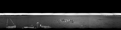
Here's the view from sol 1157, next to Granada, looking back at Alicante (largest rock in left-foreground) near rover turnaround tracks, then the tracks leading back up the dark streak towards the 1137 location, then back towards VwP, which we can just see in the far left background:
Click to view attachment
atomoid
Apr 27 2007, 08:47 PM
QUOTE (fredk @ Apr 27 2007, 09:58 AM)
...But they still may do a "toe dip" at VwP before the main entry at Duck Bay. We should know soon enough.
gosh i hope we do that toe-dip, otherwise well never be sure just what the nature of the darkening on the bedrock there at the streak origin is; pivotal evidence.. same dark stuff as whats gathered in the bottom of
Granda i say
Stu
Apr 27 2007, 11:09 PM
They didn't go look at the inside of this..? Shame, I wanted a close up look at those ripples of dark Whatever...
 Click to view attachment
Tesheiner
Apr 28 2007, 07:02 AM
QUOTE (fredk @ Apr 27 2007, 06:58 PM)
But they still may do a "toe dip" at VwP before the main entry at Duck Bay.
I was so excited thinking on the drive into the crater that I just forgot the stop at VwP.
Edward Schmitz
Apr 28 2007, 08:37 AM
I don't think the toe dip is off the table. We'll find out soon enough. And I doubt they drove over here just to take a few quick shots. They'll probably move in closer.
I'm really interested in the rock on the right. It almost looks like it has a pincher facing toward the crater. An alien life form maybe? Probably not. but interesting none the less...
mhoward
Apr 28 2007, 02:03 PM
Here's the Navcam pan from sol 1157 (360x90 degree equirectangular projection, centered on north)
Stu
Apr 28 2007, 02:19 PM
One of the most striking things about Victoria Crater has been the wonderful shapes seen in the "Gargoyles" (outcrops) around its edge. This latest one (which Cape? I've lost track of names a little...) has some beautiful structure, don't you think..?
Click to view attachment
mhoward
Apr 28 2007, 02:28 PM
QUOTE (Stu @ Apr 28 2007, 02:19 PM)
This latest one (which Cape? I've lost track of names a little...) has some beautiful structure, don't you think..?
That's the base of Cape St. Vincent, according to the map.
Floyd
Apr 28 2007, 03:13 PM
I'm surprised that Opportunity did not go the tip of Terra del Fuego for the Big Color Pan. I guess the next stop is therefore the tip of Cape St. Vincent for the Pan? The CSV position may have an advantage over TdF because it gives the team additional imaging data for reconstructing the topography of Valley Without Peril.
fredk
Apr 28 2007, 04:36 PM
In Byron Jones'
podcast, he mentions that they likely wouldn't traverse the interior of Victoria, rather just go in at a Bay, spend "maybe a few months", exit, and then move to a new bay to enter again. Of course that's subject to what they actually find inside.
edstrick
Apr 29 2007, 08:39 AM
My impression is that the "footing" gets really iffy down near the base of the capes. The surface gets smoother and I expect there's increasing amounts of unconsolidated sandy fines. Remember the sand traps Oppy ran into exiting Eagle crater and way down on the lower slope of Endurance. I think the traction to "round the cape" won't be there.
Phil Stooke
Apr 29 2007, 12:16 PM
The driving targets change frequently, so it's hard to keep up with the current planning. But when Jim Bell spoke here last month he showed a map suggesting the big pan would be further south than Tierra del Fuego. If they have not changed their minds about that, the current trip to the small rocky crater may only be a detour, not the start of the return journey.
Phil
djellison
Apr 29 2007, 01:05 PM
Indeed - to quote Pete Theisinger from the Jan '04 days "All our truths are temporary" - something like that.
A drive to a little crater is just that...a drive to a little crater. When they get there they might go "right - Duck Bay.." or "Oo - whats this" or "Let's go East more".
There is a bigger picture plan in place obviously - but as to day to day decisions, don't bother predicting beyond what the tracking database says, it's a waste of time
Doug
fredk
May 1 2007, 11:18 PM
Lots of good details in
the latest update, including no VwP toe-dip, because of the bands of dark sand, and one more stop planned en route back to Duck Bay to reimage CSV from CGH. Then more imaging of CSM from Verde.
Also, good news power-wise:
QUOTE
At some point about a week or so ago, Opportunity's power began rising from the high 500s to 700 watt-hours, leading the MER team to conclude it had experienced a cleaning event. Whether or not the gust of wind that surely cleaned the rover's solar arrays was in any way related to the Hellas dust storm or not is anybody's guess. "But I wouldn't rule it out completely," said Squyres. In any case, "it's is one of the bigger cleaning events we've had on Opportunity."
BrianL
May 1 2007, 11:27 PM
QUOTE (fredk @ May 1 2007, 05:18 PM)
Also, good news power-wise:
Well, of course Oppy had a major cleaning event. She was sitting in an area where dust gets swept away.
And that's the last I shall say on that.
Brian
atomoid
May 1 2007, 11:28 PM
QUOTE (fredk @ May 1 2007, 04:18 PM)
Also, good news power-wise:
"At some point about a week or so ago... ...said Squyres. In any case, "it's is one of the bigger cleaning events we've had on Opportunity.""
it was certainly a good idea for Oppy to go "streaking"
centsworth_II
May 2 2007, 12:36 AM
QUOTE (BrianL @ May 1 2007, 07:27 PM)
And that's the last I shall say on that.
But you posted in the wrong thread!
This is a "lo-fi" version of our main content. To view the full version with more information, formatting and images, please
click here.