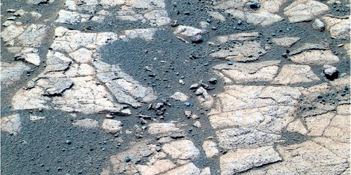
Bunch of MI's of the "rind" (mentioned in Steve Squyres' latest mission update), I believe, starting with this one:
http://nasa.exploratorium.edu/mars/opportu...DIP2956M2M1.JPG
Forward hazcam:
http://nasa.exploratorium.edu/mars/opportu...DIP1110L0M1.JPG
Full Version: Checking Out The Rind
The area being checked out is to the left of this image:
I wager that Mars has had a more interesting history than anyone has necessarily imagined thus far.. Perhaps it was Earth, just a few billion years earlier and terminated before it had space-faring beasties. Then again, maybe it had space-faring beasties, and all their Earth-sent probes have since been obliterated. Earth would have been rather uninteresting compared to Mars back then.
How about this, Earth was going along pretty well, then whatever gave us the Moon hit Earth, and voila, set us back a few hundred million years or so. Mars on the other hand keeps cranking, and hey, Deimos and Phobos aren't huge, but neither is Mars, so surely they would induce some sort of decent tidal effects (thought to be important to the formation of life on Earth, by me if no one else). But then, the sun cools down, Mars' lower gravity isn't enough, and it all disappears, or freezes onto the surface, or both, and next comes Earth.
As the sun cools down further (before going red giant..), I imagine Earth's climate will change quite noticeably and Venus will cool down etc. etc. etc.
And if I'm wrong about the current ideas of star formation (perhaps stars start cold and get hotter and hotter until they go red giant, eh?), then guess what, THEY'RE ALL WRONG. But in that case I'll couch my bets and just say that Venus was once Earth and Mars will be Earth soon enough. Except that we don't have any probes on Venus (yet) so I don't find that as exciting right now.
Once we find those ancient Martian tools a few feet beneath the surface, you'll all know I was right.
QUOTE (mike @ Aug 17 2005, 02:14 PM)
As the sun cools down further (before going red giant..), I imagine Earth's climate will change quite noticeably and Venus will cool down etc. etc. etc.

Actually, I think the current thinking on main sequence stellar evolution is that the sun is expected to increase slowly... but continuously, in luminosity over the next few billion years. In fact, the earth would probably become uninhabitable due to this effect long before the sun reaches the red giant stage. (I think it has to do with the fact that the hydrogen "burning" keeps progressing out in a layer from the center... which becomes too helium-rich for efficient nuclear fusion).
I'm assuming this area has had the RAT Brush applied to it?
http://qt.exploratorium.edu/mars/opportuni...DIP2936M2M1.JPG
Very unusual.
http://qt.exploratorium.edu/mars/opportuni...DIP2936M2M1.JPG
Very unusual.
QUOTE (Sunspot @ Aug 17 2005, 04:40 PM)
I'm assuming this area has had the RAT Brush applied to it?
http://qt.exploratorium.edu/mars/opportuni...DIP2936M2M1.JPG
Very unusual.
http://qt.exploratorium.edu/mars/opportuni...DIP2936M2M1.JPG
Very unusual.
Oh wonderful, more fossils.

(That smilie would work better if it weren't...er...smiling.)
QUOTE (Sunspot @ Aug 17 2005, 08:40 PM)
I'm assuming this area has had the RAT Brush applied to it?
http://qt.exploratorium.edu/mars/opportuni...DIP2936M2M1.JPG
Very unusual.
yep, its a rat-brushed version of this same spot thats in shadow herehttp://qt.exploratorium.edu/mars/opportuni...DIP2936M2M1.JPG
Very unusual.
...rat HOLE coming soon?
Should we assume that the "mysterious rind" was created by moist contact between the bedrock and the overlying (or blowing) basaltic sands (or dusts)?
We're starting to see some interesting things there.
From Sol-556 (the same time as MHoward's FHazcam shots), we have a Pancam shot off to the side of this outcrop we're on:
http://qt.exploratorium.edu/mars/opportuni...DIP2584L7M1.JPG
A couple of observations: the weathering rind is dark, with a similar value as the sand. You can see an area just left of center where the crust is wind-eroding down to the underlying evaporite. And notice the HUGE blueberries on the left side and below center. They must be in the 10-12mm range!
This is what I suppose: a thin blueberry-sand covering is over the evaporite bedrock and protects it from aeolian erosion. But this covering is thin enough that the bedrock is heated by the Sun and can pick up some water from surface condensation. This is a good setup for chemical weathering; heat and water, and the weathering crust is protected from erosion and can continue to "cook" for a long time. The thin sand shifts and we are observing a freshly-exposed weathering surface.
I think this is why we saw that dark ejecta and the dark floor at the heatshield impact bonk. My thoughts were that was a weathering surface and I was disappointed that we didn't look closer then; hopefully, we will now. It will be interesting to know the minerology of the weathering crust.
--Bill
Where have all the blueberries go, seems to be only one in the middle? I assume this is a grind of the rind.
Here's a falsecolor view on the double RAT action (RAT and brush?, RAT and RAT?) on the rind and nearby outcrop. I believe the 'berry-less' MI's are of the bottommost hole.


Excellent image, slinted. This is getting interesting. My apologies for the length, but please bear with me...
Recent comments from the team said the rind is more red than the interior. Slinted's image clearly shows the red color in the RAT cuttings and a lighter interior. In chemical weathering and other secondary geochemical rock altering processes observed on earth, oxidized and hydrated forms of iron are often the cause of red colors. If such iron minerals have been concentrated in the rind, did the iron arrive there after being leached from the interior? Or could it have migrated from a previous covering of iron rich sediment.
Some have noticed that parts of the rind near vertical fractures bear a strong resemblance to the interesting structures seen at Razorback in Endurance crater. It is difficult to imagine a process that could create such rinds that did not require water to facilitate the migration of ions.
Consider also that rocks on the other side of the planet also have displayed an outer rind and a soft interior. (Breadbox et al. come to mind) It has been hypothesized by others that this is a phenomenon called "case hardening." It has been observed in rocks on earth and involves leaching, migration and redeposition of ions. I have seen it caused in several different geochemical environments, and in different kinds of rocks. I now wish I had paid more attention to them at the time, or at least colected samples of them.
Having said that, it seems curious that similar processes that are not common on earth were observed by two, somewhat randomly placed rovers on opposite sides of Mars. Could this be evidence of a global phenomenon?
QUOTE (CosmicRocker @ Aug 26 2005, 02:20 AM)
Having said that, it seems curious that similar processes that are not common on earth were observed by two, somewhat randomly placed rovers on opposite sides of Mars. Could this be evidence of a global phenomenon?
We probably shouldn't draw too many conclusions from two just two sites, but my guess is that the effects of weathering on different places on Mars probably is very similar because nothing much really happens on the surface of Mars, relative to Earth. It's very dry, very cold, and in most cases, the rocks have just been sitting there being gently sandblasted, perhaps occasionally moistened, for a very, very long time.
In the news conference, Steve Squyres has said that the rind is similar in composition to the underlying rock, but has elevated amounts of Na and Cl. He allowed that yes, it might be because of a final precipitation of NaCl onto the rock. But he was guarded enough that you can take it with a grain of salt. 
QUOTE (David @ Sep 1 2005, 12:34 PM)
In the news conference, Steve Squyres has said that the rind is similar in composition to the underlying rock, but has elevated amounts of Na and Cl. He allowed that yes, it might be because of a final precipitation of NaCl onto the rock. But he was guarded enough that you can take it with a grain of salt.
Very good
 So, is the percolation of groundwater up from below and evaporation at the surface an option, or does this really point towards precipitation onto the rock from a "shallow, salty sea" ?
QUOTE (stevo @ Aug 26 2005, 06:09 PM)
We probably shouldn't draw too many conclusions from two just two sites, but my guess is that the effects of weathering on different places on Mars probably is very similar because nothing much really happens on the surface of Mars, relative to Earth. It's very dry, very cold, and in most cases, the rocks have just been sitting there being gently sandblasted, perhaps occasionally moistened, for a very, very long time.
Stevo:
That was firmly my view, too, until seeing the debris blowing into the RAT hole recently, and the weathering at the top of Husband Hill (not to mention discussions about, well, dampness...)! I always veered towards the slow, dry and cold variety of weathering, but might now be prepared to reconsider... ...perhaps things can be a bit more dramatic than we thought.
Bob Shaw
QUOTE (Bob Shaw @ Sep 1 2005, 04:04 PM)
Stevo:
...perhaps things can be a bit more dramatic than we thought.
Bob Shaw
...perhaps things can be a bit more dramatic than we thought.
Bob Shaw
Bob,
I hope you're right, I'd love things to be more dynamic. The more that's going on, the more there is to see. Although what we've seen already is impressive to say the least.
Stephen
Here is an interesting rind which appears to be displaced from the parent rock. I disremember which Sol it is from, but it's from the "recent" Oppy Pancams at the entrance to the Erebus Highway.
The "Bugs and Buds" faction is going to have fun with this feature...
--Bill
The "Bugs and Buds" faction is going to have fun with this feature...
--Bill
QUOTE
Bill Harris said: The "Bugs and Buds" faction is going to have fun with this feature...
Afraid they will.
Wonder what they make out of it, one Martian hedgehog?

No, a hedgehog would be too sane and rational.
I wish that we had a close look at it; unfortunately, in the Sea of Dunes Oppy has to stay on the chosen path. I suspect that it is a weathering crust that was displaced by the wind.
I've developed a LOT of respect for the winds of Mars...
--Bill
I wish that we had a close look at it; unfortunately, in the Sea of Dunes Oppy has to stay on the chosen path. I suspect that it is a weathering crust that was displaced by the wind.
I've developed a LOT of respect for the winds of Mars...
--Bill
I see what you mean. At first it almost resembled a fossil skull, so I guess it could be a rind from which the softer core had been eroded away. But then I started looking at it closer, and now I'm not so sure. There were L1 and R2 images, so I made an anaglyph and increased the image size 250%. In magnified 3D, it appears to be a boulder that has broken into 3 pieces. The various parts in sunlight and shadow may be creating the illusion of one object that is hollow. Along side the anaglyph, I have included a magnified crop from the R1 image.
I noticed another anomalous feature from the Sol 574 pancams. There is a fairly steep, elevated segment of blueberries. If this is a windblown ripple it sure is a strange one. It seems to be too rounded in vertical profile. I'm attaching an anaglyph and a cropped false color composit from MMB. The anaglyph is particularly intriguing, since the sides of this thing appear to be almost vertical.Click to view attachmentClick to view attachment
I wonder if this could be caused by one of those vertically extending pieces of rind we have seen along some of the rock edges, but in this case perhaps the blueberries have been cemented onto it. I'm not very satisfied with that hypothesis, since I haven't seen any prior examples of berries being cemented after being eroded from the parent rock. Anyone have a better explanation?
I wonder if this could be caused by one of those vertically extending pieces of rind we have seen along some of the rock edges, but in this case perhaps the blueberries have been cemented onto it. I'm not very satisfied with that hypothesis, since I haven't seen any prior examples of berries being cemented after being eroded from the parent rock. Anyone have a better explanation?
QUOTE
At first it almost resembled a fossil skull... But then I started looking at it closer, and now I'm not so sure...
Blush, you're correct-- this is an optical illlusion. Putting an L1-R2 pair up and looking at them cross-eyed it clearly is a cobble with an odd light-shadow pattern.
Oh well...
I noticed that Sol574 anomaly and don't know what to make of it. We'll take your explanation for the time being...
--Bill
QUOTE (Bill Harris @ Sep 5 2005, 04:39 PM)
I've developed a LOT of respect for the winds of Mars...
It is true! The wind makes many surprises to the humanity. The wind changes the landscape and makes us crazy to figure out what has it was alike before. So we know what the Mar's wind can take, not only dust and also very fine powder and able to roll a spheric or cylindric alikes sand ball up to a determineted size according to the surface friction and slope along with the wind density and strength.
Below the Mediterranean Terra is covered of outcrop and most of these is covered by the sand. At the bottom of the sea, neigher a lake there is outcrop or not? When the water ran out, at the beginning, the bottom is covered by outcrop with lots of fissures. With the time, the wind started to cover them with ash, sand, powder and blueberries?
Rodolfo
Here is a Rear Hazcam of the Sol574 "wrinkled rug" anomaly. My speculation is that this is an early stage of the blueberry sand blowing off of bedrock.
It's still puzzling, but there are more mysteries ahead...
--Bill
It's still puzzling, but there are more mysteries ahead...
--Bill
Thanks, Bill. I missed the hazcam images. It doesn't look so anomalous from that hazcam viewpoint. I also noted one or two similar features in the sol 576 images. I'm becoming convinced it is just a wind-blown ripple that is related to the edge of that rock. I may have been misled by vertical exaggeration in the pancam anaglyphs.
Now that looks odd
http://qt.exploratorium.edu/mars/opportuni...EKP1214R0M1.JPG
http://qt.exploratorium.edu/mars/opportuni...EKP1214R0M1.JPG
QUOTE (alan @ Sep 9 2005, 10:54 PM)
Alan:
Nope. Not odd. VERY odd!
What on Earth (haha) are we seeing around the (forgive me) pterosaur skull?
And has Oppy been gouging out holes in the pavement?
Bob Shaw
QUOTE (Bob Shaw @ Sep 9 2005, 10:31 PM)
Alan:
Nope. Not odd. VERY odd!
What on Earth (haha) are we seeing around the (forgive me) pterosaur skull?
Nope. Not odd. VERY odd!
What on Earth (haha) are we seeing around the (forgive me) pterosaur skull?
Shadow, mostly. But the stone seems to have been dislodged; as if a hand had pulled it out of a hole in the ground, and then placed it back in, but without sweeping the sand back into the crevices. Did Oppy run over it? And the diamond-shaped marks on the rocks, and the circles -- I hope that's something Oppy did. Otherwise I'll find myself lying awake at night wondering if somebody else has been there before.

I saw that and said "Hmmmm... odd". And decided that Oppy nudged it with a wheel. There are those unusual marks on the flat rock next to it that might (or might not ) be from the wheel. Hopefully, Oppy was lining up to look closer.
This rear Hazcam was made 52 seconds later:
http://qt.exploratorium.edu/mars/opportuni...EKP1315L0M1.JPG
I decided to keep my mouth shut after my discovery of the Hedgehog skull earlier this week...
--Bill
) be from the wheel. Hopefully, Oppy was lining up to look closer.This rear Hazcam was made 52 seconds later:
http://qt.exploratorium.edu/mars/opportuni...EKP1315L0M1.JPG
I decided to keep my mouth shut after my discovery of the Hedgehog skull earlier this week...
--Bill
I think you're right, she drove over a rock and pushed it to the side a little. The bright "scratches" on the rocks appear pretty closely associated with the wheel marks on the left side of the image (same spacing, at least initially).
That rock must be fairly soft if the wheels are making marks on it. Or is that just the rind ?
Stephen
That rock must be fairly soft if the wheels are making marks on it. Or is that just the rind ?
Stephen
QUOTE (stevo @ Sep 9 2005, 06:18 PM)
IThat rock must be fairly soft if the wheels are making marks on it. Or is that just the rind ?
The outcrop looks somewhat harder than a dry mud. It might be hardened by billions years without water and having a very dry weather.
Rodolfo
Remember, Oppy's right wheel has the bad steering actuator and that is the wheel that was "dragging" across the rock with the marks. May be nothing, we'll see what other images come down from this spot.
--Bill
--Bill
http://marsrovers.jpl.nasa.gov/gallery/all...84P2275L1M1.JPG
http://marsrovers.jpl.nasa.gov/gallery/all...84P2275R1M1.JPG
http://marsrovers.jpl.nasa.gov/gallery/all...84P2275R2M1.JPG
Sol 572, panoramic camera -- and I'm sure I saw several more images of whatever this is a few sols earlier, noticed while watching my updates come in.
I can't find the images at JPL, these numbers are captured from MMBrowser.
Anyone else noticed this odd looking little thing? Closeup attached from a screenshot.
http://www.unmannedspaceflight.com/index.p...topic=1279&st=0
See Post #17 and following posts. This is a classic optical illusion and a good reason why anything "odd" needs to be looked at closely.
"BT,DT"
--Bill
See Post #17 and following posts. This is a classic optical illusion and a good reason why anything "odd" needs to be looked at closely.
"BT,DT"
--Bill
Can someone explain this one ?
http://qt.exploratorium.edu/mars/opportuni...00P2213L2M1.JPG
I swear, it looks like a deflated beach ball, or one of those chocolate orange things...
http://qt.exploratorium.edu/mars/opportuni...00P2213L2M1.JPG
I swear, it looks like a deflated beach ball, or one of those chocolate orange things...
Airbag mark ... that image is 19 months (or so) old.
Ah, I wondered about that. Not so far off a beach ball
Yesterday, a lot of pictures part of the "mission success" panorama (is the naming correct?) were downloaded again. I was surprised to realize that they are still stored into the flash memory.
What's the reason to download them again, if they are indicated as *complete* here on earth?
I may have a guess...
What's the reason to download them again, if they are indicated as *complete* here on earth?
I may have a guess...
The image is from Sol 3. The real mystery is why images from earlier sols are showing up on Exploratorium. Could they actually have been in the rover's memory for this long?
Edit: Oops, too slow.
Edit: Oops, too slow.

3D crossed-eyes/anaglyph versions.
Click to view attachment
Click to view attachment
The big BB in the center/extreme left is 2.5cm wide!
Click to view attachment
Click to view attachment
The big BB in the center/extreme left is 2.5cm wide!
QUOTE (Tesheiner @ Sep 23 2005, 02:29 PM)
Yesterday, a lot of pictures part of the "mission success" panorama (is the naming correct?) were downloaded again. I was surprised to realize that they are still stored into the flash memory.
I noticed that the JPL site had a whole bunch of heatshield MIs come down from way back when. Though it was fascinating to have a look at them again.
Most of these old images had pieces missing, so I figure that JPL just never downloaded them because they had plenty of complete images of the same basic areas and there was no reason to waste the time..
Wow! New stunning image from Oppy!
Great finding, Dilo!!
And new strange features ...
Sol 592:

Great finding, Dilo!!
And new strange features ...
Sol 592:
QUOTE (dilo @ Sep 23 2005, 06:35 PM)
The layers are rather strongly inclined here, probably as a result of the Erebus impact. Upended stratigraphy is common around impact craters.
As for the download of "historic" images, the rovers have plenty of power at the moment and Mars is close enough to Earth to permit increasing the bit-rate for the HGA, so I suppose every corner of the Flash is being cleaned out. It probably works like a HDD, everything stays around until You overwrite it.
tty
Hmm, thinking more about the missing areas on the recently downloading images, those are caused by transmission problems (noise, probably) rather than a problem with the imager itself, aren't they? So I suppose that JPL just wasn't too concerned about the integrity of the images and just wanted to get them offloaded.. I will freely admit that at this point I may be completely wrong altogether. At least I tried.
QUOTE (tty @ Sep 23 2005, 06:51 PM)
The layers are rather strongly inclined here, probably as a result of the Erebus impact. Upended stratigraphy is common around impact craters.
As for the download of "historic" images, the rovers have plenty of power at the moment and Mars is close enough to Earth to permit increasing the bit-rate for the HGA, so I suppose every corner of the Flash is being cleaned out. It probably works like a HDD, everything stays around until You overwrite it.
tty
So far as I understand Flash Memory, you have to make an active effort to delete any data, and that takes time and effort (not least the considerable effort required to ensure that you delete the right data!). Additionally, some early forms of Flash Memory had a limited (but high) number of writes/rewrites without a full-scale reformat (I have no idea about the MER memory, but it's hardly going to be the latest technology). Presumably we're seeing some slow-but-steady housekeeping at the moment.
QUOTE (mike @ Sep 23 2005, 09:29 PM)
Hmm, thinking more about the missing areas on the recently downloading images, those are caused by transmission problems (noise, probably) rather than a problem with the imager itself, aren't they?
Yep.
QUOTE (mike @ Sep 23 2005, 09:29 PM)
So I suppose that JPL just wasn't too concerned about the integrity of the images and just wanted to get them offloaded.. I will freely admit that at this point I may be completely wrong altogether. At least I tried.
Who knows why those images were downloaded again...
The fact that they are part of the first 360º panorama (sol 2-3?) -- and that pano is reported as *complete* (at least on the pancam database) -- makes me wonder if this download could be part of the troubleshooting to find the culprit of that reset some days ago e.g. damaged flash memory.
QUOTE
Great finding, Dilo!!
And new strange features ...
Sol 592:
And new strange features ...
Sol 592:
Those rough-looking pieces are from the oddly-weathered piece above it.
What is really strange is the specular reflection on the two rocks to the left of the rough pieces. We've seen shiny wind-polished rocks on HH, but not here...
--Bill
Steve Squyres Update: September 23
http://athena.cornell.edu/news/mubss/
--- It's been a good week at Meridiani. We've had several solid drives, and we're now effectively at the northern rim of Erebus Crater. We're currently parked on a large outcrop named South Shetland, and we're going to spend the weekend working it over with the instruments on the IDD.
After that comes the big decision... which way do we drive to attack Erebus?
The good outcrops at Erebus are on the southeastern rim (called the Vermillion Cliffs) and on the western rim (called the Mogollon Rim). The Vermillion Cliffs look easier to get to, but not as high. The Mogollon Rim exposes more rock, but looks harder to get to. There's a particularly tasty-looking promontory on the Mogollon Rim named Payson that's probably the biggest outcrop anywhere along the rim, but whether we can actually get to it or not is an open question
At the same time we're doing the IDD work on South Shetland, we're going to be taking a big Pancam panorama that hits most of Erebus at the highest resolution possible. And then, on Monday afternoon, we're going to sit down, look at the images carefully, and make a decision. We may go left, we may go right, or we may cut straight across the crater... stay tuned. ---
This is a "lo-fi" version of our main content. To view the full version with more information, formatting and images, please click here.