Help - Search - Members - Calendar
Full Version: The drive back to Duck Bay
Unmanned Spaceflight.com > Mars & Missions > Past and Future > MER > Opportunity
Pages: 1, 2, 3, 4
fredk
Tosol (1162) Oppy appears to have begun the drive back to Duck Bay with a nice long drive that has taken us to just past the 1134-1137 leg, if I'm right:
Click to view attachment
As I wrote already in another thread, the current plans are to make one stop en route back to Duck Bay to reimage Cape St. Vincent from Cape of Good Hope. Near the end of the return to Duck Bay they plan more imaging of Cape St. Mary/Beacon from Verde.

Are there places along the route you'd like to see again? Views from new angles? Better views of/from the Beacon would be one of my picks. That is our best bet to catch a glimpse of Endurance, too. Of course many of these ideas won't have any scientific interest, but it's still fun to imagine.

Dare I ask it: predictions for date of arrival at Duck Bay? ohmy.gif

Edit: Alan reminds me we've already got an entry pool thread.
mhoward
According to the tracking data, it was a 65.9 meter drive at about -62 azimuth (west-northwest). So it sure looks like the trip back to Duck Bay has begun.

fredk
Another long drive on sol 1163. We're back at the western side of VwP, just outside the 1108-1111 drive leg. This is a familiar view looking across VwP. Notice how the wind has blown light dust out of the old rover tracks; again the wind is blowing towards the rim:
http://qt.exploratorium.edu/mars/opportuni...XUP0705R0M1.JPG
Tesheiner
Perhaps this might be the windiest place of the whole mission.
And about the same images from sol 1163, but now the pancams, it looks like this planned imaging session of CSV will be made from the rim right south from the current position.
ddeerrff
QUOTE (Tesheiner @ May 3 2007, 11:22 AM) *
Perhaps this might be the windiest place of the whole mission.

I'm surprised I haven't seen anything posted here (or perhaps I missed it) about the 'cleaning event'
http://marsrovers.nasa.gov/mission/status.html#opportunity
fredk
From the route map thread:
QUOTE (brellis @ May 3 2007, 05:09 PM) *
Seeing the distance covered in the last few sols, I wonder, what is the longest single drive accomplished by Opportunity? Will its new hazard-avoidance software allow it to reach new lengths?
The distance to the next planned stop (Verde) after the current imaging location is a bit over 500 metres. It sure would be cool to see what they could do on this ideal driving surface of Victoria's apron. With 200-metre-plus drives, could we make it back to Verde in two or three sols?! blink.gif

In reality we know they have trouble driving on these essentially featureless plains, and have to do a "drunken sailor walk" or whatever. I suppose that would limit the maximum drive lengths.
MarsIsImportant
I still like my Sol 1219 prediction for ingress. The MER team is going to want to study some of the changes made by the wind in the tracks. They will stop to do another in depth study of the beacon area. They might want to slow down to get better images of Cabo Frio. Another complete pan of the Duck Bay area will be necessary before entering. They will note any changes...as there now appears to be minor changes in small dust accumulations over fairly short periods of time (as evidenced from the changes in the tracks). I noticed some changes between the HiRise image and the Opportunity close ups at Valley Without Peril (very minor).
CosmicRocker
fredk: Returning to your original questions, one place along the route I would like to see again from new viewing angles would be the lump, as well as any of the rimmed ejecta blocks we might encounter along the way.
QUOTE (ddeerrff @ May 3 2007, 11:44 AM) *
I'm surprised I haven't seen anything posted here (or perhaps I missed it) about the 'cleaning event'
I'm surprised you missed it, too. wink.gif
mhoward
76m drive on Sol 1163, according to the tracking data.


Images for 1164 are down, but I haven't seen the data yet. Looks like a shorter drive toward the edge.
mhoward
Here's a view of where Opportunity is on sol 1164, according to the tracking data


fredk
Sol 1163 navcam. If you didn't know better you might think Oppy has been madly zipping around, then careening out of control near the end.
Click to view attachment
mhoward
Heh. It was taken on sol 1163 but it's actually at the sol 1162 location.

ronatu
Does anyone knows why Opps is turned back?
mhoward
Do you mean why are they retracing their steps? Apparantly they feel they have gathered enough data travelling around the rim, and they've determined that Duck Bay is the best place to enter Victoria Crater. Duck Bay is where we arrived at Victoria Crater, all that time ago.
ronatu
QUOTE (mhoward @ May 5 2007, 01:31 PM) *
Do you mean why are they retracing their steps? Apparantly they feel they have gathered enough data travelling around the rim, and they've determined that Duck Bay is the best place to enter Victoria Crater. Duck Bay is where we arrived at Victoria Crater, all that time ago.


Educated guess?

Circle around Victoria was far from complete to jump to conclusion...
centsworth_II
QUOTE (ronatu @ May 5 2007, 01:20 PM) *
Does anyone knows why Opps is turned back?

The plan from the very beginning was to go about as far around as Opportunity did and then
decide on going in. I think the deciding factor is the realization that at any time Opportunity
could lose the use of a wheel, like Spirit, or suffer some other debilitating event. Better to
get on with exploring Victoria from the inside before that happens.
mhoward
QUOTE (ronatu @ May 6 2007, 04:12 AM) *
Educated guess?


No. Read the latest update at the Planetary Society, or just read some of the other posts on this forum. This line of inquiry is a bit of a waste of time.

Edit: And by "a bit of a waste of time", I mean I'm going to start deleting posts if this goes on much longer.
CosmicRocker
Hehe. You might notice some people here making "educated guesses." laugh.gif
jvandriel
The view in the drive direction on Sol 1164.

Taken with the L2 Pancam.

jvandriel
CosmicRocker
Interestingly, "Little Miss Perfect" seems to have paused at quite an interersting ejecta block for some IDD work. It looks like a good place to study the concretions' relationship to the bedrock's erosion, or maybe something else. I hope there are several targets here.
Stu
Very crude attempt but have to go out in 5 mins...

Click to view attachment
Stu
Fascinating difference between the two rocks on the left there... is the lighter, smoother one a piece of impactor? And does anyone else think that the debris here, with its cracked and pitted surface, looks like bits of Wopmay that we saw in Endurance?

Click to view attachment

... and in 3D...

Click to view attachment

Hello..? Anyone else out there..? smile.gif
Shaka
We're out here alright, but have you noticed the condition of the roads around here?
Ballpark Highway
Stadium Ring Road
I think it's high time the county did some repairs! What are we paying taxes for anyway?
mad.gif
CosmicRocker
Hehe, that's why I drive a 4wd SUV. You never know what the road conditions will be like after it rains meteors and people drive around in defective vehicles on their wheel rims.

I think those most probably are pieces of the impactor. I've been making the right filter ratio images as they become available. Although I think this particular algorithm was intended to highlight the blueberries, it does seem to qualitatively highlight other mineralogical differences in the materials. There are several rocks rocks in and near this crater that clearly aren't from the neighborhood.
Click to view attachment
SteveM
Nicely done Tom.

That's what I call a beautiful picture!

Steve
Stu
Very nice. Those colours stand out pretty well on a colour image, too...

Click to view attachment
Chmee
QUOTE (Stu @ May 8 2007, 03:32 AM) *
Very nice. Those colours stand out pretty well on a colour image, too...


This does not appear to be like the other meteorites we have seen. My guess that this is a secondary impact crater and the 'impactor' is from another location on Mars. It appears to be very recent as well, note the blocks are not smoothed out at all and there are rocks of all sizes surrounding the crater...
remcook
I think it's worth a closer look smile.gif
mhoward
QUOTE (remcook @ May 8 2007, 07:54 PM) *
I think it's worth a closer look smile.gif


A bit late for that, I think... we've already travelled about 150 meters away from it. It is a nice picture, though.
Tesheiner
Today was supposed to be a driving sol (1169), but the latest images (navcams) are from exactly the same site as yesterday.
Change of plans and/or an aborted drive.
fredk
Another 3D view of Granada:
Click to view attachment
WindyT
QUOTE (fredk @ May 9 2007, 03:18 PM) *
Granada:

You know for an area that's supposed to be pretty windy, that fine dust in the raised sections of that pic sure doesn't make it look like it's been excessively windy --lately, anyway. Not a lot of dust on the lee side of these rocks either. And relatively sharp edges there. The 3-D view shows that off nicely. Thanks.
atomoid
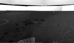
The little sand dunes, so 'cleanly' visible in the anaglyph ive inferred are created by the higher winds inside the eddies and vortices created when the wind interacts with the jumbled rocks, speeding up and slowing down airflow and precipitating dunes in these patterns. well, true, not excessively windy, but windy enough to build them up. unless they are left over from seasons past, in which case they would have been recently swept clean of any light dust falling on them in intervening seasons. but im under the impressing they are ongoing, changing shape subtly even as Oppy stolls on past.

Which brings me to another vexing connundrum: what is the shape of the winds anyway? are these winds like some sort of thin layer sliding along the ground and poking up only when perturbed by landforms? i've heard (somewhere) that the air heats up signifficantly only at the ground in a layer mere centimeters thick, although i cant correlate this concept with the dust devils at Gusev, which seem to be swept along by winds that persist in high columns similar to Earth's winds. maybe these are apples and oranges, but im still flummoxed about the vertical profile of the smooth prevailing winds or wind gust fronts (and these types may differ in this regaard as well) I keep thinking in terms of Earth processes, but its gotta be signifficantly different when there is less gravity and pressure to work with. I guess if i had payed attention to studying the martian dust storms i would probably have my answer.
Gray
On the subject of winds. Here's a quote from a recent 'Opportunity Update' at the JPL site:

"On sol 1159 Opportunity experienced yet another dust cleaning event. Solar array energy production is now over 800 watt-hours."
djellison
The problem with Oportunity is of course that stuck arm heater, which will pull, I think, 150Whrs in a night. Were it not for that, 800Whrs is the sort of figure where you could stay up every night to do at least two Odyssey passes every Sol. When much of the science campaign is pancam intensive, bandwidth is the constraint sad.gif DAMN YOU STUCK HEATER!

Doug
Tesheiner
This is the latest navcam mosaic, taken on sol 1170 after driving to the west side of CGH.
Opportunity is now located next (a few meters) to the "lump" (aka Madrid).

Click to view attachment

Given the "drive direction" pancam images it looks like the plan is to move closer to it.

And here below is the approx. current site as viewed from sol 1096.
Click to view attachment
fredk
QUOTE (CosmicRocker @ May 4 2007, 03:56 AM) *
fredk: Returning to your original questions, one place along the route I would like to see again from new viewing angles would be the lump...
Definitely one of my picks too, and, as Tesheiner points out, it appears we got our wish! Here's a navcam anaglyph of the Lump from the current location:
Click to view attachment
CosmicRocker
biggrin.gif I was on the edge of my chair as I saw the hazcams and navcams come down from sol 1170, fredk. The "lump" didn't appear quite the way I expected it to. What about the rest of you folks? I didn't check, but I assume pancams were planned. I'd sure like to see them, and then maybe a bump closer for more imagery.

I also got my second wish. We now have a veritable zoo of rimmed block images, with and without sediment on them. These things are fascinating me. They defy a simple explanation.
fredk
Lovely images coming down from our perch above the Lump. Perhaps it's just me, but there's something really cool about images like this: http://qt.exploratorium.edu/mars/opportuni...8BP1951R0M1.JPG

Lot's of pancam imaging of the nearby surface going on. I suspect there are fragments of the Lump material scattered around, perhaps they want to investigate them. For example, there are fragments in the foreground of this image that vary in colour, judging from their look in different filters. Recall the Lump had a distinctive hue in the old pancam views.

Stu, are you taking requests for colour images? unsure.gif

Finally, look at that beautifully clean rover deck! biggrin.gif
Stu
Just waitin for those pancams to come down fred, the sooner the better... smile.gif
nprev
Ah, yes...wind is a good thing! smile.gif

Hopefully not too OT here, but what does the fact that 'cleaning events' are even possible tell us about the electrostatic properties of Mars dust at two widely separated locations? Doesn't seem as if static charging is a problem at all...extremely high iron content maybe, but then again the dust would have to be pretty heavy...?
Stu
Here you go fred...

Click to view attachment
fredk
Thanks, Stu! biggrin.gif

Some very distinct colours there. There's an interesting story to work out here no doubt.
Stu
Left over from t'other day...

Click to view attachment
WindyT
QUOTE (fredk @ May 12 2007, 06:09 PM) *
Some very distinct colours there. There's an interesting story to work out here no doubt.
Thin layering, less friable/more erosion resistant...
Possible non-aeolian deposition?
Get me a trampoline, I'm jumping to conclusions!
Tesheiner
This is my attempt to make the 360º navcam panorama from sol 1173.
Autostitch gave me a bit of trouble so I had to manually touch the picture in a few places.

Click to view attachment

On another note and about the naming of the features around the lump (aka Madrid): "Guadarrama", "Cercedilla", and "Fuenfria" are places at the Sierra de Guadarrama, a mountain chain some 50-100km to the north of Madrid. Beautiful places for trekking and mountain biking.
climber
QUOTE (Tesheiner @ May 14 2007, 12:26 PM) *
Sierra_de_Guadarrama a mountain chain some 50-100km to the north of Madrid. Beautiful places for trekking and mountain biking.

Thanks Eduardo, look nice... and much much closer to get there than to Victoria wink.gif
jvandriel
A panoramic view from Sol 1170 and Sol 1171.

Taken with the L0 Navcam.

jvandriel
jvandriel
Opportunity looking under her left Shoulder. smile.gif

Taken on Sol 1171 with the L0 Navcam.

jvandriel
climber
Amazing how clean she seams to be dd.gif
This is a "lo-fi" version of our main content. To view the full version with more information, formatting and images, please click here.
Invision Power Board © 2001-2024 Invision Power Services, Inc.