QUOTE (stevo @ Jun 15 2006, 12:32 AM)

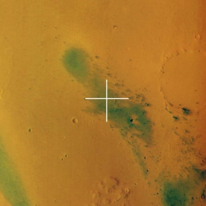
Indeed they are beautiful. I was day-dreaming through the color image above and saw one little crater (approx 2 km in diameter) near the middle of the image with a lot of "stuff" radiating from it. This is in contrast to the vast majority of the other craters in the caldera. It honestly looks like something went "splat". Can someone tell me if this says something about the nature of the impactor, the timing of the impact, or is it a volcanic event, presumably one of the last in this particular caldera ?
Stephen
Stephen:
That MEX image is indeed full of stunning features.
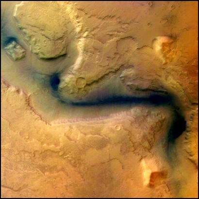
The 'splat' crater looks unusual, inasmuch as the ejecta blanket appears to show some relief against the surrounding terrain. It's reasonably fresh, but probably not that fresh in Earthly terms. I wonder if there are IR THEMIS images of it, which would tell us if there were any big boulders involved? The whole basin looks to me like a heavily eroded impact crater - there are no features which I'd see as volcanic, so the term 'caldera' would be a misnomer. As for the ejecta blankets around the other, larger crater pair - that's also interesting. It seems highly eroded and 'rotten' near the crater lip, and 'bouldery' (I know the scale is wrong to see boulders, it's just a term I invented to cover the granular texture!) at the rim. perhaps this tells us that the material near the rim - from the deepest pre-impact layers - was more water-rich than the surface deposits which form the outer reaches of the ejecta blanket.
Also of interest in the image must be the excellent fossil crater - you can see the arcuate ridges which define it quite clearly. To have survived, I'd expect that to have been made into good solid bedrock (unlike the rather 'rotten' crater pair in the middle of the big crater).
And there are even nice streaks, too...
I didn't see any water flow features, or volcanoes anywhere - but a history of icy mud, yes...
Bob Shaw